Quercy Outdoor: Le Gaillard

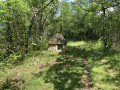
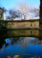
This walk will take you up to the heights of Salviac, where you can admire the view over the village and its church, take in the Ourajou valley and explore the stone houses of Pech Gaillard.

Details

4431859
Creation:
Last update:
Last review:
  • Walking
    Activity: Walking
  • ↔
    Distance: 7.77 mi
  • ◔
    Average duration: 4h 20 
  • ▲
    Difficulty: Moderate

  • ⚐
    Back to start: Yes
  • ↗
    Ascent: + 922 ft
  • ↘
    Descent: - 909 ft

  • ▲
    Highest point: 1,014 ft
  • ▼
    Lowest point: 499 ft
  • ⚐ Country: France
  • ⚐ City: Salviac (46340)
  • ⚑
    Start/End: N 44.683711° / E 1.270079°
  • ❏
    IGN map(s): Ref. 2037OT
  • Hour-by-hour weather

Description of the walk

Start from the car park at the Salviac municipal swimming pool.

(S/E) From the car park, cross the D673 and head right until you reach the first lane opposite No. 330. Walk between the houses and follow the small path on the left to the cemetery. Continue straight on at the first junction to reach a second one.

(1) Turn left towards the village of Salviac, then right onto Route du Bascoul. Walk past the Chapelle de l’Olm, then continue for about 15 metres along the road that descends to the left. Then cross the ford to reach a road, with a glimpse of Lacoste Castle.

(2) Turn right onto the footpath that runs alongside the road until you reach a large crossroads (D673).

(3) Cross it and head up the Route des Crozes Hautes. Take the Route des Perdigous and turn down the first path on the left. At the junction, turn right and walk along the fields for a long stretch until you reach the edge of the forest.

(4) Just before you reach it, take the path that climbs to the right up to a wide track, then turn left. Carry on straight ahead until you come to a tarmac road.

(5) Turn left onto this road for about 20 metres, then take the first path on the left. Carry on straight ahead, then turn right at the bottom of the first descent. Walk downhill for a long way until you reach a junction with a GR®.

(6) Turn right onto theGR® 652 and reach the hamlet of Pech Gaillard by following the road and going straight on at the junction.

(7) In the centre of the hamlet, leave theGR® 652 and continue for about 40 metres along the road, to the left of the iron cross. Take the path on the left which descends to the foot of a pylon until you reach a road (D47).
Turn left, then immediately right onto the track, cross the Ourajou and stay on this track until the next junction.

(8) Turn right onto the hairpin bend, then left again onto another hairpin bend. Climb for a long stretch (enjoy the panoramic view over the Ourajou valley) until you reach the road. Cross it and continue along this track until you reach another road.

(9) Cross it, go straight on and pass through the hamlet of Le Mas. At the hairpin bend to the right, head down to the left along the first path until you reach a road.

(10) Turn left onto this road, then right. Pass in front of the Moulin de Labro and come out onto a cross-road (D47). Turn right, then quickly take a path leading uphill to the left. At the start, there is a fork in the road; continue to the right towards Salviac and reach the next junction.

(11) Turn left, heading due west, past the ruins of Taillardas and Île Ferme, then take the first small path on the right, before the no-entry sign. At the road (D2), turn right as far as the Pigeonnier, then left to return to the starting point (S/E).


Waypoints

  1. S/E : mi 0 - alt. 499 ft - Municipal swimming pool car park - Eglise Saint-Jacques-le-Majeur
  2. 1 : mi 0.39 - alt. 528 ft - Junction - Chapelle Notre-Dame-de-l'Olm
  3. 2 : mi 0.57 - alt. 522 ft - Cateau de Lacoste
  4. 3 : mi 0.75 - alt. 538 ft - D673
  5. 4 : mi 1.5 - alt. 696 ft - Entrance to the forest. Path on the right
  6. 5 : mi 2.55 - alt. 991 ft - Road
  7. 6 : mi 3.51 - alt. 682 ft - GR 652
  8. 7 : mi 3.91 - alt. 778 ft - Pech Gaillard
  9. 8 : mi 4.41 - alt. 571 ft - Junction, turn right
  10. 9 : mi 5.25 - alt. 794 ft - Road, towards Le Mas
  11. 10 : mi 6.18 - alt. 568 ft - Road, on the left
  12. 11 : mi 7.01 - alt. 620 ft - Junction: turn left towards Salviac
  13. S/E : mi 7.77 - alt. 499 ft - Municipal swimming pool car park - Eglise Saint-Jacques-le-Majeur

Worth a visit

Always be cautious and plan ahead when you're outdoors. Visorando and the author of this route cannot be held responsible for any accidents occurring on this route.

The GR® and PR® markings are the intellectual property of the Fédération Française de Randonnée Pédestre.

Reviews and comments

3.8 / 5
Based on 4 reviews

Reliability of the description
4.3 / 5
Ease of following the route
3.8 / 5
Route interest
3.5 / 5
OTCS
OTCS

Hello,
Thank you for your feedback. Feel free to check out the other hikes offered by Quercy Outdoor!

Gwendoline, Pays de Gourdon Tourist Office, between Lot & Dordogne

Machine-translated

User 27271820

Overall rating : 4.3 / 5

Date of your route : Aug 23, 2025
Reliability of the description : ★★★★★ Very good
Ease of following the route : ★★★★☆ Good
Route interest : ★★★★☆ Good
Very busy route : No

Pleasant hike, not much road, just the right amount of elevation gain.

Machine-translated

Celineetfrederic
Celineetfrederic

Overall rating : 4.7 / 5

Date of your route : Feb 01, 2025
Reliability of the description : ★★★★★ Very good
Ease of following the route : ★★★★★ Very good
Route interest : ★★★★☆ Good
Very busy route : No

A lovely walk, well signposted and marked

Machine-translated

marino01
marino01
• Edited:

Overall rating : 3.3 / 5

Date of your route : Jun 28, 2022
Reliability of the description : ★★★★☆ Good
Ease of following the route : ★★★☆☆ Average
Route interest : ★★★☆☆ Average
Very busy route : No

At point 2, where you take the path down into the valley, a ‘private property’ sign is misleading.
Signposts are few and far between on this route.

Machine-translated

CAPRON MARTINE
CAPRON MARTINE
• Edited:

Overall rating : 3 / 5

Date of your route : Aug 19, 2021
Reliability of the description : ★★★☆☆ Average
Ease of following the route : ★★★☆☆ Average
Route interest : ★★★☆☆ Average
Very busy route : No

A walk starting from Salviac; the sign at the three-way junction wasn’t very clear, so we turned off too early – we’ll have to do it again. Then, the section near the first mill was obstructed by a car parked on the path, despite the signs, on the pretext that the owners live nearby. Lovely view of Salviac on the way back.

Machine-translated

Other walks in the area

For more walks, use our search engine .

The GPS track and description are the property of this route's author. Please do not copy them without permission.