Circuit de Couéguel

The seigneury of Couéguel occupies the northern part of the commune of Péaule. In this stretch of land on the border with the commune of Limerzel, everything bears this name: mill, farm, stream.
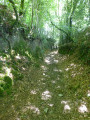
It is also an ideal spot for a pleasant walk through heathland and wooded valleys where peaceful streams flow.

Details

2724691
Creation:
Last update:
Last review:
  • Walking
    Activity: Walking
  • ↔
    Distance: 5.15 mi
  • ◔
    Average duration: 2h 40 
  • ▲
    Difficulty: Easy

  • ⚐
    Back to start: Yes
  • ↗
    Ascent: + 338 ft
  • ↘
    Descent: - 361 ft

  • ▲
    Highest point: 256 ft
  • ▼
    Lowest point: 89 ft
  • ⚐ Country: France
  • ⚐ City: Péaule (56130)
  • ⚑
    Start/End: N 47.594542° / W 2.36412°
  • ❏
    IGN map(s): Ref. 1021E, 1021SB
  • Hour-by-hour weather

Description of the walk

Start from the village of Couépion.

(S/E) At the far end of the village, leave the farm on your right and head up the road heading west towards Touchal.
As you approach the first buildings, leave the road and take the path branching off to the right, towards a wooded area. This wide path takes a sweeping bend as it descends into a small valley, then climbs back up towards the village of Kerhervio after crossing the stream.

(1) Ignore the signposting heading left and continue straight on. Pass the houses in the hamlet and turn left after the last one, onto the small path nestled between two large hedges.
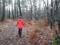
At the next crossroads, turn right. Pass the Ferme de Couéguel on your right and continue straight on along a wide, tree-lined path. It crosses a beautiful agricultural landscape before reaching an area of heathland planted with maritime pines.

(2) In the heart of this area, a wide path branches off to the right. Follow it down until you reach the vicinity of the stream. Just before you get there, a path branches off to the right into the woods. It winds its way some distance from the stream, sometimes deep within the woodland, sometimes along the edge, before emerging into an agricultural area. Please note: in wet weather, the proximity of the stream can make the path difficult to follow.

(3) Pass the chicane, turn left, cross the stream and head up the slope until you pass the rear of the first houses in Kerbodo. Turn right to enter the hamlet and cross it, following the tarmac road uphill. Follow it to the first junction, then turn right. Continue along the road until you can see the buildings of Kerlerno.

(4) As you approach this hamlet, a road branches off to the left. At the junction of the two paths, a flight of steps has been built to descend the embankment. Take these and follow the edge of the woods, then head deeper into the woods, following the embankments that once bordered an old track.
As you approach the bottom of the valley, ignore a path branching off to the left and continue straight on until you reach the stream again. Turn right then left to reach the footbridge that takes you across it.

(5) After crossing the stream, turn left onto the path that follows the valley floor, at the foot of the wooded hillside overlooking it. Pass two ponds that have been created on the other side of the stream, and continue along this same path. Just before reaching the Limerzel road, it climbs up the slope to join a magnificent sunken path lined with beech trees that descends to the vicinity of the Couéguel mill.
As you approach the property, turn away from it and take the path on the left that runs between the foot of the slope and the stream. Cross the stream a little further on and follow the path back up to the road.

(6) When you reach the road, turn right. This road is not very busy, but walking along its edge requires a degree of caution. Follow it until you pass the old mill and the left-hand bend overlooking it (approx. 500m).

(7) Just before the Talhouët mill, take the path that branches off the road to the right and heads down the slope towards the stream. A ford allows you to cross the stream, just before the entrance to the property. Continue straight on, following the wide sandy track that runs alongside the valley and climbs up onto the plateau in a broad S-shape. You will soon see the first houses of Couépion, the end of the route (S/E)

Waypoints

  1. S/E : mi 0 - alt. 223 ft - Couépion
  2. 1 : mi 0.86 - alt. 177 ft - Kerhervio
  3. 2 : mi 1.84 - alt. 256 ft - Landes de Mordan
  4. 3 : mi 2.29 - alt. 144 ft - Crossing the stream below Kerbodo
  5. 4 : mi 2.83 - alt. 213 ft - Before Kerlerno
  6. 5 : mi 3.17 - alt. 121 ft - Crossing the stream below Couéguello
  7. 6 : mi 4.03 - alt. 98 ft - Limerzel Road
  8. 7 : mi 4.36 - alt. 108 ft - Path to Talhouet Mill
  9. S/E : mi 5.15 - alt. 223 ft

Notes

Par temps humide, certains passages (proximité des ruisseaux, gué de Talhouet, abords d'exploitations agricoles...) peuvent être plus ou moins boueux. Il n'en demeure pas moins que les chemins sont bien solides et que, s'il est parfois possible de salir ses chaussures, pas de risque de s'y enliser.

Ravitaillement possible à Péaule.

Worth a visit

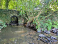
Le parcours suit pendant un long moment l'un des ruisseaux qui aboutissent au moulin de Couéguel. Le sentier y longe d'anciennes noës, prairies humides de fond de vallon, qui constituaient autrefois les garde-mangers de fin d'été pour les exploitations riveraines. Inadaptées à la mécanisation de l'agriculture, elles ont fait l'objet de déprise agricole et nombre d'entre-elles sont désormais en friches ou boisées, voire ont laissé la place à des plans d'eau. Toutefois, ce circuit permet de constater la survivance de certaines d'entre-elles et de leur système d'écoulement.

Reviews and comments

4.4 / 5
Based on 6 reviews

Reliability of the description
4.3 / 5
Ease of following the route
4.5 / 5
Route interest
4.5 / 5
Arzaela
Arzaela

Overall rating : 5 / 5

Date of your route : Apr 06, 2026
Reliability of the description : Not used / Not applicable
Ease of following the route : ★★★★★ Very good
Route interest : ★★★★★ Very good
Very busy route : No

Beautiful, especially between points 5 and 6. After point 2, there’s a muddy path that should definitely be avoided during heavy rain.

Machine-translated

Denis26
Denis26 ★

Thank you, Arzaela, for pointing that out; I’ve just amended the diagram so that it matches the description.

Machine-translated

Arzaela
Arzaela

Overall rating : 5 / 5

Date of your route : Apr 06, 2026
Reliability of the description : Not used / Not applicable
Ease of following the route : ★★★★★ Very good
Route interest : ★★★★★ Very good
Very busy route : No

It’s lovely, especially between points 5 and 6. At point 2, you can’t turn right; you have to take the previous path, which was very muddy and should definitely be avoided during heavy rain.

Machine-translated

Dede974
Dede974

Overall rating : 4 / 5

Date of your route : Jun 01, 2025
Reliability of the description : ★★★★☆ Good
Ease of following the route : ★★★★☆ Good
Route interest : ★★★★☆ Good
Very busy route : No

A nice route

Machine-translated

LouKas
LouKas

Overall rating : 5 / 5

Date of your route : Aug 22, 2024
Reliability of the description : ★★★★★ Very good
Ease of following the route : ★★★★★ Very good
Route interest : ★★★★★ Very good
Very busy route : No

A lovely walk! Thank you – it gave us a whole new perspective on Brittany!

Machine-translated

philrandovilaine
philrandovilaine

Thanks for the info. I’ll have a look when I get a chance. However, whilst it may overlap with existing marked routes, the proposed route wasn’t mapped out based on those, but solely following the route as it’s actually used. It’s therefore possible that there are several possible routes, even if this may cause some temporary disruption to the trail.
Best regards
Phil RV

Machine-translated

bobaliseurs
bobaliseurs

Hello, there is an error on the route. Point 2 is too far away, forcing you to cross a pine plantation and an impassable wood to reach the link between LIMERZEL and PEAULE.... Watch out for TICKS.
This walk is marked with yellow signs and signs from the municipality of PEAULE, which you must follow at all times.

Machine-translated

MG 91300
MG 91300

Overall rating : 4 / 5

Date of your route : Nov 04, 2022
Reliability of the description : ★★★★☆ Good
Ease of following the route : ★★★★☆ Good
Route interest : ★★★★☆ Good
Very busy route : No

And what’s more, there are lovely chestnuts
MG91300

Machine-translated

philrandovilaine
philrandovilaine

Could you please specify where and what kind of changes you are referring to? If you are referring to any signposting, please note that this route does not include any.
Kind regards
PhilRV

Machine-translated

593615
593615

Overall rating : 4 / 5

Date of your route : Mar 08, 2021
Reliability of the description : ★★★★☆ Good
Ease of following the route : ★★★★☆ Good
Route interest : ★★★★☆ Good
Very busy route : Yes

Hello.
This route has been modified

Machine-translated

Other walks in the area

For more walks, use our search engine .

The GPS track and description are the property of this route's author. Please do not copy them without permission.