Baudrières Route

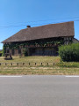
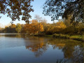
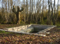
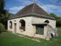
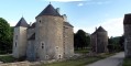
Baudrières is a charming village in the heart of the Natura 2000 area. During your walk, you’ll pass through picturesque landscapes comprising woods, meadows, streams and ponds, and you’ll come across several beautiful Bresse-style houses, including the ‘Maison Forte’ in the hamlet of Tenarre. You can admire the11th-century church with its stone bell tower, and also stop off at La Verne, a lake equipped for fishing and leisure activities.

Details

4656617
Creation:
Last update:
Last review:
  • Walking
    Activity: Walking
  • ↔
    Distance: 12.28 mi
  • ◔
    Average duration: 5h 50 
  • ▲
    Difficulty: Moderate

  • ⚐
    Back to start: Yes
  • ↗
    Ascent: + 243 ft
  • ↘
    Descent: - 262 ft

  • ▲
    Highest point: 689 ft
  • ▼
    Lowest point: 571 ft

Photos

Description of the walk

The walk starts in front of the11th-century Saint-Pierre Church. A large free car park is available a few metres away at Baudrières Park, near the tennis courts and baseball pitches.

(S/E) From the church, follow the Route de Saint-Vincent (D160) towards Saint-Vincent-en-Bresse, passing Baudrières Park on your right and the cemetery on your left.

(1) Turn left at thefirst road, the Route des Chevrières. Follow the pond on your right and continue along this road until you reach the junction with the Route de Saint-Étienne (D162).

(2) Turn right and take thefirst road on the right a few metres further on, Route du Nuzeret.

(3) Turn onto thefirst track on the left. Follow the track alongside the woodland until you reach Route des Buissons. Carry straight on along this road. Pass the farm buildings (on the left) and continue until you reach Route de Saint-Étienne (D162).

(4) Cross the Route de Saint-Étienne (taking care), take the Route des Roussenne and stay on this road until you reach the junction with the Rue de la Boucle.

(5) Turn left onto this street and carry on to the next junction. Turn left onto the Route du Petit Limon and, after about 150 metres, take thefirst track on the right, the Chemin de la Fouillie.

(6) Follow this track, which leads into the woods. Turn right into the woods, then you’ll come to a junction after a left-hand bend.

(7) Turn sharply right, then left in the middle of the woods onto the path running at right angles. Staying in the woods, carry on to the next path running at right angles and turn left. Continue to the Chemin des Grands Curtils. At the end, turn right until you reach the junction with Rue de Chevanys.

(8) Turn right onto this street from Chemin des Grands Curtils. At the junction of Rue des Chevanys and Chemin des Bruyères Janin, carry straight on along Chemin des Bruyères Janin heading west until you reach the crossroads in a left-hand bend.

(9) Ignore the path opposite and turn left towards the south. Continue along the road through the woods. At the junction with Rue des Chevanys, turn right and you will reach the junction with Route de Saint-Germain (D160) at a place called Les Bruyères.

(10) Cross the road (with care) and take Route du Château opposite. At the central junction, turn 90° left onto Route des Routis until you reach the junction at the hamlet of Les Routis.

(11) Turn right onto Rue du Moulin. For about 1 km, follow the path alongside the pond in the woods (on the left), then past a flour mill (on the right) and finally a farm. At the junction with Route de Cuisery (D933), cross the road (with care ) and take the small road opposite until you reachthe first path at right angles on the left.

(12) Head south along this track until you reach a T-junction. Continue left, pass La Tenarre and arrive at the tarmac road, Route du Pâquier, a few metres further on. Turn left onto it and follow it for about a hundred metres.

(13) Turn onto the track through the field on the right. At the end of this track, turn left onto Impasse du Chemin Creux and continue for a few dozen metres until you reach Route de Cuisery (D933). The Étang de Tenarre is right in front of you.

(14) Turn right onto Route de Cuisery, passing a beautiful Bresse farmhouse and a large farm , but watch out for traffic. Take thefirst road on the left, which leads to the Étang de la Verne.

(15) Turn left towards the lake onto Route de la Verne; keep to the right after a small car park, walk alongside Étang de la Verne and join a stony track. Take the track on the left between two fields to rejoin Route de la Verne. Follow it for 50 metres to the right.

(16) At the junction, turn right onto Route des Berceaux. The road runs between cultivated fields. When you reachthe first houses in Saugy, ignore the cul-de-sac on the right and carry on to Route de Simandre (D162).

(17) Turn left, then takethe first road on the right, Chemin du Bois de la Porte. After a left-hand bend followed by a right-hand bend, turn onto Chemin du Bouchy until you reach Route de Donant.

(18) Veer to the right to pass in front of Donant Pond. Continue along Route de Donant. This takes you through the fields. At thefirst junction, turn right; at the second, turn left; and at thethird, turn right until you reach the next crossroads.

(19) Pass Impasse des Petites Ravières on your right and continue along Route de Donant. At the junction, rejoin Route de Saint-Vincent (D160) – the road you took on the way there – turn left and continue to Saint-Pierre Church and the car park (S/E).

Waypoints

  1. S/E : mi 0 - alt. 656 ft - Starting point: Saint-Pierre Church
  2. 1 : mi 0.47 - alt. 633 ft - Route des Chevrières
  3. 2 : mi 1.06 - alt. 686 ft - Route du Nuzeret
  4. 3 : mi 1.38 - alt. 689 ft - La Grande Bernouse
  5. 4 : mi 2.04 - alt. 666 ft - Route de Saint-Étienne
  6. 5 : mi 2.24 - alt. 646 ft - Rue de La Boucle
  7. 6 : mi 2.56 - alt. 653 ft - Chemin de La Fouillie
  8. 7 : mi 3.01 - alt. 640 ft - Bois des Grandes Communautés
  9. 8 : mi 4.06 - alt. 630 ft - Rue des Chevanys
  10. 9 : mi 4.43 - alt. 607 ft - Chemin des Bruyères Janin
  11. 10 : mi 4.94 - alt. 636 ft - Les Bruyères
  12. 11 : mi 5.52 - alt. 604 ft - Les Routis
  13. 12 : mi 7.02 - alt. 574 ft - Pont des Relouises
  14. 13 : mi 8.37 - alt. 574 ft - Route du Pâquier
  15. 14 : mi 8.6 - alt. 623 ft - Tenarre Pond
  16. 15 : mi 8.91 - alt. 643 ft - Étang de la Verne
  17. 16 : mi 9.38 - alt. 643 ft - Route des Berceaux
  18. 17 : mi 10 - alt. 686 ft - Saugy
  19. 18 : mi 10.68 - alt. 666 ft - Route de Donant
  20. 19 : mi 11.64 - alt. 636 ft - Route de Donant
  21. S/E : mi 12.28 - alt. 656 ft - Car park – Saint-Pierre Church

Notes

You can stop off at La Verne, a lake equipped for fishing and leisure activities. It’s ideal for a picnic. Please be aware that you may encounter some vehicles whilst travelling along the various roads on this route.

Worth a visit

This route circles the village, passing close to various farms and three ponds. Woods and meadows alternate throughout the walk. Be sure to stop off at the ‘Maison Forte’, a beautiful Bresse-style house (exterior only).

Reviews and comments

3.8 / 5
Based on 3 reviews

Reliability of the description
4.3 / 5
Ease of following the route
3.7 / 5
Route interest
3.3 / 5
User 4023247

Thank you
Don’t worry, it’s absolutely lovely and stunning
Thank you
Thank you for your dedication to ensuring that we hikers can continue to discover more magnificent places whilst keeping fit

Machine-translated

OT Bresse Bourguignonne
• Edited:

Hello User 4023247

Thank you for leaving a review. We will look into the issue you raised in point 13.
We hope you still had a nice outing.
Have a nice day

Mélise
OT Bresse Bourguignonne

Machine-translated

User 4023247

Overall rating : 3.7 / 5

Date of your route : Jul 12, 2025
Reliability of the description : ★★★★☆ Good
Ease of following the route : ★★★☆☆ Average
Route interest : ★★★★☆ Good
Very busy route : No

Problem with point 13: the route indicated on the website does not exist or is not indicated. We drove 2 km further looking for it
There is a lot of tarmac and the route is difficult in hot weather as there is little shade
The lake has been dry for a long time, but drinking water is available, which is a plus
It took us 6 hours in 35°C heat

Beautiful hike

Machine-translated

User 4023247

Overall rating : 3.7 / 5

Date of your route : Jul 12, 2025
Reliability of the description : ★★★★☆ Good
Ease of following the route : ★★★☆☆ Average
Route interest : ★★★★☆ Good
Very busy route : No

We got lost at point 13 because the path indicated does not exist or is not visible. We ended up walking an extra 2 km back and forth trying to find it
Nice hike, but a lot of tarmac
It remains difficult in the heat because there are few places in the shade

Machine-translated

OT Bresse Bourguignonne

Hello,

Thank you for taking the time to leave a review of this route.
We hope you’ll find another tour that better meets your requirements.
Kind regards,

Mélise
Pays Bresse Bourguignonne Tourist Office

Machine-translated

cuzcodom
cuzcodom

Overall rating : 4 / 5

Date of your route : Mar 20, 2022
Reliability of the description : ★★★★★ Very good
Ease of following the route : ★★★★★ Very good
Route interest : ★★☆☆☆ Disappointing
Very busy route : No

Flat, with plenty of roads or dirt tracks.
Best avoided in hot weather.

Machine-translated

Other walks in the area

For more walks, use our search engine .

The GPS track and description are the property of this route's author. Please do not copy them without permission.