Country:

 City:
City:


When arriving in Aubusson via the D941, at the roundabout by the bridge over the Creuse, take the4th exit – the one after the bridge – to reach the Passerelle car park, a large free car park, though best avoided on Saturdays, market day. This walk is not signposted; the Visorando app is recommended.
(S/E) Return to the roundabout, leave the bridge on your left and go straight on (Avenue des Lissiers) with the River Creuse on your left. On your right, pass the Manufacture Saint-Jean, then, when you reach the Cité Internationale de la Tapisserie, take the pedestrian path on the left to avoid the coach station car park. Further on, you’ll rejoin the avenue and immediately cross the bridge over the Creuse.
(1) On the other side, turn slightly left, cross at the pedestrian crossing and head down Rue Jean Jaurès, which branches off to the right. After about sixty metres, take the steep, poorly maintained staircase on the left (alternative route: you can avoid this staircase by continuing along Rue Jean Jaurès and then turning left into Rue de la Vedrenne). The staircase leads to a junction; continue straight ahead.
(2) At the next junction of narrow streets, turn right and immediately take the earth and wooden steps on the right (which are somewhat neglected). Alternative route: if you’d prefer to avoid this section of fairly steep footpaths, carry on straight ahead along the street to rejoin the route a little further on at (3).
At the top of the few steps, continue along a path that climbs and offers your first views from the town’s heights. Walk for about 200 m; then, before a steep climb, you’ll quickly come to three descending paths in quick succession on the left. The first two are very steep; take the third one. Follow the path as it descends and joins a street at a junction.
(3) Follow Rue du Marchedieu straight ahead, slightly to the right, downhill. Continue straight on along Rue du Silence. At the end of the lane, turn right. You’ll reach a roundabout in the town centre, Place du Général Espagne. On the left, look out for a 15th-century corbelled house. Head towards the old Caisse d’Épargne building, then turn right. You’ll reach Rue Jules Sandeau; follow it to the left (the writer’s house is a little further on to the right). Turn left onto Rue de Méris. At the end of the street, you’ll arrive at the car park of a block of flats.
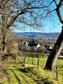
(4) Take a grassy path that climbs gently to the left. At the T-junction with a footpath, turn left. Further on, the path becomes tarmac; ignore the path that leads back down to the left. Enjoy the views of the town below. A little further on, ignore another path leading down to the left, then you’ll reach the Clock Tower and its viewpoint. Continue along a dirt track that descends and leads onto some steps. At the bottom, take the road on the right to quickly reach an old bridge over the Creuse, the Pont de la Terrade.
(5) Cross the bridge; on the other side (in the old housing estate), go straight on, turn left at the first street, then left again onto a cobbled street, then keep left at the junction and you’ll come back to the Pont de la Terrade. Cross the Creuse again.
(5) Head to the right, then turn right at the junction just after that (Quai des Îles). Turn left onto Rue des Îles. At the crossroads, with a fountain opposite, go straight on along Grande Rue (the main shopping street) for just a few metres. Head diagonally left towards the war memorial, then turn right onto Rue Vieille. Further on, you’ll rejoin Grande Rue. Follow it straight on for a few metres, then, when you reach a mural on the left (depicting a falconer), take the steps on the right. When you reach a street, walk a few metres to the right, then turn immediately left onto Rue de l’Escarpe. At the junction, opposite a flight of steps, turn right and you’ll arrive at the junction of the narrow streets you passed on the way there.
(2) Turn right onto Rue du Chapitre. About fifty metres further on, head towards the ruined tower on the embankment to your left, which overlooks the town – a remnant of the medieval castle. On the other side of the ruins, take a few steps and follow a path that leads back to the street, then continue to the left. You’ll arrive at a car park; walk straight across it towards the church, then walk along its right-hand side to find the entrance. It’s poorly lit, which is a shame as it features some beautiful paintings on its vaults and in its chancel.
(6) On leaving the church, go down the stairs then turn left (mural, pink birds). Stay on this street until you reach the junction opposite the bridge over the Creuse. Turn right onto Rue des Déportés Politiques, then take the left-hand passageway under the archway marked ‘Vers mairie’ (Towards the town hall), which leads to the footbridge. Take the footbridge to cross the Creuse one last time. On the other side, turn left towards the large car park (S/E).
 Visorando Member
 Moderate