Lachaud and La Genête circular loop

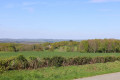
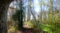
A walk mostly along shaded paths around Saint-Marc-à-Frongier. The walk starts at the entrance to the village, next to the bread oven. At the start, there is a view of Saint-Marc-à-Frongier Castle.

Details

107593340
Creation:
Last update:
Last review:
  • Walking
    Activity: Walking
  • ↔
    Distance: 6.34 mi
  • ◔
    Average duration: 3h 15 
  • ▲
    Difficulty: Moderate

  • ⚐
    Back to start: Yes
  • ↗
    Ascent: + 433 ft
  • ↘
    Descent: - 440 ft

  • ▲
    Highest point: 2,064 ft
  • ▼
    Lowest point: 1,831 ft

Description of the walk

Start at the Place du Presbytère at the entrance to the village, next to the bread oven. Parking spaces and picnic tables available.

(S/E) From the bread oven, turn right towards Aubusson.

(1) Turn left onto the Chemin de la Sagne. Then turn sharply left.

(2) Turn right onto the road for 50 metres , then take the path on the left. You’ll see a cross a little further along the road, known as the Croix des Chameaux. Pass one junction, then another on the right. Continue to the first path on the left, then, at the end, turn right towards Farges.

(3) Cross the road and take Rue du Dognon, first turning right then left.

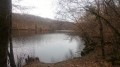
(4) In the village of Lachaud, take the path by first turning left then right next to the “pêcherie”. At the Fork in the road, keep left.

(5) At the end of the path, take the road on the left.

(6) Then take the D32 on the right.

(7) Turn off onto the path on the left.

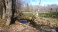
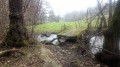
(8) Cross the stream using the wooden footbridge. At La Genête, keep to the right and take the path on the right again at the next junction.

(9) As you pass through the village of Saint-Marc-à-Frongier, walk past the church and head towards the bread oven (S/E).

Waypoints

  1. S/E : mi 0 - alt. 1,873 ft - Bread oven
  2. 1 : mi 0.07 - alt. 1,883 ft - Impasse de la Sagne, a peatland area
  3. 2 : mi 0.79 - alt. 1,972 ft - Croix des Chameaux
  4. 3 : mi 1.32 - alt. 2,014 ft - Farges, Rue du Dognon
  5. 4 : mi 3.35 - alt. 2,014 ft - The village of Lachaud
  6. 5 : mi 4.19 - alt. 1,893 ft - End of the path
  7. 6 : mi 4.5 - alt. 1,946 ft - Four roads, D32
  8. 7 : mi 4.88 - alt. 1,873 ft - Chemin de la Genête
  9. 8 : mi 5.03 - alt. 1,831 ft - La Genête Plank Bridge
  10. 9 : mi 6.23 - alt. 1,877 ft - Église Saint-Marc (Saint-Marc-à-Frongier)
  11. S/E : mi 6.34 - alt. 1,873 ft - Bread oven

Worth a visit

View of the castle at St-Marc-à-Frongier

Other walks in the area

For more walks, use our search engine .

The GPS track and description are the property of this route's author. Please do not copy them without permission.