Country:

 City:


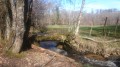
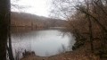
The starting point is at the entrance to the village as you come from Aubusson, at Place de l’Ancien Presbytère, next to the pond. There are parking spaces available and a shaded picnic table where you can enjoy a light snack to round off your walk.
(S/E) Opposite the house (the former presbytery), take the road on the right towards Aubusson for about a hundred metres, then turn left onto Chemin de la Sagne.
(1) Turn sharply left, rejoin the tarmac road and continue to the right for about 200 metres.
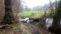
(2) Turn left: a little further on you’ll see the Croix des Chameaux. Continue along the shaded path.
(3) Before reaching the main road, take Chemin de Farges on the left. This leads onto a small road called La Planchette.
(4) Turn left and follow this road straight on for about 700 m. Take the path on the right and carry on straight until you reach another road, the Route de Mergoux.
(5) Turn left and continue to the Ouchères housing estate. Turn left again onto the Chemin des Pontes, which bends to the right and then joins the Rue de la Planchette near the town hall.
(6) Turn right and walk past the school and the community hall. Enter the village and walk past a fountain and a hazelnut press. At the next junction, you’ll find yourself facing the village fountain, with a wash house behind it. Keep to the left.
(7) Walk past the village church, built in the transitional Romanesque style. It dates from the 12th century, was remodelled in the 15th century and restored in the 19th century. Continue to the Place de l’Ancien Presbytère (S/E).
The description must end with a reference to the finishing point: (E) for a point-to-point walk, (S/E) for a circular walk.

 Local authority
 Moderate

 Visorando Member