Montrugeas Chapel and Saint-Roch Fountain

A short walk in the hills above Saint-Marc-à-Frongier, taking you from the Chapel of Montrugeas to the Saint-Roch Fountain via the terraced village of Chambroutière. On the way back, you can admire the views of the surrounding countryside and the Auvergne mountains.

Details

22454277
Creation:
Last update:
Last review:
  • Walking
    Activity: Walking
  • ↔
    Distance: 2.51 mi
  • ◔
    Average duration: 1h 25 
  • ▲
    Difficulty: Easy

  • ⚐
    Back to start: Yes
  • ↗
    Ascent: + 279 ft
  • ↘
    Descent: - 282 ft

  • ▲
    Highest point: 2,254 ft
  • ▼
    Lowest point: 2,028 ft

Photos

Description of the walk

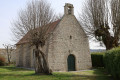
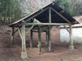
Park at the side of the path or on the right-hand side in front of the Saint-Roch de Montrugeas Chapel

(S/E) With your back to the chapel, join the RD32 and follow it to the left until you reach the first junction.

(1) Turn left, leave the RD32 and head down a track which is tarmac at first. Pass under a power line.

(2) Shortly afterwards, take the first track on the right to head back up towards the village of Chambroutière. At the entrance to the village, turn left into Rue Combes Barraud, then go up the track on the right and take the Chemin de l’Ouchette.

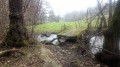
(3) Head downhill to the right, walk past a fountain and turn left to rejoin the RD32. Leave the road and take the first path on the left.

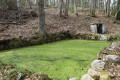
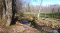
(4) A sign points to the Fontaine Saint-Roch. Head a short way into the woods to reach it and continue along the path.

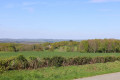
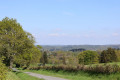
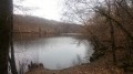
(5) At the top of the path, turn right. As you walk on, you’ll be able to admire the view of the surrounding countryside. At the end of the path, turn right onto the road. You’ll have a view of the Auvergne mountains ahead of you. Carry on until you reach the D32.

(1) Turn left to return to the chapel. A little further along the road, you’ll see a stone cross with a shrine in a field on your left (S/E).

Waypoints

  1. S/E : mi 0 - alt. 2,113 ft - Chapelle Saint-Roch (Montrugeas)
  2. 1 : mi 0.11 - alt. 2,103 ft - Crossroads at the end of the circular loop
  3. 2 : mi 0.51 - alt. 2,028 ft - Fork in the path
  4. 3 : mi 1.09 - alt. 2,129 ft - Chambroutière Fountain
  5. 4 : mi 1.6 - alt. 2,139 ft - Saint Roch Fountain
  6. 5 : mi 1.81 - alt. 2,254 ft - Viewpoint
  7. S/E : mi 2.51 - alt. 2,113 ft - Chapelle Saint-Roch (Montrugeas)

Notes

You can park along the path leading to the chapel or on the right-hand side next to the chapel.

Worth a visit

Reviews and comments

4.7 / 5
Based on 2 reviews

Reliability of the description
5 / 5
Ease of following the route
5 / 5
Route interest
4 / 5
BRELAUD
BRELAUD

Overall rating : 4.7 / 5

Date of your route : Nov 17, 2025
Reliability of the description : ★★★★★ Very good
Ease of following the route : ★★★★★ Very good
Route interest : ★★★★☆ Good
Very busy route : No

Beautiful countryside, pretty hamlet of Chambroutière, very pleasant short walk.

Machine-translated

ThierryGomez
ThierryGomez

Overall rating : 4.7 / 5

Date of your route : Feb 02, 2023
Reliability of the description : ★★★★★ Very good
Ease of following the route : ★★★★★ Very good
Route interest : ★★★★☆ Good
Very busy route : No

A lovely little route, with no difficulties.
It’s impossible to get lost because it’s so well signposted – well done to the trail markers.

Machine-translated

Other walks in the area

For more walks, use our search engine .

The GPS track and description are the property of this route's author. Please do not copy them without permission.