Noirchain and Asquillies

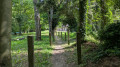
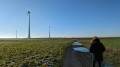
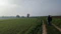
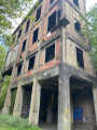
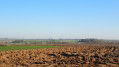
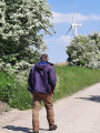
A lovely rural walk between these two villages, where four wind turbines are currently being erected at a place called Tout Vent, offering a lovely view of the Borinage slag heaps, the horses from the stud farm grazing in the meadows at Noirchain, and the deconsecrated church at Asquillies, which was converted into a home in 2014. https://fr.wikipedia.org/wiki/Noirchain

Details

n°25531794
Creation:
Last update:
Last review:
  • Walking
    Activity: Walking
  • ↔
    Distance: 4.05 mi
  • ◔
    Average duration: 1h 55 
  • ▲
    Difficulty: Easy

  • ⚐
    Back to start: Yes
  • ↗
    Ascent: + 105 ft
  • ↘
    Descent: - 98 ft

  • ▲
    Highest point: 243 ft
  • ▼
    Lowest point: 154 ft

Photos

Description of the walk

In Noirchain, park in the small square on Rue du Chêne.

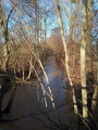
(S/E) Head towards the sign for “Ruisseau des Rogneaux”, then turn left towards the stud farm buildings on Rue d’Asquillies.

(1) When you reach the bend in front of the riding school, turn left onto the path crossing over the Ruisseau des Rogneaux; walk up through the meadows towards the slag heap until you reach the cemetery, then turn right onto what used to be the route of the Roman road.

(2) Before the motorway bridge, turn right, then right again, and head up to the junction.

(3) Turn left towards Asquillies.

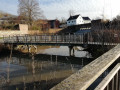
(4) When you reach the isolated house, turn right, pass the cemetery and turn left. Walk down Rue du Château and the footpath at No. 19 (gate with a horse-drawn carriage), join Rue des Montrys – which runs alongside the Ruisseau le By – and turn left.

(5) When you reach the white chapel, set back from the street, turn left, walk up to Rue du Château, and turn right towards the church.

(6) At the fork before the church, turn left onto Chemin de Ciply, pass the chapel and continue straight on along the copse.

(7) Pass the copse, follow the path to the left which goes round it (it may be hidden by vegetation in the summer months), and return to the junction you passed on the way there.

(4) Turn right towards Noirchain, following the route back in the opposite direction to the way out.

(3) Carry on straight ahead to return to the riding school.

(1) Turn left to return to the car park (S/E).

End of a short countryside walk through a landscape that is gradually changing – have a lovely day.
Waypoints

  1. S/E : mi 0 - alt. 187 ft - Small square on Rue du Chêne
  2. 1 : mi 0.12 - alt. 184 ft - Stud Farm
  3. 2 : mi 0.83 - alt. 167 ft - R5 Bridge
  4. 3 : mi 1.41 - alt. 236 ft - Junction common to both the outward and return journeys
  5. 4 : mi 2.06 - alt. 200 ft - Junction common to both the outward and return journeys
  6. 5 : mi 2.49 - alt. 171 ft - White Chapel
  7. 6 : mi 2.61 - alt. 187 ft - T-junction before the church
  8. 7 : mi 2.91 - alt. 164 ft - Path after the copse
  9. S/E : mi 4.05 - alt. 187 ft - Small square on Rue du Chêne

Reviews and comments

5 / 5
Based on 1 review

Reliability of the description
5 / 5
Ease of following the route
5 / 5
Route interest
5 / 5
mich simon
mich simon
• Edited:

Glad you enjoyed it
You can actually vary the route and link it up with the one in Bougnies if you’re feeling up to it .
Have a lovely day

Machine-translated

Kérian4
Kérian4
• Edited:

Overall rating : 5 / 5

Date of your route : Aug 20, 2023
Reliability of the description : ★★★★★ Very good
Ease of following the route : ★★★★★ Very good
Route interest : ★★★★★ Very good
Very busy route : No

A brilliant walk! We did it at sunset – it was absolutely breathtaking.
It’s very relaxing as the paths are mostly through fields, so this walk is very peaceful and quite safe.

We had a bit of trouble spotting the edge of the hedgerow and lost our way there for a moment; in the end (as mentioned in the description), it was hidden by the vegetation and it was quite fun to make our way through it.

There’s very little elevation gain, so it’s almost effortless. And this route takes you along plenty of little paths, which leaves scope for exploring alternative routes in the future.

I’d highly recommend it! For us, this route was a 10 out of 10.

Machine-translated

Other walks in the area

For more walks, use our search engine .

The GPS track and description are the property of this route's author. Please do not copy them without permission.