


Unfortunately, the route shown does not pass directly through Mont-Louis. For walkers who also wish to explore the fortified town and continue along the Chemin Vauban towards La Llagonne, here is the route for the Mont-Louis–La Llagonne section: Chemin Vauban Mont-Louis–La Llagonne
The Chemin Vauban: From Villefranche de Conflent to Aunat


This multi-day hike allows you to explore the Chemin Vauban between Villefranche-de-Conflent and Aunat, along a route of over 100 km crossing the Pyrénées-Orientales, Ariège and Aude.
The route offers a wide variety of landscapes and heritage sites. In particular, it takes you past Fort Libéria, the Séjourné Bridge, the Tour de Creu, Usson Castle, as well as numerous villages and examples of local heritage.
However, the route presents varying levels of difficulty depending on the section. Some sections are easy and accessible to everyone, whilst others are long, challenging and involve significant elevation changes.
This is an ideal route for walkers wishing to explore a trail combining heritage, history and scenery, whilst being well prepared for the differences in difficulty and signposting depending on the section.
Logistics: linear route. Arrange for a vehicle in Aunat to take you to the starting point.
Details
Creation:
Last update:
Last review:
–
–
-
 Activity: Walking
 -
 Distance: 62.70 mi
 -
 Average duration: 5 days
 -
 Difficulty: Difficult
 -
-
 Back to start: No
 -
 Ascent: + 12,717 ft
 -
 Descent: - 11,096 ft
 -
-
 Highest point: 6,509 ft
 -
 Lowest point: 1,394 ft
-
 Country:
France
Country:
France
-
 Area: Pyrenees
 -
 City:
Corneilla-de-Conflent (66820)
City:
Corneilla-de-Conflent (66820) -
 Start: N 42.587017° / E 2.369807°
 -
 End: N 42.792376° / E 2.095937°
 -


 Hour-by-hour weather
Stages of the route
This route needs several days, find the details below:
Notes
Other walks in the area
Chemin Vauban from Villefranche de Conflent to Olette
 Visorando Member14.38 mi
+4,308 ft
-3,694 ft
10h 20
Difficult
Departure from Corneilla-de-Conflent (Pyrénées-Orientales)
Visorando Member14.38 mi
+4,308 ft
-3,694 ft
10h 20
Difficult
Departure from Corneilla-de-Conflent (Pyrénées-Orientales)
This section of the Chemin Vauban links Villefranche-de-Conflent to Olette via a challenging and demanding route, characterised by a succession of ascents and descents that give the route a real ‘yo-yo’ effect and can make the walk particularly tiring. Despite this difficulty, the scenery is well worth the effort, with beautiful panoramic views of the surrounding peaks and the chance to explore the village of Jujols, situated halfway along the route.
Historical route above Villefranche-de-Conflent
 9.92 mi
+2,592 ft
-2,585 ft
6h 50
9.92 mi
+2,592 ft
-2,585 ft
6h 50
 Moderate
Departure from Corneilla-de-Conflent (Pyrénées-Orientales)
Moderate
Departure from Corneilla-de-Conflent (Pyrénées-Orientales)
This route allows you to discover military remains (Vauban's cistern and redoubt) as well as former ore quarries (marble, manganese and talc) and, above all, superb panoramic views of the Têt and Cady valleys. You can also see Villefranche-de-Conflent and Fort Libéria from above.
This is a fairly easy hike, but don't underestimate the length.
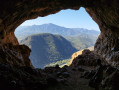
Chapel of Our Lady of Life and caves
 1.33 mi
+1,086 ft
-1,086 ft
1h 35
Moderate
Departure from Fuilla (Pyrénées-Orientales)
1.33 mi
+1,086 ft
-1,086 ft
1h 35
Moderate
Departure from Fuilla (Pyrénées-Orientales)
What could be more surprising than visiting a chapel built by human hands, completely isolated on a seemingly impassable rock face, with a huge cave overlooking it, also equipped with an altar forming another chapel, this one natural and even larger than the previous one!On the way up, there is a smaller cave. Both caves are completely safe. With a torch, you can explore them more fully...From up there, you'll get a breathtaking view of the Têt Valley, the surrounding valleys and the Canigou.
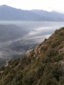
Loop on the steep slopes of Sant-Pere, at the foot of Roc Campanya
 4.62 mi
+2,159 ft
-2,146 ft
4h 00
Difficult
Departure from Fuilla (Pyrénées-Orientales)
4.62 mi
+2,159 ft
-2,146 ft
4h 00
Difficult
Departure from Fuilla (Pyrénées-Orientales)
This is a good, challenging hike, mostly off the beaten track, along ancient paths in the Sant-Pere massif. At the foot of Roc Campanya/Campagna, you will discover an incredible view of the Têt and Rotja valleys. There is a 180° view with the 2,784-metre-high Canigou in the south.
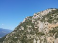
Tour and ascent of Roc Campanyà via the Vauban trails
 6.30 mi
+3,163 ft
-3,153 ft
4 hrs
6.30 mi
+3,163 ft
-3,153 ft
4 hrs
 Extremely difficult
Departure from Fuilla (Pyrénées-Orientales)
Extremely difficult
Departure from Fuilla (Pyrénées-Orientales)
Roc Campanyà or Campagnia rises to an altitude of 1,134 metres, just above the Mas de Lastourg campsite in the Têt Valley, very close to Villefranche-de-Conflent. Its pointed, aggressive silhouette and the chaos of the Sant-Pere massif on which it is perched suggest that it is inaccessible without climbing equipment... But it's not. With a good pace and a good sense of direction, hikers can reach the summit in just 3 hours.Read the comments carefully before setting off on this route. Don't hesitate to turn back. There is a way out of the route between (10) and (5): return via the Vallon des Horts, a hike described here on visorando. The point (10) on this route corresponds to the point (4) on the other route.
De Lastourg à Villefranche-de-Conflent
1.50 mi
+69 ft
-138 ft
0h 45
 Easy
Departure from Fuilla (Pyrénées-Orientales)
Easy
Departure from Fuilla (Pyrénées-Orientales)
Comment gagner Villefranche-de-Conflent depuis Lastourg sans emprunter la dangereuse N116, qui n'a aucune circulation piétonne de prévue ?Petite découverte d'un circuit alternatif le long de la Têt !Attention, cette randonnée qui emprunte un itinéraire partiellement sur le terrain d'ERDF (non clôturé), se fait à vos risques et périls !
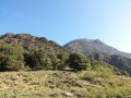
From Lastourg to the Jando Canal
 3.20 mi
+669 ft
-640 ft
2h 05
Moderate
Departure from Fuilla (Pyrénées-Orientales)
3.20 mi
+669 ft
-640 ft
2h 05
Moderate
Departure from Fuilla (Pyrénées-Orientales)
This short hike of just over 7 km takes you along the banks of the Canal de Jando (or "Rec Nou"), an abandoned irrigation canal that now serves as a footpath.The unmarked trail is located on the south side of the Têt valley and offers a sunny 2.5-hour walk or 1.5-hour run on suitable sections, close to the campsite, providing hikers with an alternative to longer hikes that require a car.
From Mas de Lastourg to Serdinya along the banks of the River Têt
2.15 mi
+197 ft
-0 ft
1h 10
Easy
Departure from Fuilla (Pyrénées-Orientales)
To get from the outskirts of the Mas de Lastourg campsite to Serdinya without taking the main road, there is a lovely path that runs alongside the River Têt.Please note: you are not permitted to cross the campsite – it is private property!
For more walks, use our search engine .
The GPS track and description are the property of this route's author. Please do not copy them without permission.

