Chemin des Trois Pierres in Latronquière

Latronquière Town Hall invites you to explore the area via a series of routes that allow you to admire the unspoilt natural surroundings and heritage typical of the Haut Ségala region.
Route No. 5 takes you around Lake Tolerme, the largest artificial lake in the Lot department.

Details

n°47851309
Creation:
Last update:
Last review:
  • Walking
    Activity: Walking
  • ↔
    Distance: 9.18 mi
  • ◔
    Average duration: 5h 05 
  • ▲
    Difficulty: Moderate

  • ⚐
    Back to start: Yes
  • ↗
    Ascent: + 1,020 ft
  • ↘
    Descent: - 1,027 ft

  • ▲
    Highest point: 2,169 ft
  • ▼
    Lowest point: 1,739 ft

Photos

Description of the walk

(S/E) With your back to the town hall, head right into Rue du Foirail. Turn right into Rue de la Fontaine. At the ‘give way’ sign, turn right into Rue du Ségala. Walk past the bakery and, at number 25, take the path on the left until you reach Route des Méjas. Continue straight on until you reach the Fork in the road and Route de Puéchuzal.

(1) Turn right. At the top of the hill, take the path on the left. Walk through the hamlet of Les Méjas and continue along the path until you rejoin Route des Méjas.

(2) Turn left onto it, then take the grassy path on your right which leads down to the Route de Goutteredonde.

(3) Turn right onto it until you reach the path leading down to the Moulin de Tarenque (first on the right).

(4) Follow it to the mill, then continue along the track. At the Fork in the road, take the left-hand path to the Route de Goutteredonde, which you follow to the right.

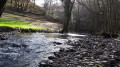
(5) At the Fork in the road, carry on to the right and turn left onto the path leading down towards the River Tolerme. Pass the pumping station.

(6) Take the Route du Moulin. Cross the Tolerme. At the crossroads, continue along the path on the left until you reach Rue de la Rivière. Follow this road uphill to reach the village of Sénaillac-Latronquière.

(7) At the square, turn left onto Rue Jean Moulin to reach Rue du Ségala. Cross the road and continue straight ahead onto Route du Lac.

(8) At the edge of Lac du Tolerme, take the path that goes round the lake. You’ll pass the Haut Ségala rowing club and the restaurant Les Rives du Tolerme, which overlooks the beach.

(9) Continue round the lake until you reach the restaurant La Presqu’Île on the other side.

(10) Take the road that passes in front of the Arche du Tolerme.

(11) At the crossroads, carry on straight ahead until you reach the top of the hill.

(12) Take the path on the left and continue until you reach the road. Turn right onto it, heading towards Lavergne de Pagnoux.

(13) At the fork in the road, turn left. Walk through the hamlet and, at the next crossroads, carry on straight ahead until you reach a fork, Impasse du Prat.

(14) Turn left. Leave the hamlet on your right and continue along the path. You’ll cross the Puech Lasvieilles stream. You’ll pass the three stones and arrive at the Route des Cadourques.

(15) Turn left onto it, walking along the pavement. After the fire station, take Rue du Lavoir and walk up to Place de l’Église.

(16) To the left of the wayside cross, take Rue André Malraux, which leads back to Place de l’Église, circling round the Templiers neighbourhood. Take Rue de l’Église on the right, until you reach the junction with the Salle des Fêtes (former town hall).

(17) Cross the road to reach Rue de la Fontaine. Walk past the bookshop and turn right to reach the town hall. (S/E)

Waypoints

  1. S/E : mi 0 - alt. 2,142 ft - Latronquière Town Hall – Place du 19 mars 1962
  2. 1 : mi 0.47 - alt. 2,087 ft - Route de Puéchuzal
  3. 2 : mi 1.22 - alt. 1,916 ft - Route des Méjas
  4. 3 : mi 1.67 - alt. 2,169 ft - Route de Goutteredonde
  5. 4 : mi 2.04 - alt. 2,067 ft - Chemin du Moulin de Tarenque
  6. 5 : mi 2.97 - alt. 2,001 ft - Le Cayla, two buildings
  7. 6 : mi 3.55 - alt. 1,824 ft - Pumping station
  8. 7 : mi 3.97 - alt. 1,814 ft - Sénaillac-Latronquière village square
  9. 8 : mi 4.31 - alt. 1,749 ft - Lake Tolerme Circular Trail
  10. 9 : mi 4.81 - alt. 1,768 ft - Les Rives du Tolerme restaurant
  11. 10 : mi 5.81 - alt. 1,772 ft - La Presqu’ïle restaurant
  12. 11 : mi 5.94 - alt. 1,795 ft - Arche du Tolerme
  13. 12 : mi 6.58 - alt. 2,037 ft - At the top of the hill
  14. 13 : mi 7.11 - alt. 1,890 ft - Lavergne de Pagnoux
  15. 14 : mi 7.31 - alt. 1,942 ft - Impasse du Prat
  16. 15 : mi 8.53 - alt. 2,110 ft - Route des Cadourques
  17. 16 : mi 8.91 - alt. 2,123 ft - Place de l’Église, wayside cross
  18. 17 : mi 9.11 - alt. 2,123 ft - Crossroads at the Salle des Fêtes (former Town Hall)
  19. S/E : mi 9.18 - alt. 2,139 ft - Latronquière Town Hall – Place du 19 mars 1962

Notes

Muddy stretch between points (14) and (15).
Toilets and a motorhome service point behind the post office, next to Latronquière Town Hall.

Worth a visit

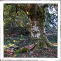
The three stones, one of which is marked with a cross, remain a mystery… As this simple cross does not resemble those of the Commandery of the Knights Hospitaller, for which La Tronquière was the birthplace in the 13th century. For more information on the village’s history, click here

Discover the activities around Lake Tolerme:
The lake, covering an area of 38 ha, is situated at an altitude of 532 m.
It is popular with anglers and walkers all year round. Part of the path that circles the lake features a fitness trail. The sandy beach is lifeguarded in July and August and offers a range of water sports.

Reviews and comments

4.7 / 5
Based on 1 review

Reliability of the description
5 / 5
Ease of following the route
4 / 5
Route interest
5 / 5
User 1419736

Overall rating : 4.7 / 5

Date of your route : May 28, 2026
Reliability of the description : ★★★★★ Very good
Ease of following the route : ★★★★☆ Good
Route interest : ★★★★★ Very good
Very busy route : No

A lovely first part of the walk with some beautiful shaded paths. As Lake Tolerme was halfway along the route, we stopped there for a picnic, joined by some friends who weren’t walking.
And as the weather was too fine and too hot... we stayed there.
What about the rest of the walk? Next time

Machine-translated

Other walks in the area

For more walks, use our search engine .

The GPS track and description are the property of this route's author. Please do not copy them without permission.