Country:

 City:
City:



Unless otherwise stated in the description below, follow the green signposts.
(S/E) From the school car park, walk up Rue du Lavoir then turn right onto the D233 towards the village centre, leaving the square on your left. Walk past the post office.
(1) Turn right at the roundabout in front of the bakery.
At the bridge, turn right into Rue Lamartine. After 150 m uphill along the road, take the path straight ahead under the trees until you reach a small road.
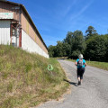
(2) Turn left onto this road at the shed fitted with solar panels, then turn right onto the road after 150 m, following the sign for Contival / Minerves Hautes.
(3) Leave the road and take the path to the right at the ‘Croix de Contival’ sign, leaving the green signposting behind. A little further on, you can visit the Croix de Contival, which is signposted on the left. The path leaves the woods and leads to the hamlet of Le Bos.
(4) Turn onto the road on the left and follow it as it passes through Périécanot and then Labroussette, where you rejoin the green signposting.
(5) Follow the road to the left, passing the Moulin de Labroussette.
(6) After the road bends left into a fir wood, take the path leading uphill through the wood on the left, heading due north, to reach the hamlet of Lagarde.
(7) In the hamlet, veer slightly to the right and follow the road to a pond.
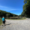
(8) At the pond, which is surrounded by wire fencing, take the path to the left and then to the right, following the fence around the pond. You will come to a fork in the path.
(9) Turn right onto the path that runs alongside the meadow. Follow the green signposts and head up the path to the small housing estate. Join the road on the left, leaving the Route de la Garouste on your right. Continue until you reach the departmental road.
(10) Turn right onto it for 100 m, then leave it on the left and follow the path that goes round the farm on the hill (Comps). Follow the path and the green signposts to the hamlet of Maurian, where you rejoin the small tarmac road.
(11) Turn left onto the departmental road for a few metres, then turn right towards the Moulin de Maurian, its pond and its rural lodge. The path signposted in green continues to the hamlet of Madelco.
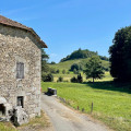
(12) Turn right, at the bread oven, onto the path leading up towards the craft workshop, then follow the path on the left.
(13) Cross the meadow, heading for the tree with a signpost for the route; once at the tree, follow the path through the meadow to the edge of the woodland, where the path heads south (use the GPS track here).
(14) When you see the houses at La Bitarelle, turn right onto the path running alongside the meadow. After 400 m, follow the path to the left and join the district road leading back to the village (on the left).
(15) Opposite the football pitch, take the path on the left before the EDF transformer. This path leads down to the village.
(1) When you reach the road, you’ll recognise the path you took on the way there. Turn right at the starting point (S/E).


 Visorando Member

 Easy
Easy