Country:
 City:


Starting point: car park between the cemetery and the Caisse d’Épargne, Avenue Lavoisier.
Yellow markings
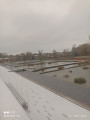
(S/E) With your back to the starting signpost, turn left towards the park. Follow the path round the pond, then continue to follow the markings as you cross to the other side of the avenue and walk past the sports grounds on your left. You’ll come out onto a road.
(1) Follow it to the left along the wide pavement until you reach the next junction.
(2) Take the grassy path branching off to the right and join a road. Follow it to the left, alongside the N25. After a left-hand bend, at the junction, turn right to come straight away to a crossroads.
(3) Turn right again to cross the bridge over the ring road. Continue on the other side for about 150 m until you reach a crossroads.
(4) At the sign for the hamlet of Wagnonlieu, turn right onto a dirt track which then becomes a grassy path leading towards the N25.
(5) Stay on the grassy track, which turns left to begin the descent towards Duisans (no signposting at this point). Cross a road and continue straight ahead along the track that turns left (no signposting here) until you reach the D60.
(6) Cross the road, continue straight ahead, diagonally, and further on, pass under the railway line.
(7) On the other side, turn left and follow the track uphill until you reach a bridge on the left.
(8) Cross the bridge to return to the other side of the railway line, heading towards Dainville. At the junction, keep right and return to a junction you passed on the way there.
(4) Follow the route back in the opposite direction to the outward journey, crossing the road bridge again and continuing to the next junction, which you also passed on the outward journey.
(3) Turn right twice and follow the tarmac road, which takes two left-hand bends before reaching a junction.
(9) Turn left, then take the first path on the right. Carry on straight ahead, passing the military cemetery on your right, then continue for about twenty metres along the road (D19) on the right.
(10) Take the road on the left with the cycle path, then turn right onto Rue Pasteur; continue to the junction and carry on straight ahead along Rue de la Gare until you reach the path on the left.
(11) Follow this path to enter part of Dainville Park. On leaving the park, turn right onto Rue Jean Jaurès, follow it up and re-enter the park at the top of the street. Turn left at the park entrance, then continue straight on, passing under the archway and exiting onto Rue des Prés.
(12) Follow it to the left, then turn right to cross the last small park on the walk. Then turn left onto Rue des Sorbiers for a few metres.
(13) Turn right onto Rue d’en Bas, go round the roundabout and return to the car park (S/E).

 Association / Club / Walk leader

 Visorando Member
 Easy