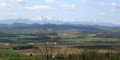
Route Le Bayle in Villelongue-d’Aude

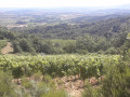
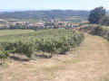
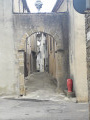
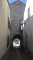
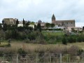
A route through the lower Razés, amidst the wine-growing valleys, a charming little village built in a circular layout to ensure its defence.

Details

3542192
Creation:
Last update:
Last review:
  • Walking
    Activity: Walking
  • ↔
    Distance: 3.36 mi
  • ◔
    Average duration: 1h 55 
  • ▲
    Difficulty: Moderate

  • ⚐
    Back to start: Yes
  • ↗
    Ascent: + 469 ft
  • ↘
    Descent: - 472 ft

  • ▲
    Highest point: 1,463 ft
  • ▼
    Lowest point: 1,010 ft

Photos

Description of the walk

Start from the car park by the cemetery at the village entrance.

Signposted: Yellow Circle.

(S/E) Head uphill towards the village centre, turn left past the town hall and the post office, and continue along the road towards La Bézole.

(1) Turn right at the third street (Rue des Bordes, then Chemin de Coumeillo), at the last house on the left as you leave the village. Follow the path straight ahead, ignoring the one on the left.
Walk up the path, which is partly gravel and partly tarmac, keeping straight on and ignoring the paths on either side until you reach the top of the hill.
Pass to the left of a shed. Behind a hedge, the path branches off to the left and descends to a hairpin bend to the right.

(2) Turn left and walk alongside a field on your right until you reach the woodland.

(3) At the crossroads, turn left and head uphill to the next crossroads.

(4) Continue to the left, heading uphill through the woodland and past a vineyard. Ignore the junctions and head downhill towards a mobile phone mast on your right, then a wind turbine.

(5) Turn left, then right towards the village centre, passing an old mill.

(1) Retrace your steps along the route you took on the way out until you reach the car park near the cemetery at the entrance to the village (S/E).

Waypoints

  1. S/E : mi 0 - alt. 1,014 ft - Car park near the cemetery at the entrance to the village
  2. 1 : mi 0.27 - alt. 1,037 ft - Crossroads on the circular loop
  3. 2 : mi 1.27 - alt. 1,207 ft - Turn left at the fork
  4. 3 : mi 1.78 - alt. 1,240 ft - Turn left onto the path leading uphill
  5. 4 : mi 2.02 - alt. 1,421 ft - Turn left at the crossroads
  6. 5 : mi 2.87 - alt. 1,109 ft - Turn left at the fork
  7. S/E : mi 3.36 - alt. 1,010 ft - Car park near the cemetery at the entrance to the village

Notes

Bring water and a hat in hot weather.

Worth a visit

The circular village walk, the Sainte-Barbe route.
Hiking information board at the start.

Reviews and comments

4.8 / 5
Based on 2 reviews

Reliability of the description
5 / 5
Ease of following the route
5 / 5
Route interest
4.5 / 5
Ribandre
Ribandre

Overall rating : 4.7 / 5

Date of your route : Dec 01, 2020
Reliability of the description : ★★★★★ Very good
Ease of following the route : ★★★★★ Very good
Route interest : ★★★★☆ Good
Very busy route : No

Machine-translated

Sandrine darles
Sandrine darles

Overall rating : 5 / 5

Date of your route : Aug 03, 2020
Reliability of the description : ★★★★★ Very good
Ease of following the route : ★★★★★ Very good
Route interest : ★★★★★ Very good
Very busy route : Yes

A lovely route, a lovely surprise… A bit of a workout.

Machine-translated

Other walks in the area

For more walks, use our search engine .

The GPS track and description are the property of this route's author. Please do not copy them without permission.