Sainte-Barbe circular in Villelongue-d’Aude

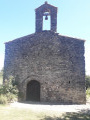
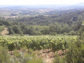
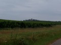
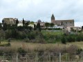
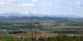
A magnificent route between Villelongue-d’Aude and Loupia, featuring the superb Sainte-Barbe Chapel, nestled in the countryside.

Details

3542664
Creation:
Last update:
Last review:
  • Walking
    Activity: Walking
  • ↔
    Distance: 3.23 mi
  • ◔
    Average duration: 1h 45 
  • ▲
    Difficulty: Easy

  • ⚐
    Back to start: Yes
  • ↗
    Ascent: + 279 ft
  • ↘
    Descent: - 279 ft

  • ▲
    Highest point: 1,033 ft
  • ▼
    Lowest point: 817 ft

Photos

Description of the walk

Start from the car park by the cemetery at the village entrance.

Path marked with a yellow line and a Blue Circle.

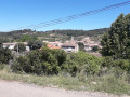
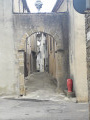
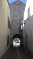
(S/E) Walk uphill towards the village centre, turn left, walk past the town hall and the post office, then continue straight on along the Grande Rue.

(1) Turn left at the first street, follow the road for about 100 metres, then turn right and head downhill to a junction.

(2) Turn slightly right, head uphill towards a building on the edge of a vineyard and continue straight on along the path to the Sainte-Barbe Chapel.

(3) Cross the park behind the chapel, then a footbridge over the ditch, and follow the vineyard on your right.
You’ll reach the path leading to Cammas Nau; turn left until you reach the road.

(4) Turn left, walk for about 200 metres along the road, then turn right onto the path before the copse. Continue straight on until you reach the village of Loupia. Turn left onto the D626 and walk for about 150 metres.

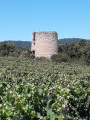
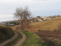
(5) Turn left onto Chemin du Moulin. Head uphill, pass the mill situated behind a vineyard, ignore a path on the left and head back down between the vineyards.

(6) After passing a ruin, turn right at the crossroads and head uphill towards Villelongue-d’Aude.
When you reach the D52, turn left to reach the car park near the cemetery at the entrance to the village (S/E)

Waypoints

  1. S/E : mi 0 - alt. 1,014 ft - Car park near the cemetery at the entrance to the village
  2. 1 : mi 0.28 - alt. 1,033 ft - Turn left at the fork
  3. 2 : mi 0.83 - alt. 915 ft - Turn right at the fork
  4. 3 : mi 1.1 - alt. 919 ft - Sainte-Barbe Chapel
  5. 4 : mi 1.47 - alt. 833 ft - Turn left at the fork
  6. 5 : mi 2.28 - alt. 840 ft - On the left, Chemin du Moulin
  7. 6 : mi 2.6 - alt. 846 ft - Ruins
  8. S/E : mi 3.23 - alt. 1,014 ft - Car park near the cemetery at the village entrance

Notes

Bring water and a hat in hot weather.

Worth a visit

The circular village walk, the Bayle route: you can combine the two routes.
Hiking information board at the start.
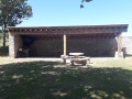
Picnic area at the Sainte-Barbe Chapel.

Reviews and comments

4.7 / 5
Based on 2 reviews

Reliability of the description
5 / 5
Ease of following the route
5 / 5
Route interest
4 / 5
Tannier
Tannier

Overall rating : 4.7 / 5

Date of your route : Sep 04, 2023
Reliability of the description : ★★★★★ Very good
Ease of following the route : ★★★★★ Very good
Route interest : ★★★★☆ Good
Very busy route : No

A short, easy walk through the hills and vineyards. Nothing too exciting, but pleasant scenery and a lovely chapel. The description is spot on. The route is exposed, so avoid the hottest part of the day.

Machine-translated

general11
general11
• Edited:

Thank you for your comment, and I look forward to going for a walk along the trails of the Limoux region

Machine-translated

Irisdesuze
Irisdesuze
• Edited:

Overall rating : 4.7 / 5

Date of your route : Jan 21, 2021
Reliability of the description : ★★★★★ Very good
Ease of following the route : ★★★★★ Very good
Route interest : ★★★★☆ Good
Very busy route : No

A well-maintained route. The route markers are easy to spot on the posts (trees and other structures).
The highlight of this walk is the picnic area next to the chapel – an idyllic setting.
No major difficulties, although it can be quite slippery in places in wet weather.

Machine-translated

Other walks in the area

For more walks, use our search engine .

The GPS track and description are the property of this route's author. Please do not copy them without permission.