Gaja-et-Villedieu circular loop

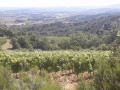
A short walk near Limoux through the Blanquette de Limoux vineyards.

Details

n°3172626
Creation:
Last update:
Last review:
  • Walking
    Activity: Walking
  • ↔
    Distance: 3.04 mi
  • ◔
    Average duration: 1h 45 
  • ▲
    Difficulty: Easy

  • ⚐
    Back to start: Yes
  • ↗
    Ascent: + 433 ft
  • ↘
    Descent: - 427 ft

  • ▲
    Highest point: 1,027 ft
  • ▼
    Lowest point: 620 ft

Photos

Description of the walk

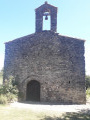
Park in the small car park by the cemetery in the centre of the village.

(S/E) Turn right as you leave the car park, continue for 50 metres and turn left onto the tarmac road towards Villedieu.

(1) After 650 metres along the road, turn left onto the dirt track between the vineyards towards the ‘Garde-Miel’ wood. Walk along the right-hand side of a fenced-off area with dogs and other animals, and at the end, turn right into the wood.

(2) Take the path to the left, walk for about a hundred metres, then turn right to reach the edge of the woodland. Then turn left onto the path leading up to the ridge.

(3) Enjoy the view over Limoux. Head down the path on the right, leave the woods and walk alongside the vineyard on your right. At the corner of the vineyard, turn right then carry on straight ahead. Pass beneath the hamlet of Villedieu on your left. At the large cypress tree with a well, cross the ditch and follow it to the right until you reach the road.

Cross the road, go straight on along the dirt track, continuing to follow the ditch on your right and the Roderie estate. Turn right and then immediately left onto the railway crossings to cross the ditch, then follow it until you reach the Ruisseau du Blau.

(4) At the junction, turn right and continue for about 500 metres until you reach a crossroads.

(5) Turn right onto the ascending dirt track and continue straight on to reach the village of Gaja-et-Villedieu. On arriving in the village via the Chemin des Poux, turn right and head uphill to the cemetery (S/E).

Waypoints

  1. S/E : mi 0 - alt. 702 ft - Car park at the village cemetery
  2. 1 : mi 0.39 - alt. 810 ft - Vineyard path on the left
  3. 2 : mi 0.71 - alt. 814 ft - At the junction, turn left
  4. 3 : mi 1.16 - alt. 1,027 ft - Viewpoint, on the right
  5. 4 : mi 2.25 - alt. 623 ft - Turn right at the fork
  6. 5 : mi 2.5 - alt. 623 ft - At the crossroads, turn right
  7. S/E : mi 3.04 - alt. 709 ft - Car park at the village cemetery

Notes

In hot weather, a cap and water are essential.

Worth a visit

Walk through the “Garde-Miel” woodland, home to numerous species characteristic of Mediterranean vegetation: fragot, holm oak, juniper and Spanish broom.

The Blanquette de Limoux vineyards, where you can enjoy wine tastings in the town’s cellars and take part in the famous carnival from January to April.

Reviews and comments

4.7 / 5
Based on 1 review

Reliability of the description
4 / 5
Ease of following the route
5 / 5
Route interest
5 / 5
Jean-François Mézières

Overall rating : 4.7 / 5

Date of your route : Aug 06, 2021
Reliability of the description : ★★★★☆ Good
Ease of following the route : ★★★★★ Very good
Route interest : ★★★★★ Very good
Very busy route : No

A walk best avoided in very hot weather; the first climb is tough.
Lovely view of Limoux. A lovely walk through the vineyards afterwards.

Machine-translated

Other walks in the area

For more walks, use our search engine .

The GPS track and description are the property of this route's author. Please do not copy them without permission.