Roquetaillade-et-Conilhac Agroecological Trail

Discover the diversity of natural and agricultural habitats between the villages of Roquetaillade and Conilhac-de-la-Montagne.

Details

45120648
Creation:
Last update:
Last review:
  • Walking
    Activity: Walking
  • ↔
    Distance: 5.00 mi
  • ◔
    Average duration: 2h 55 
  • ▲
    Difficulty: Easy

  • ⚐
    Back to start: Yes
  • ↗
    Ascent: + 738 ft
  • ↘
    Descent: - 738 ft

  • ▲
    Highest point: 1,768 ft
  • ▼
    Lowest point: 1,135 ft

Description of the walk

Park in the car park at the Salle Sainte-Anne, on the edge of the D421, on the outskirts of the village of Roquetaillade, on the road leading towards Conilhac-de-la-Montagne.

The entire route is signposted with a single yellow line.

(S/E) Head towards the village centre and continue to the end of Rue Sainte-Anne.

(1) Turn left onto Rue du Cimetière, then continue straight on along Chemin Sainte-Marie.

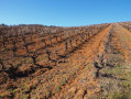
(2) After passing the last houses in the village, turn left onto the path that climbs up through the vineyards. As you climb the slope, look out for the ruins of an ancient tower on the left, standing amidst a grove of pine trees on the site of a former motte-and-bailey castle. The local association Terre de Passage is carrying out archaeological excavations there, which have uncovered the remains of an ancient castle. Follow the path which runs alongside the vineyards and eventually enters a woodland. Cross through the woodland until you reach a crossroads.

(3) Turn right to walk alongside a field. The path is now much flatter and alternates between sections along the edge of the woodland and fields. Be careful: several paths branch off to the left or right. Instead, carry on straight ahead, following the yellow markings.

(4) At the three-way junction, head right until you reach the village of Conilhac-de-la-Montagne via the Chemin de Bouriège. You’ll arrive at the church square and the town hall. You can go through the black gate and enjoy the view from the old school playground.

(5) Cross the small tree-lined square to reach the main road (Route de Roquetaillade) below. Turn left onto the D421, towards Roquetaillade, and carry on to the cemetery.

(6) Take the road leading down to the right. About 100 metres further on, at the 90° bend in the road, carry straight on along a path running alongside the vineyards. Pass the first path on your left and reach the second one in an uncultivated area.

(7) Turn left and follow the path uphill (yellow markings) until you reach a small road.

(8) Cross over to take the path that starts almost directly opposite and continue uphill along the edge of the forest.

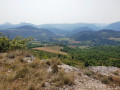
(9) At the crossroads, turn right towards the wind turbines. Please note: just fifty metres further on, leave the main path and turn left, skirting a field, and you’ll soon reach a forest track that leads downhill. At the fork further down in the woods, head right and continue descending gently until you reach a promontory overlooking the valley, just as you emerge from the woods.

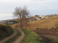
(10) Turn left and follow the track, which descends at a more or less steep gradient before ending with a short climb up to the village of Roquetaillade. At the Sainte-Anne Chapel, turn left to reach the car park (S/E).

Waypoints

  1. S/E : mi 0 - alt. 1,194 ft - Salle Sainte-Anne car park
  2. 1 : mi 0.16 - alt. 1,158 ft - Rue du Cimetière
  3. 2 : mi 0.43 - alt. 1,181 ft - Path on the left
  4. 3 : mi 1.01 - alt. 1,378 ft - Crossroads – Pla de La Lano
  5. 4 : mi 1.64 - alt. 1,493 ft - Three-way junction
  6. 5 : mi 2 - alt. 1,473 ft - Conilhac-de-la-Montagne, town hall
  7. 6 : mi 2.24 - alt. 1,440 ft - Conilhac Cemetery
  8. 7 : mi 2.67 - alt. 1,444 ft - Path junction
  9. 8 : mi 3.11 - alt. 1,631 ft - Road junction
  10. 9 : mi 3.39 - alt. 1,768 ft - Junction with the Chemin des Éoliennes
  11. 10 : mi 3.95 - alt. 1,608 ft - Viewpoint
  12. S/E : mi 5 - alt. 1,194 ft - Salle Sainte-Anne car park

Notes

This trail was conceived and created by students from ENSAT in Toulouse and LEGTA Charlemagne in Carcassonne.
Information boards on agroecology will soon be installed.
Numerous nature walks and activities take place along this trail: contact the Fonte-Vivo association for further information.

During the summer months, it is best to walk the circular route in the direction indicated in the description: the main ascents are shaded.
The signposting has been changed between points (7) and (8): although it’s not really possible to get lost, do follow the route description carefully.
A water point is available in the village of Roquetaillade, on Place du Cantou.

Worth a visit

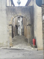
Make the most of your walk to visit the beautiful village of Roquetaillade, built from stone quarried locally. Stroll through the streets to admire the various views of the valley, the medieval castle, Saint-Étienne Church, Sainte-Anne Chapel, and more.

The village of Conilhac-de-la-Montagne and its surroundings boast a sublime view of the Pyrenees mountain range, stretching from the Pyrénées-Orientales to Ariège: the Pics de Bugarach, Canigou, Madres, Carlit, Saint-Barthélemy, and so on.

Reviews and comments

4 / 5
Based on 4 reviews

Reliability of the description
3.8 / 5
Ease of following the route
4 / 5
Route interest
4.3 / 5
patrick colin
patrick colin

Overall rating : 4 / 5

Date of your route : May 11, 2026
Reliability of the description : ★★★★☆ Good
Ease of following the route : ★★★★☆ Good
Route interest : ★★★★☆ Good
Very busy route : No

A pleasant walk; do follow the route description, as signposting is extremely scarce and often obscured by vegetation

Machine-translated

Tenzig11250
Tenzig11250

In anticipation.

Machine-translated

Bingo
Bingo

Overall rating : 4 / 5

Date of your route : Apr 28, 2025
Reliability of the description : ★★★★☆ Good
Ease of following the route : ★★★★☆ Good
Route interest : ★★★★☆ Good
Very busy route : No

Hiio

Machine-translated

ksagro1968
ksagro1968

Overall rating : 4.3 / 5

Date of your route : Jan 13, 2025
Reliability of the description : ★★★★☆ Good
Ease of following the route : ★★★★☆ Good
Route interest : ★★★★★ Very good
Very busy route : No

A lovely walk with open stretches and beautiful views of the Pyrenees, Bugarach and the Pic de Brau, as well as some very pleasant sections through the woodland.
The signposting is sparse and not always very visible, but there’s no problem following the route using GPS.
We’re still waiting for the information boards.

Machine-translated

crismarl
crismarl

Overall rating : 3.7 / 5

Date of your route : Jan 01, 2025
Reliability of the description : ★★★☆☆ Average
Ease of following the route : ★★★★☆ Good
Route interest : ★★★★☆ Good
Very busy route : No

A bit of uncertainty about the route at junctions
A lovely walk with views of the Pyrenees – best avoided on foggy days:

Machine-translated

Other walks in the area

For more walks, use our search engine .

The GPS track and description are the property of this route's author. Please do not copy them without permission.