


Ardennes landscapes in Chenogne


No dazzling monuments here, just nature at its best! The walk begins on a stretch of an old local track and gradually winds its way into the woodland.
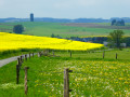
After passing the hamlet of ‘Mesy’ – a charming clearing with a few beautifully restored houses – the route reaches the village of Poisson-Moulin and continues towards Magerotte and Houmont along country lanes offering magnificent panoramic views of the green hills, which are coloured in season by a profusion of flowers and fields of rapeseed.
The return to the starting point first climbs up to the wooded heights between Hubermont and Senonchamps before descending once more towards Chenogne through the Ardennes countryside.
Details
–
-
 Activity: Walking
 -
 Distance: 11.43 mi
 -
 Average duration: 5h 55
 -
 Difficulty: Moderate
 -
-
 Back to start: Yes
 -
 Ascent: + 771 ft
 -
 Descent: - 771 ft
 -
-
 Highest point: 1,857 ft
 -
 Lowest point: 1,401 ft
-
 Country:
Belgium
Country:
Belgium
-
 Area: Massif des Ardennes
 -
 City:
Vaux-sur-Sûre
City:
Vaux-sur-Sûre -
 Start/End: N 49.991565° / E 5.619911°
 -


 Hour-by-hour weather


Photos
Waypoints
- S/E : mi 0 - alt. 1,568 ft - Chenogne
- 1 : mi 1.13 - alt. 1,732 ft - St Joseph des Bois Chapel
- 2 : mi 3 - alt. 1,722 ft - Mesy
- 3 : mi 4.16 - alt. 1,555 ft - Poisson-Moulin
- 4 : mi 5.43 - alt. 1,575 ft - Fork in the road
- 5 : mi 6.06 - alt. 1,480 ft - Magerotte
- 6 : mi 6.99 - alt. 1,427 ft - Picnic table
- 7 : mi 7.22 - alt. 1,401 ft - Laval Stream
- 8 : mi 7.76 - alt. 1,417 ft - Bus stop and picnic table
- 9 : mi 8.08 - alt. 1,539 ft - Houmont – picnic tables
- 10 : mi 9.19 - alt. 1,578 ft - On the hills between Hubermont and Senonchamps
- S/E : mi 11.43 - alt. 1,568 ft - Chenogne
Other walks in the area
Around the Tram and Laval
 Visorando Member
 11.49 mi
+951 ft
-928 ft
6h 05
Moderate
11.49 mi
+951 ft
-928 ft
6h 05
Moderate
 Departure from Sainte-Ode (Province de Luxembourg)
Rolley Pond and the water tower
5.73 mi
+318 ft
-305 ft
2h 55
Moderate
Departure from Bastogne (Province de Luxembourg)
Around the hamlet of Beauplateau
 8.89 mi
+794 ft
-768 ft
4h 45
Moderate
Departure from Sainte-Ode (Province de Luxembourg)
8.89 mi
+794 ft
-768 ft
4h 45
Moderate
Departure from Sainte-Ode (Province de Luxembourg)
Beauplateau and l’Agaric via the Côte de la Chapelle
 9.98 mi
+840 ft
-843 ft
5h 20
Moderate
Departure from Sainte-Ode (Province de Luxembourg)
9.98 mi
+840 ft
-843 ft
5h 20
Moderate
Departure from Sainte-Ode (Province de Luxembourg)
The Sentier de la Girolle from Beauplateau
 11.25 mi
+853 ft
-866 ft
5h 55
Moderate
Departure from Sainte-Ode (Province de Luxembourg)
11.25 mi
+853 ft
-866 ft
5h 55
Moderate
Departure from Sainte-Ode (Province de Luxembourg)
In the Laval and Western Ourthe valleys
 6.15 mi
+453 ft
-430 ft
3h 15
Moderate
Departure from Sainte-Ode (Province de Luxembourg)
6.15 mi
+453 ft
-430 ft
3h 15
Moderate
Departure from Sainte-Ode (Province de Luxembourg)
Remience Route
 12.07 mi
+627 ft
-633 ft
6h 05
12.07 mi
+627 ft
-633 ft
6h 05
 Difficult
Departure from Vaux-sur-Sûre (Province de Luxembourg)
Difficult
Departure from Vaux-sur-Sûre (Province de Luxembourg)
The Art Trail of the Orti Nature Reserve
 2.59 mi
+92 ft
-105 ft
1h 15
2.59 mi
+92 ft
-105 ft
1h 15
 Easy
Departure from Sainte-Ode (Province de Luxembourg)
Easy
Departure from Sainte-Ode (Province de Luxembourg)
For more walks, use our search engine .
The GPS track and description are the property of this route's author. Please do not copy them without permission.

