The Kerbholz, the Névés Trail and the Wormsa Trail

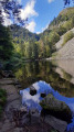
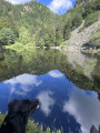
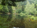
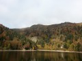
A very varied hike starting from Mittlach. A steep climb via the Kerbholz to the snowfield path, passing at the foot of the Hohneck, a descent towards the Schiessrothried and Fischboedle lakes via the Wormspel cirque (and its chamois), then back to Mittlach via the Wormsa valley, passing by the two lakes.

6 February 2023: Hiking prohibited until further notice by municipal order, due to a rock and stonefall on theGR®531.

Details

3449075
Creation:
Last update:
Last review:
  • Walking
    Activity: Walking
  • ↔
    Distance: 8.12 mi
  • ◔
    Average duration: 6h 05 
  • ▲
    Difficulty: Difficult

  • ⚐
    Back to start: Yes
  • ↗
    Ascent: + 2,651 ft
  • ↘
    Descent: - 2,651 ft

  • ▲
    Highest point: 4,301 ft
  • ▼
    Lowest point: 1,719 ft

Description of the walk

Parking is available in the village on Chemin du Herrenberg (via Rue Raymond Poincarré) or on the square in front of the Hôtel Valneige, from where Rue Erbersch begins.

(S/E) From the car park, after 60 m, turn left onto a path running alongside the Fecht. Cross over the Kolbenfecht and join Rue Erbersch; follow it up to number 48, at the entrance to Chemin du Kastelberg.

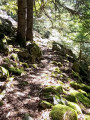
(1) Take the Blue Triangle trail towards Kastelberg. The trail climbs steeply above Mittlach. It’s a fairly steep ascent through the forest, with a bit of cool relief provided by the stream, which is never far from the trail.

(2) When you reach the forest road, turn left. Leave the forest road shortly after the left-hand bend, taking thefirst path on the right, which climbs very steeply. A steep climb through blueberry bushes.

(3) At the junction with a Blue Triangle-marked path heading uphill to the right, turn left then immediately right onto the Blue Cross path, towards Kerbholz; finally, a bit of flat ground.

(4) Walk round the mountain hut, ignoring the paths branching off to the right, and take theGR®531path, signposted with a Blue Rectangle, towards Kastelberg.

(5) At the Kastelberg farmhouse inn, follow the signs for the ‘Sentier des Névés’ via the connecting path leading north-north-east from the car park.

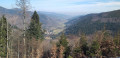
(6) At the junction, take the ‘Sentier des Névés’ marked with a Yellow Cross towards the Col du Wormspel (and the Hohneck). A ridge path with views of the Hohneck and the Wormspel cirque.

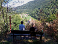
(7) Wormspel Pass, at the foot of the Hohneck; you can make a round trip to the summit to enjoy the view or have a blueberry tart.
From the pass, leave the Yellow Cross markings and take the Blue Triangle path, which descends to the right towards Lake Schiessrothried and the Wormsa. Steep descent; chamois are frequently sighted in the area.

(8) At Lake Schiessrothried, follow theGR®5path to the right, marked with a Red Rectangle, towards Wormsa (just before the dam).

(9) When you reach Fischboedle Lake, continue on theGR®5to the left, ignoring the path on the right marked with a Blue Cross. You will very soon reach a Fork in the road.

(10) Leave the Fischboedle Path (Red Saltire) on your left and continue to the right on the Wormsa path (GR®5 ). It passes over numerous small wooden bridges and a few scree slopes.

(11) At the bottom of the valley, keep following theGR®5(Red Rectangle) to the right to head back towards Mittlach.

(12) At the next junction, turn right again onto the road to return to the centre of Mittlach (S/E).

Waypoints

  1. S/E : mi 0 - alt. 1,788 ft - Start from Mittlach – Car park in the village - Source de la Fecht
  2. 1 : mi 0.4 - alt. 1,841 ft - Blue Triangle Trail
  3. 2 : mi 1.27 - alt. 2,907 ft - Forest track to the left
  4. 3 : mi 1.72 - alt. 3,442 ft - Blue Cross Trail towards Kerbholz
  5. 4 : mi 2.1 - alt. 3,537 ft - Blue Rectangle trail towards Kastelberg
  6. 5 : mi 2.44 - alt. 3,806 ft - Kastelberg Farm Inn towards the Sentier des Névés
  7. 6 : mi 2.87 - alt. 4,186 ft - Yellow Cross towards Col du Wormspel
  8. 7 : mi 4.22 - alt. 4,193 ft - Blue Triangle towards Wormsa - Col du Wormspel (1275m)
  9. 8 : mi 5.46 - alt. 3,045 ft - Red Rectangle - lac de schiessrothried
  10. 9 : mi 5.96 - alt. 2,618 ft - Lac de Fischboedle
  11. 10 : mi 6.25 - alt. 2,470 ft - Y-junction
  12. 11 : mi 7.25 - alt. 1,811 ft - Red Rectangle trail to the right
  13. 12 : mi 7.57 - alt. 1,742 ft - Path on the right towards Mittlach
  14. S/E : mi 8.12 - alt. 1,788 ft - Car park

Always be cautious and plan ahead when you're outdoors. Visorando and the author of this route cannot be held responsible for any accidents occurring on this route.

The GR® and PR® markings are the intellectual property of the Fédération Française de Randonnée Pédestre.

Reviews and comments

4.6 / 5
Based on 3 reviews

Reliability of the description
5 / 5
Ease of following the route
3.7 / 5
Route interest
5 / 5
lemarcheur65
lemarcheur65 ★

Hello vaillantjm
Thank you for your comment.

Machine-translated

vaillantjm
vaillantjm

Contrary to what is stated on the website, this walk is not off-limits as it does not follow the GR 531, which is currently closed.
I’d recommend doing it the other way round, as the descent into the Wormspel is difficult due to the steep slope and the rocks you have to climb over. At least for older people who no longer have nimble legs and flexible knees!

Machine-translated

mlecarpe
mlecarpe

Overall rating : 4.3 / 5

Date of your route : Sep 03, 2023
Reliability of the description : ★★★★★ Very good
Ease of following the route : ★★★☆☆ Average
Route interest : ★★★★★ Very good
Very busy route : Yes

A lovely walk on a day of glorious weather, which gets off to a flying start with a lovely, long climb! Beautiful scenery and views; we enjoyed a delicious blueberry tart at the Kastelberg farm inn. Quite a few people on the route, except on the first section. We had a bit of trouble finding our way on the first section (the signposting isn’t very clear, point 2). A fairly challenging and steep descent from the Wormspel Pass (point 7).

Machine-translated

Vincent Alsace
Vincent Alsace

Overall rating : 4.7 / 5

Date of your route : Aug 14, 2023
Reliability of the description : ★★★★★ Very good
Ease of following the route : ★★★★☆ Good
Route interest : ★★★★★ Very good
Very busy route : No

A lovely walk, with varied scenery; very few people from the start to Kerbholz and on the return journey from the Hohneck Pass to Mittlach.
The Sentiers des Névés and the summit of the Hohneck were quite busy, but it’s still well worth it
Starting point: go through the small park along the river before the bridge; there’s no sign for the Club Vosgiens.

Machine-translated

denis weiss
denis weiss

Overall rating : 4.7 / 5

Date of your route : Jul 21, 2022
Reliability of the description : ★★★★★ Very good
Ease of following the route : ★★★★☆ Good
Route interest : ★★★★★ Very good
Very busy route : Yes

The route is magnificent. The first part of the route up to Kerbholz was completely deserted. It’s a shame, because the path is perfect, although a bit steep.

Machine-translated

Other walks in the area

For more walks, use our search engine .

The GPS track and description are the property of this route's author. Please do not copy them without permission.