Country:
 City:
City:


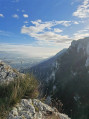
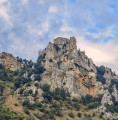
Park at the Château de Crussol car park, the ideal starting point for exploring this iconic mountain in the Rhône Crussol Tourisme area.
(S/E) Head towards the inn.
(1) Take the path that branches off to the left after the wooden gate below the inn. You will come to a junction with a sign for “Haut du Mialan”.
(2) Head towards "Soyons" and follow the yellow and white markings. Make sure you keep going in the same direction, ignoring the paths branching off on either side, until you reach the junction marked by the sign "Baume des Bois".
(3) Continue along the main path which veers to the right, leaving the yellow and white markings behind. You will reach a crossroads situated a few dozen metres from a tarmac road.
(4) Take the path on your left to stay within the mountain range and begin the climb up to the ridges. Please note: from here on, it is best to keep the trail in sight, as there are no further signs or markings. Reach the ridge at the hamlet of Saint-Estève and join the GR®42, marked in white and red.
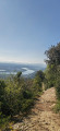
(5) Head left and continue, admiring the view of the Rhône valley to your right and Toulaud to your left.
(6) Pass a path on the left that heads downhill; do the same at the next two junctions and reach a crossroads with a sign for “Chavaran le haut”.
(7) Keep to the right, following the signs for “Saint-Peray” and staying on the GR®. You will reach the ruins of Crussol Castle.
(8) Take the path on your right to reach the castle viewpoint. Return to the GR® and follow it to begin the descent. Reach the access path to the Théâtre de Verdure.
(9) Take the GR® to the left, then head right to return to the car park (S/E).

 Visorando Member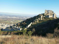

 Association / Club / Walk leader
 Moderate