Country:
 City:


Start from the Tête de Sainte-Catherine car park.
(S/E) Turn right when facing the Route de Cacale, heading towards the Sainte-Catherine signpost 150 metres away. Once you reach the signpost, continue straight on along the Route des Saulx for 500 metres to reach the Père André signpost.
(1) Take the second path on the left, the Route du Père André (marked ‘Chemin Noir’ on the map).
After 350m, ignore the first track on the right and, at the next junction 700m on (between plots 340 and 355 on the right), turn onto the track on the left.
Ignore the first path branching off to the left; carry on straight ahead (westwards) down towards the Parc à Biches (caution: it’s slippery), then follow this path as it climbs further on. At the end of the path, after the descent at 500m, turn left.
At the junction 300 metres ahead, take the Route Centrale, which climbs to the right, and carry on straight ahead.
(2) At the Mont Huguet signpost, carry on straight ahead (still on the Route Centrale). After 500m, turn onto the path on the right (before plot 329).
Follow the track for 1 km until you reach the D115. Follow the D115 to the right; you’ll see the Château de la Vigogne on your left.
Ignore the first path (which splits into two) on the right at the bend.
(3) Take the next path 20 metres to the right after the left-hand bend.
The path ‘La Route Parallèle’ climbs through the forest. Follow it for 900 metres. Ignore the paths to the right and left until you reach a large crossroads (you are now right at the top of the hill, plot 359 on the left).
Take the path on the left; at the end of the path, 400 metres on, turn right and continue straight on.
(4) At the ‘Poteau des Merliers’ signpost, turn left past plot 353, opposite the ‘Route Parallèle’, which descends for 300 metres. At the bottom of the valley and at the junction, turn left onto the ‘Chemin du Fond des Merliers’.
Follow the track for 700 metres; it will take you to the outskirts of the hamlet of “Les Saulx”.
(5) At the first junction in the hamlet, turn right onto the Route de la Bonne Entente, which takes you back into the forest. Follow the main track (Route du Fond Belnod) for 3 km.
(6) At the end, turn left for 20 metres, cross over and take the path opposite.
Follow the path down for 350 metres. The path disappears. Carry on straight ahead to rejoin a path further down which leads to a wooden staircase that you’ll see on your left (you can take a shortcut here without any problem).
Follow the path to the left.
(7) Climb the steps, follow the yellow-marked path (in the opposite direction) which turns left after 400 metres.
After 200m, turn right following the yellow markings.
(8) Follow the path to the end until you reach a bench. Leave the yellow route, which branches off to the left, and continue straight on behind the bench. At the end, turn left.
After 100m, you’ll reach a small pond (with a patch of fir trees on your left); turn right. Follow the path, which will turn to the right, make a circular loop on the left and join the Route Tournante.
Follow the Route Tournante to the right.
(9) At the Soreng signpost, turn right and cross the D149 after 300 metres. Continue along the path opposite.
After 250m, follow theGR® de Pays on the right.
Carry on straight ahead for 345m, then at the junction take the path on the left through the gully, which descends into the Yères valley. Continue for 600m.
(10) Take the first path on the right at the hairpin bend and follow it towards the forest for 600m.
Cross the D149 road and take the small path opposite.
After 60m, at the junction, turn left onto the path that runs along the edge of the forest and overlooks the valley.
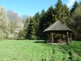
(11) After the orientation table, follow the path on the right (the Route des Saulx); you’ll see the Sainte Catherine gazebo on your right, which takes you back to the Tête de Sainte-Catherine car park (S/E).


 Visorando Member

 Easy