


 Country:

 City:


Coming from the D103, park at the entrance to the village, in the car park on the right before the town hall.
(S/E) Take the main street through the village and walk past the town hall. After passing the town hall, take the second street on the right (Rue du Chemin de Ronde), then keep left to follow the downhill path called Chemin du Gand.
(1) Turn right onto Chemin des Lagunes: there’s a wooden gate and a grassy track.
(2) After the sewage treatment plant on the left, turn left at the junction with this small tarmac road (Chemin de la Pélagie), which further on becomes an uphill track. Continue until you come to a small road near a farm.
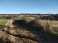
(3) Turn left onto this road, despite the Yellow Cross at La Copler. Walk past the farm on your right, then continue straight on past the barn where bales of straw are stored. The road then becomes a track which you follow downhill until you reach a crossroads. Turn right and continue along the main track.
(4) Before the tarmac climb towards Saint-Just-la-Pendue, take the path on the left (Chemin du Trou) signposted by the Copler. Continue along the ascending path, which bends left at the houses in La Roche Montifet. Carry on straight ahead along the path, which turns into a small road and leads to a junction opposite the houses in the hamlet of Latta: there’s a beautiful stone porch here.
(5) Turn right and walk past the Saint-Éloi farm on your right.
(6) Then take the first road on the left (Chemin de Vilars) and carry on straight ahead with the field on your left
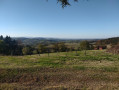
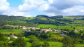
(7) Pass the cul-de-sac and continue straight on along the Chemin du Bois Rallye, which climbs into the woods. Carry on along this path, which curves to the left (heading north). When you reach the houses at Bois Rallye, take in the panoramic view on your left, with Saint-Symphorien-de-Lay and Roanne in the background. Head downhill to the crossroads.
(8) Turn right, then take the first path on the left (Chemin de l’Aubépin). Walk along the edge of the Bois de Landine until you reach a junction by the pastures, with a clear-cut area on your right.
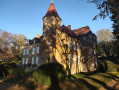
(9) Turn left, continue straight on, then at the Fork in the road, take the left-hand path down the slope lined with deciduous trees to reach the Château de l’Aubépin: it may be possible to access the garden (private property). Please refer to the Roannais Tourisme website for further information; the garden is open to the public in October.
(10) After admiring the château, retrace your steps slightly and turn right onto the path signposted by the Copler. Walk alongside a small pond on your left.
(11) Turn right, then left a few metres further on. Continue straight ahead along the small tarmac road (Chemin de Saint-Just).
(12) At the next junction, take the path on the right. Carry on straight ahead until you reach the hamlet of La Rivière, where the path becomes a road. Cross a stream, pass the farm on your left and ignore the road to the left.
(13) At the next junction, turn left onto the small road – which is none other than the Chemin du Gand, which you took at the start – leading back up towards the village of Croizet. Continue along this small road.
(1) Reach the centre of the village. Walk through the village, take a stroll near the church before returning to the starting point (S/E).
 Visorando Member
 Easy

 Difficult

