


Refine your search for walks in Chapelle Sainte-Apollonie (Tours de Savoie)
Chapelle Sainte-Apollonie (Tours de Savoie) walks


 Route de la Chapelle Saint-Clément (Viéryâ d’la stapèla Saint Clément)
 Visorando Member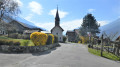
 2.30 mi
 +446 ft
 -446 ft
 1h 25
1h 25
 Easy
Easy
 Departure from Tours-en-Savoie (Savoie)
A family walk through the woodland. Pass by the 17th-century Saint-Clément Chapel, sheltered by the Brèche rock, and the Sainte-Apollonie Chapel in the centre of the village.
Walks near Chapelle Sainte-Apollonie (Tours de Savoie)
From Albertville station to the Refuge du Soplat des Streams
 7.03 mi
+4,177 ft
-604 ft
6h 50
7.03 mi
+4,177 ft
-604 ft
6h 50
 Difficult
Departure from Albertville (Savoie)
Difficult
Departure from Albertville (Savoie)
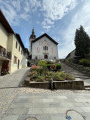
A lovely climb starting from Albertville, passing through the medieval town of Conflans and pretty mountain hamlets with views of the Tarentaise Valley, before reaching the Refuge du Soplat des Stream. The refuge is ideally located near the Tour du Beaufortain with a beautiful view of Albertville and the Olympic Park. Hike to be done from May to November: avalanche risk in winter above 1,100 metres.
La Ravoire – Arêches Alpine Refuge
 5.05 mi
+2,425 ft
-961 ft
4h 25
5.05 mi
+2,425 ft
-961 ft
4h 25
 Moderate
Departure from La Bâthie (Savoie)
Moderate
Departure from La Bâthie (Savoie)
First (easy) stage of a two-day tour of the Grand Mont.
A well-marked path forming part of the Tour du Beaufortain.
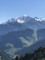
Magnificent views of Mont Blanc from the Col de la Bâthie
Molliessoulaz Lodge - Les Saisies
9.49 mi
+4,888 ft
-2,579 ft
8h 35
Difficult
Departure from Queige (Savoie)
The final stage of the Tour du Beaufortain, between Molliessoulaz and Les Saisies.
Chalet des Arolles - Molliessoulaz Lodge
7.87 mi
+2,005 ft
-5,089 ft
5h 20
Difficult
Departure from Beaufort (Savoie) (Savoie)
Another long stage between the Chalet des Arolles and the hilltop village of Molliessoulaz.
Refuge de la Thuile – Col de l’Arc
9.24 mi
+4,009 ft
-3,770 ft
7h 45
 Very difficult
Departure from Sainte-Hélène-sur-Isère (Savoie)
Very difficult
Departure from Sainte-Hélène-sur-Isère (Savoie)
A change of scenery: the view opens out towards the Beaufortain, the Tarentaise, the Aravis and then the Vanoise. You pass beneath the Grand Arc, descend towards the Vallon de Bayet, cross the Col Basmont, then spend the night at the Col de l’Arc in the unmanned hut
Arêches Alpine Refuge – La Ravoire
 8.18 mi
+3,419 ft
-4,836 ft
6h 45
Difficult
Departure from Beaufort (Savoie) (Savoie)
8.18 mi
+3,419 ft
-4,836 ft
6h 45
Difficult
Departure from Beaufort (Savoie) (Savoie)
Second stage of the Tour du Grand Mont, passing via the summit. Starting from the mountain hut at Arêches.
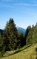
A long stage with two steep descents, but superb views from the summit of the Grand Mont and a magnificent finish overlooking the Valley of the Seven Lakes.
Lac Tournant
 7.86 mi
+2,064 ft
-4,298 ft
5h 25
Moderate
Departure from Beaufort (Savoie) (Savoie)
7.86 mi
+2,064 ft
-4,298 ft
5h 25
Moderate
Departure from Beaufort (Savoie) (Savoie)
This is a circular walk based on trail 5 as promoted by the Arêches tourist board. It is well marked with yellow signs and paint flashes or markers for trail 5. There are good views over to Mont Blanc, the Beaufortain Mountains and the lake, although small, is a nice place to eat your sandwiches.
Col de l’Arc – Refuge du Logis des Fées
8.91 mi
+3,353 ft
-3,406 ft
7h 00
Difficult
Departure from La Léchère (Savoie)
It’s hard to say much about this section, as we completed the whole of it in driving rain and cloud. The route is challenging and stony, with numerous herds of livestock and detours… But it remains so beautiful despite everything. The climb up the Bellachat is less difficult than it looks. The landscape is actually very varied: there’s a lot of rocky terrain on the ascent of the Bellachat, with steep cirques all the way to the Lacs du Loup, where the mountain pastures take over before giving way to the Cirque du Colomban, only to return near the Refuge du Logis des Fées.