Refine your search for walks in Chapelle Sainte-Anne (Bouhy)
Chapelle Sainte-Anne (Bouhy) walks


 The Chemin des Deux Visages
 Tourist office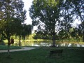
 8.56 mi
 +659 ft
 -646 ft
 4h 30
4h 30
 Average
 Departure from Dampierre-sous-Bouhy (Nièvre)
Marked route No. 101.
The area of Dampierre-sous-Bouhy spans two natural regions: the Forterre and the Puisaye. Numerous flint tools found near the Moulin Bléneau bear witness to the presence of humans during the Neolithic period. In the hamlet of Les Pasquiers, the discovery of the remains of a Gallo-Roman villa also attests to human occupation during this period.
Walks near Chapelle Sainte-Anne (Bouhy)
Treigny - Druyes-les-Belles-Fontaines
 Association / Club / Walk leader15.94 mi
+869 ft
-1,079 ft
8h 05
Association / Club / Walk leader15.94 mi
+869 ft
-1,079 ft
8h 05
 Difficult
Departure from Treigny (Yonne)
Difficult
Departure from Treigny (Yonne)
From castle to castle from the village of Treigny, taking in Ratilly and Guédelon, via Perreuse and its former barony, to reach Druyes-les-Belles-Fontaines and the view of its fortified castle.
Les Quatre Arpents
 Visorando Member
 4.03 mi
+295 ft
-121 ft
2h 05
4.03 mi
+295 ft
-121 ft
2h 05
 Easy
Departure from Sainpuits (Yonne)
Easy
Departure from Sainpuits (Yonne)
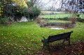
A pleasant route in all weathers, with plenty of springs at the end of the route. This route partly follows the path once taken by the ox-herders to drive the oxen from the Morvan to Paris.
 Entrains - Ouanne via the Roman road
15.69 mi
+1,234 ft
-1,033 ft
2 hrs
Average
Departure from Entrains-sur-Nohain (Nièvre)
Route along part of the Roman road linking Bourges to Auxerre, starting from Entrains-sur-Nohain (formerly Intaranum in Gallo-Roman times) in the Nièvre department to Ouanne (Odoana) in the Yonne department.From the vast expanses of woods and forests and the large plains of cultivated land, passing through two of the highest points in this region (367m and 368m), discover new spaces, views, fauna and flora on these limestone plateaus and hills.
From the Côte de Labert to the bell tower
 4.14 mi
+312 ft
-240 ft
2h 10
Easy
Departure from Sainte-Colombe-sur-Loing (Yonne)
4.14 mi
+312 ft
-240 ft
2h 10
Easy
Departure from Sainte-Colombe-sur-Loing (Yonne)
From the village, this path follows part of the ridges of the hill separating the two natural regions of Puisaye to the west and Forterre to the east.