


Start from the Place de l’Église.
Head east towards Druyes-les-Belles-Fontaines. Turn right onto the Route d’Etais, then leave the road and take the path on the right, which leads to a small tarmac road; turn left onto this.
Leave this road and, before reaching the village of Chauminet, take a small grassy track that leads into the village. On the main street, head up to the right and, at the junction a few metres past the pond, take the street on the right, then the path on the left.
This path leads to the old Roman road; turn left at the ‘carrefour des 5 chemins’ junction (1) – be careful to take the path furthest to the left! – On the uphill stretch, there is a hidden little track (2) leading to an old underground quarry.
When you reach the junction with a small tarmac road, follow it for 200 metres to the right, then leave it again and turn right onto a small tarmac road which continues as a dirt track. Keep going straight on until you come to another small road, then take the path opposite. At the end of this track, you’ll come to a small road; take the path on the left, which goes through a wood and joins the main road.
Take this road to the right for 150 metres and follow the one-way street through Vaurimbert and then La Montagne. At the bottom of the hamlet, you’ll pass the St Martin fountains (4) and continue on to the Place du Champ de Foire.
From Sougères to Lainsecq via La Montagne


The wooded paths of Forterre, an underground quarry, an ancient Roman road and scenic viewpoints – everything you need for a few enjoyable hours.
Details
-
 Activity: Walking
-
 Distance: 6.30 mi
-
 Average duration: 3h 30
-
 Difficulty: Moderate
-
-
 Back to start: No
-
 Ascent: + 656 ft
-
 Descent: - 446 ft
-
-
 Highest point: 1,178 ft
-
 Lowest point: 709 ft
-
 Country:
France
-
 Area: Puisaye
-
 City:
Sougères-en-Puisaye (89520)
-
 Start: N 47.559109° / E 3.32961°
-
 End: N 47.555576° / E 3.274421°
-
 IGN map(s): Ref. 2522SB, 2621SB, 2622SB
-


 Hour-by-hour weather
Description of the walk
Waypoints
- S : mi 0 - alt. 735 ft
- 1 : mi 2.19 - alt. 899 ft
- 2 : mi 2.33 - alt. 968 ft - Former underground quarry
- 3 : mi 3.23 - alt. 1,168 ft - Viewpoint from the Roman road
- 4 : mi 6.18 - alt. 945 ft
- E : mi 6.3 - alt. 951 ft
Notes
A route suitable for all seasons, but ensure you wear suitable footwear. There is no water along the route.
This route can be completed by mountain bike.
Worth a visit
Stunning panoramic views from the Roman road (3).
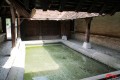
There are numerous springs and wash houses in the surrounding villages.
Reviews and comments
4 / 5
5 / 5
5 / 5


Thank you for your comment on this walk. We look forward to seeing you on other walks in this area.
Machine-translated

Overall rating : 4.7 / 5
Date of your route : Oct 30, 2014
Reliability of the description : ★★★★☆ Good
Ease of following the route : ★★★★★ Very good
Route interest : ★★★★★ Very good
There were five of us and we decided to shorten the route a little, but we did go as far as the Moulin de la Montagne. A very pleasant walk: 12 km in 3 hours.
Machine-translated
Other walks in the area
From the Church to Le Sully via the Cèdres de la Lavière
 Visorando Member
 8.21 mi
+404 ft
-417 ft
4h 05
Moderate
Departure from Sougères-en-Puisaye (Yonne)
Around the village of Sougères-en-Puisaye
 4.64 mi
+305 ft
-295 ft
2h 25
 Easy
Departure from Sougères-en-Puisaye (Yonne)
The Druyes Viaduct and the Panama Valley
10.00 mi
+341 ft
-358 ft
4h 55
Moderate
Departure from Sougères-en-Puisaye (Yonne)
The leisure trail along the old tracks
8.08 mi
+371 ft
-390 ft
4h 00
Moderate
Departure from Sougères-en-Puisaye (Yonne)
Fougilet wash house and leisure trail
4.21 mi
+226 ft
-249 ft
2h 10
Easy
Departure from Sougères-en-Puisaye (Yonne)
From Thury to Lainsecq via the Montagne des Alouettes
 9.19 mi
+699 ft
-617 ft
4h 50
Moderate
Departure from Thury (Yonne) (Yonne)
Between the Fossés Noirs and the Pierre Noire
 4.30 mi
+262 ft
-194 ft
2h 10
Easy
Departure from Thury (Yonne) (Yonne)
The wash houses
 13.88 mi
+974 ft
-945 ft
7h 15
Moderate
Departure from Thury (Yonne) (Yonne)
For more walks, use our search engine .
The GPS track and description are the property of this route's author. Please do not copy them without permission.

