Country:
 City:


Set off from the Doyen Roubault stop on Tram Line 1 towards CHU Brabois.
(S) Walk back down Avenue du Général Leclerc for a few dozen metres (north-east), cross the road and walk up Rue Notre-Dame-des-Pauvres to the Notre-Dame-des-Pauvres Chapel.
(1) Take the path on the left in front of the chapel; it leads into the woods, following theGR®5Fmarkings (red and white).
(2) Continue along theGR® which climbs slightly to the right. Follow this path until you reach a junction. Take the path on the right, which runs alongside a cemetery.
(3) After the cemetery, carry on for about fifty metres. The path turns left (approximately 90°) and enters Vandœuvre via Rue de Bellevue. Walk down this street, cross Rue de Villers and, almost directly opposite, turn into Rue du Tonneau, which leads to a washhouse.
(4) Turn right into Rue Pasteur, then immediately left into Rue Victor Hugo, which joins Rue de Houdemont. Follow this road in the direction of the increasing house numbers until you reach a Fork in the road.
(5) Turn right onto Rue de la Louvière. This ends in a picturesque path through pastures and farmland. About 150 metres after re-entering the woods, theGR®5Fheads down to the left.
(6) Leave theGR®5Fas it descends towards Houdemont and take the path slightly to the right, then immediately to the left. It is marked with a Red Ring and leads into the forest above Houdemont. Join the Chemin de Chavigny.
(7) Take this path, heading uphill to the right alongside the A33 motorway. Follow this tarmac path to a footbridge that takes you across the motorway. Turn immediately left as you come off the footbridge to walk alongside the motorway again for 200 metres in the opposite direction. Carry on along this path, which is still signposted with the Red Ring, until you reach the junction leading to a viewpoint.
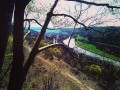
(8) Enjoy the view from the viewpoint overlooking Houdemont. After taking in the view from here, turn right of the high-voltage power line and continue along the path, which descends quite steeply towards the A33 motorway.
(9) Just before the motorway, rejoin theGR®5F. Turn right onto it and walk alongside the motorway for about 200 metres. Then continue southwards to the old Ludres mine.
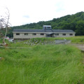
(10) It has now been converted into an equestrian centre. Carry on along Rue de Coulomheu, cross the road and continue opposite along Rue des Plisses. Turn right onto Rue Poirier le Chat until you reach the junction with Rue de la Mine.
(11) Turn left; the road continues as Chemin de la Mine, through a sparse woodland. Carry on along this track until you reach a hairpin bend to the right, climbing gently northwards. Just after this bend, take a track that climbs slightly to the left. Continue along this track until you reach a wide forest track, the Chemin Stratégique. Turn left and follow it to the Cité d’Affrique.
(12) After the first information sign, turn left onto theGRP® “Autour de Nancy” trail towards Messein. Enter the Messein Forest, leaving the Ermitage Saint-Joseph below on your left, and carry on straight ahead until you reach a new Red Ring signpost, which you should follow. This new alternative section tothe GR® takes you into the Bois des Roches. Stay on the level path until you reach the junction with a path marked with a Red Saltire sign, which descends to the left.
(13) The path descends with a view over Messein. Enter Messein via the Chemin de la Mine, then continue along the Rue des Vallieux. Turn right onto the Rue Hubert Sensiquet, where you’ll find theGR®5Fmarkings again.
(14) Follow these markings to the right, passing through the outskirts of Neuves-Maisons, through the centre of Messein, and across the Canal des Vosges.
(15) Cross the Moselle and enter Pont-Saint-Vincent. Your walk ends at the church in Pont-Saint-Vincent (E).

 Visorando Member
 Easy