Refine your search for walks in Chapeau de Gendarme (2682m)
Chapeau de Gendarme (2682m) walks


 Le Chapeau de Gendarme via the Col de Fours and Col du Gyp passes
 Visorando Member
 7.34 mi
 +3,629 ft
 -3,645 ft
 6h 30
 Difficult
 Departure from Enchastrayes (Alpes-de-Haute-Provence)
A lovely circular alpine hike starting from the Super-Sauze ski resort, with an ascent of the Chapeau de Gendarme.
Chapeau Gendarme Ouest from the Super-Sauze resort
 8.94 mi
+3,576 ft
-3,566 ft
7h 15
Difficult
Departure from Enchastrayes (Alpes-de-Haute-Provence)
A circular hike to one of the most beautiful viewpoints in the Ubaye Valley, ascending via the magnificent western path and descending via the eastern path.
⚠️ Please read the practical information carefully before undertaking this hike.
Circuit of the Chapeau de Gendarme via the north face
7.38 mi
+2,385 ft
-3,999 ft
5h 30
Difficult
Departure from Enchastrayes (Alpes-de-Haute-Provence)
A lovely hike starting from Super Sauze. The route via the north face of the Chapeau de Gendarme is not recommended for children; the east face is preferable.
Walks near Chapeau de Gendarme (2682m)
From Pra Loup 1600 via Coste Belle to La Dalle en Pente
2.45 mi
+1,594 ft
-430 ft
2h 30
 Moderate
Departure from Uvernet-Fours (Alpes-de-Haute-Provence)
A good walk to work up an appetite! Set off from Pra Loup to the La Dalle en Pente restaurant and return via the Chappe chairlift.
Allos Mountain Hut – Petit Col du Talon – Bayasse
 15.80 mi
+3,504 ft
-4,836 ft
10 hrs
 Very difficult
Departure from Uvernet-Fours (Alpes-de-Haute-Provence)
The third stage is very difficult due to its length of nearly 26 km, with a few technical sections – particularly when carrying a rucksack – which will put your body to the test. This is why I have classified this stage as ‘very difficult’. However, this stage is one of the most beautiful on this route: wild, technical, with stunning panoramic views.
You’ll cross pastures, wooded areas, mountain pastures and very rocky high-mountain sections between the two highest peaks of the Mercantour: Mont Pelat (3,051 m) and Le Cimet (3,020 m).
You’ll be crossing the northern part of the Mercantour National Park.
Allow between 8 and 10 hours for this challenging stage.
Mont Pelat - Allos via Le Cimet
 13.63 mi
+2,405 ft
-7,661 ft
8h 20
Very difficult
Departure from Allos (Alpes-de-Haute-Provence)
Second part of the circular. This second stage will take you to the village of Allos, starting from Mont Pelat, via the Trou de l'Aigle, the Cimet and its many waterfalls, including the Cascade du Pich and the Bois de Vacheresse.
Route from Val d'Allos la Foux to Val d'Allos le Seignus
 Tourist office
 9.34 mi
+1,611 ft
-2,385 ft
5h 40
Moderate
Departure from Allos (Alpes-de-Haute-Provence)
A forest trail that will take you to the Val d’Allos Le Seignus ski resort.
La Foux D’Allos – Refuge de l’Estrop
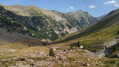 4.20 mi
+2,215 ft
-1,276 ft
3h 50
Moderate
Departure from Allos (Alpes-de-Haute-Provence)
Thefirst stage of this two-day route. An easy day’s walk to get you properly warmed up for the next day’s stage. The ascent of the Baisse de l’Auriac is gentle. At the pass, there’s a magnificent view of the Tête de l’Auriac, the Bléone valley and the Mercantour.
From the Refuge de La Cayolle to Les Louiqs via the Col de la Petite Cayolle
 8.50 mi
+1,496 ft
-3,389 ft
5h 15
Moderate
Departure from Uvernet-Fours (Alpes-de-Haute-Provence)
This second stage will take you from the La Cayolle refuge to the Ferran lodge at the Louiqs farm via the Col de La Petite Cayolle and the Pas de Lausson. It offers views of numerous mountain lakes and the Var waterfalls beneath the Pont du Diable. You can stop at the La Cantonnière refuge to shorten the route or have a snack.
Col de la Cayolle – Lac d’Allos Mountain Hut
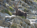 4.49 mi
+1,204 ft
-1,312 ft
3h 05
Moderate
Departure from Uvernet-Fours (Alpes-de-Haute-Provence)
A climb to a pass, followed by a descent of roughly the same length, with two beautiful lakes to admire. This walk also gives you the chance to compare the two sides of the mountain, which are quite different.
From Restefond to Sestrière via Cime de la Plate and Col de la Braïssa
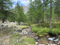 8.53 mi
+2,067 ft
-3,399 ft
5h 45
Moderate
Departure from Jausiers (Alpes-de-Haute-Provence)
A very beautiful high-mountain hike at the foot of Cime de la Bonette between the Alpes Maritimes and Alpes de Haute Provence. Very little traffic. Magnificent, rocky landscape. The upper Braissette lake is a very beautiful spot for bivouacking.
Allos - Mont Pelat
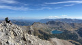 10.09 mi
+5,577 ft
-328 ft
9h 30
Difficult
Departure from Allos (Alpes-de-Haute-Provence)
The first part of this two-day circular is challenging and breathtaking, taking you through the heart of Mercantour National Park from the village of Allos, via Lac d'Allos and its refuge, Mont Pelat, Lac du Trou de l'Aigle, Le Cimet and its many waterfalls, including Cascade du Pich and Les Bois de Vacheresse.