Chaource – Etourvy

For the attention of pilgrims passing through Troyes and wishing to join theGR®654to Vézelay.
Day 3 – from Chaource to Etourvy.

This walk is part of a multi-day hike: Troyes - Etourvy - jonction GR®654

Details

n°66645
Creation:
Last update:
Last review:
  • Walking
    Activity: Walking
  • ↔
    Distance: 10.08 mi
  • ◔
    Average duration: 5h 15 
  • ▲
    Difficulty: Moderate

  • ⚐
    Back to start: No
  • ↗
    Ascent: + 719 ft
  • ↘
    Descent: - 548 ft

  • ▲
    Highest point: 866 ft
  • ▼
    Lowest point: 486 ft
  • ⚐ Country: France
  • ⚐ City: Chaource (10210)
  • ⚑
    Start: N 48.05798° / E 4.136334°
  • ⚑
    End: N 47.956823° / E 4.130857°
  • ❏
    IGN map(s): Ref. 2818SB, 2819SB
  • Hour-by-hour weather

Photos

Description of the walk

(S) Walk round the church to reach Place de la Fontaine, then turn left onto Rue des Fontaines (D444) towards the secondary school.

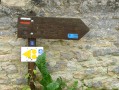
(1) Take the second street on the right, Rue des Cannes, which forms part of theGRP® des Vallées de la Sarce et de l’Hozain (GRPVSH) – look for the white/yellow markings and the ‘Meubles Robert’ sign. Carry straight on along theGRP®, pass the pumping station on your right and continue until you reach the D34.

(2) Turn right for 50 metres, then left immediately after the bridge, continuing to follow theGRP®. The trail winds through a series of left and right bends before heading straight on to the D203.

(3) Turn left and, at the entrance to Lagesse at the junction after the cemetery, leave the GRPVSH and turn right onto the Voie Basse, which leads to the junction with the D125.

(4) Turn left and, 30 metres after passing Rue du Guet Joly on your left, turn right onto a stony track with white and yellow markings on the corner of the house on the right. Follow it straight on, passing a first path on the left and a second on the right, until you reach the junction where it meets theGRP® des Vins et des Fromages (GRPVF) coming from the right. A triple wooden sign reads ‘Chesley 1h’.

(5) Carry straight on along thisGRP®, following the yellow/red markings, until you reach the D27.

(6) Cross the D27 and follow theGRP®, which bends sharply to the left (90°) before joining a road at the entrance to Chesley.

(7) Turn left, staying on the GRPVF, turn right onto Rue Cadet (D3), then, after the church, turn left and then right behind the War Memorial.

(8) Head slightly to the left and, before the bridge over the Landion, turn right at a 90° angle to follow the river. Continue to a junction at the Fontaine Saint-Blaise (ford on the left).

(9) Do not cross the ford but take a stony path on the right which leads uphill (mountain bike marker no. 4–5). TheGRP® marker is on a tree 50 metres further up. Follow theGRP® (yellow/red markings).

(10) At the edge of the woodland, turn left at a 90° angle, follow the path with the woodland on your left, then turn right to reach the entrance to Etourvy.

(11) Turn left, then right onto Route de Chesley to enter the village. Walk past the church and continue to the town hall, where the route joins theGR®654(E).

Waypoints

  1. S : mi 0 - alt. 492 ft - Chaource Church
  2. 1 : mi 0.13 - alt. 486 ft - On the right, Rue des Cannes
  3. 2 : mi 1.37 - alt. 528 ft - D34, turn right
  4. 3 : mi 2.87 - alt. 699 ft - D203, turn left
  5. 4 : mi 3.17 - alt. 715 ft - D125, turn left
  6. 5 : mi 4.69 - alt. 600 ft - Straight on along the GRPVF
  7. 6 : mi 6.1 - alt. 597 ft - D27, straight on. Crossing the - Landion (cours d'eau) - Affluent de l'Armance
  8. 7 : mi 7.05 - alt. 738 ft - Rue Orme Grappin, on the left
  9. 8 : mi 7.27 - alt. 719 ft - Turn left as you leave the village
  10. 9 : mi 8.02 - alt. 653 ft - Four-way crossroads, straight on to the right - Fontaine Saint-Blaise (Chesley)
  11. 10 : mi 8.82 - alt. 866 ft - Edge of the woods on the left
  12. 11 : mi 9.8 - alt. 673 ft - Etourvy, on the left
  13. E : mi 10.08 - alt. 676 ft - Etourvy Town Hall, GR654 junction

Notes

  • Water points:

Lagesse Cemetery.
Chesley Cemetery, 250 metres to the right at the entrance to the village.

  • A farm shed provides shelter for a snack break, 100 metres before the entrance to Chesley (please do not leave any unpleasant traces behind).

Worth a visit

In Chaource:

  • The church with its famous Entombment by the Master of Chaource, the nativity scene, the treasure and the statues.
  • The Cheese Museum.

Always be cautious and plan ahead when you're outdoors. Visorando and the author of this route cannot be held responsible for any accidents occurring on this route.

The GR® and PR® markings are the intellectual property of the Fédération Française de Randonnée Pédestre.

Reviews and comments

5 / 5
Based on 1 review

Reliability of the description
5 / 5
Ease of following the route
5 / 5
Route interest
5 / 5
véroth
véroth

Overall rating : 5 / 5

Date of your route : Jul 28, 2020
Reliability of the description : ★★★★★ Very good
Ease of following the route : ★★★★★ Very good
Route interest : ★★★★★ Very good
Very busy route : No

I was thinking of doing Troyes–Étourvy in three days. Troyes–Sommeval: far too much road and no accommodation available (COVID); Sommeval–Chaource: far too much road or too long (a route I was thinking of altering) and no accommodation in Chaource. On the other hand, Chaource to Etourvy: a real treat – varied, very well signposted and explained, with a pilgrims’ room in Etourvy and a brilliant welcome. The next day, a walk around Etourvy (the ‘Five Valleys’ route, see FFrando). Day 3: Etourvy to Bragelogne.
So the Chaource–Étouvy stage: perfect. 😄

Machine-translated

papyot10
papyot10

Hello Francis,
I’m terribly sorry for not replying to you; I hadn’t been checking my messages…
I’m probably far too late – you’ve no doubt found some leads by searching on your favourite search engine

Here are two leads I found by searching for ‘GR703’ online
- one on the MonGR.fr website – well worth looking into –
https://www.mongr.fr/trouver-prochaine-r...
- another one
https://www.gr-infos.com/en/gr703a.htm
Check with the town hall or tourist office in Domremy (55), the birthplace of Joan of Arc.

Kind regards, and once again, I’m terribly sorry for having forgotten you
Pierre

Machine-translated

birabel
birabel

Hello,
I didn’t write it; I’m looking for information about Group 703.
Kind regards,
Francis
Hello, it’s GR 703 (typo), the Jeanne d’Arc trail, from Toul to the village of Les Riceys, near Auxerre.
Kind regards
Francis

Machine-translated

papyot10
papyot10

Hello Francis,

I’m sorry, but I’ve never heard of this ‘Group 703’.
Where did you get that name from?
Kind regards,
Pierre

Machine-translated

birabel
birabel

Hello,
I didn’t write it; I’m looking for information about Group 703.
Kind regards,
Francis

Machine-translated

Other walks in the area

For more walks, use our search engine .

The GPS track and description are the property of this route's author. Please do not copy them without permission.