


Peu de points d'eau.
Les Cévennes

Découverte des Cévennes autour du Mont Aigoual en itinérance sur 5 jours.
Details
Creation:
Last update:
Last review:
–
–
-
 Activity: Walking
 -
 Distance: 70.79 mi
 -
 Average duration: 5 days
 -
 Difficulty: Difficult
 -
-
 Back to start: Yes
 -
 Ascent: + 10,761 ft
 -
 Descent: - 10,778 ft
 -
-
 Highest point: 5,125 ft
 -
 Lowest point: 2,060 ft
-
 Country:
France
Country:
France
-
 Areas: Cévennes, Massif central
 -
 City:
Meyrueis (48150)
City:
Meyrueis (48150) -
 Start/End: N 44.178165° / E 3.430504°
 -


 Hour-by-hour weather
Stages of the route
This route needs several days, find the details below:
Notes
Worth a visit
Visite du musée du Mont Aigoual; des gorges du Tarn.
Other walks in the area
Meyrueis – L’Espérou
 Visorando Member10.15 mi
+2,789 ft
-1,066 ft
7h 05
Visorando Member10.15 mi
+2,789 ft
-1,066 ft
7h 05
 Moderate
 Departure from Meyrueis (Lozère)
Walk from the village of Meyrueis (Causse Noir) in the Cévennes to get closer to Mont Aigoual.
Pauparelle
 National Park
 7.39 mi
+1,424 ft
-1,450 ft
4h 40
Moderate
Departure from Meyrueis (Lozère)
7.39 mi
+1,424 ft
-1,450 ft
4h 40
Moderate
Departure from Meyrueis (Lozère)
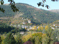
From the arid plateau of the Causses to the foothills of Puech Pounchut, this walk takes you on a journey of discovery through the upper Jonte valley and its contrasts.
A very scenic trail; climb towards Pauparelle to discover the interlocking roofs of Meyrueis, nestled at the foot of the rock, leading to the Jonte gorges bordered by the Causse Méjean and the Aigoual massif: a journey between the Causses and the Cévennes.
In Meyrueis
1.42 mi
+226 ft
-223 ft
0h 50
 Easy
Departure from Meyrueis (Lozère)
Easy
Departure from Meyrueis (Lozère)
Discover this pretty town in the Jonte valley, through its streets and from the heights of the Rocher.
Meyrueis – Hyelzas
 8.77 mi
+1,401 ft
-538 ft
5h 15
Moderate
Departure from Meyrueis (Lozère)
8.77 mi
+1,401 ft
-538 ft
5h 15
Moderate
Departure from Meyrueis (Lozère)
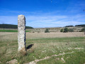
Thisfirst stage of the Tour du Causse Méjean takes the hiker up onto the Causse from Meyrueis on the banks of the Jonte. A gentle climb to get you going, featuring a picturesque stretch before reaching the Causse, the Aven Armand, and a renowned cheese dairy at the entrance to the pretty hamlet of Hyelzas. If you arrive early enough, you may be able to visit the Ferme Caussenarde in Hyelzas.
Clockwise tour of the Causse Méjean starting from Meyrueis
 51.39 mi
+7,661 ft
-7,667 ft
6 days
Moderate
Departure from Meyrueis (Lozère)
51.39 mi
+7,661 ft
-7,667 ft
6 days
Moderate
Departure from Meyrueis (Lozère)
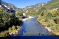
Exclusively on marked trails, this tour offers a comprehensive overview of the Causse: wooded or barren sections, ascents and descents through the Gorges de la Jonte, a walk along the Gorges du Tarn, beautiful villages, a famous karstic cave (Aven Armand), ancient remains (dolmens, menhirs), vultures – nothing is missing. The stages are generally easy, allowing you to focus on the beauty of the landscapes you pass through.
Planned as a six-day tour, it can be completed in five days by combining the last two stages.
Circular from Roquedols Castle and Col de Tribe to Meyrueis
 Association / Club / Walk leader
 4.28 mi
+518 ft
-499 ft
2h 25
Easy
Departure from Meyrueis (Lozère)
4.28 mi
+518 ft
-499 ft
2h 25
Easy
Departure from Meyrueis (Lozère)
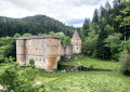
A short walk of a good two hours starting from the swimming pool car park. Pass by Roquedols Castle then the Col de Tribe before returning to Meyrueis.
From Meyrueis to Nivoliers via Aures
 9.59 mi
+1,575 ft
-797 ft
5h 45
Moderate
Departure from Meyrueis (Lozère)
9.59 mi
+1,575 ft
-797 ft
5h 45
Moderate
Departure from Meyrueis (Lozère)
A stage that allows you to fully appreciate the wide open spaces of the Causse! A very pleasant walk, with some beautiful views along the edge of the plateau.
Puech Pounchut
 5.53 mi
+1,371 ft
-1,191 ft
3h 45
Moderate
Departure from Meyrueis (Lozère)
5.53 mi
+1,371 ft
-1,191 ft
3h 45
Moderate
Departure from Meyrueis (Lozère)
This walk is located on the north side of the Aigoual massif in the Cevennes.
At the summit of the hike you will have a beautiful view of the Causse Mejean and the Valley of Jonte. On a clear day looking west you can see the Millau viaduct.
For more walks, use our search engine .
The GPS track and description are the property of this route's author. Please do not copy them without permission.

