


Refine your search for walks in Cascade de l’Artigue
Cascade de l’Artigue walks


 The Artigue waterfalls
 Visorando Member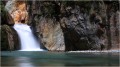
 1.82 mi
 +427 ft
 -436 ft
 1h 10
1h 10
 Easy
Easy
 Departure from Auzat (Ariège)
A gentle walk to the Artigue waterfalls.
Artigue Waterfall Loop
 3.73 mi
+1,060 ft
-1,047 ft
2h 40
3.73 mi
+1,060 ft
-1,047 ft
2h 40
 Moderate
Departure from Auzat (Ariège)
Moderate
Departure from Auzat (Ariège)
A lovely loop around the Ruisseau de l'Artigue and Estats.
This loop allows you to avoid the crowds that can gather in summer due to the easy access to the waterfall and the canyoning activity.
Étang Sourd circular loop, returning via the Waterfall d’Artigue
 6.78 mi
+2,815 ft
-2,789 ft
5h 35
6.78 mi
+2,815 ft
-2,789 ft
5h 35
 Difficult
Departure from Auzat (Ariège)
Difficult
Departure from Auzat (Ariège)
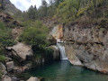
A hike suitable for people in good physical condition, for which a navigation app may be useful. The first section follows good paths which are actually shortcuts, so it’s short but steep as it climbs through the Montcalm State Forest. After a very scenic traverse through the forest, we rejoin the GR®T60 and begin the ascent along a path in poor condition. The Orri de Pla de Nouzère is of no particular interest. It’s better to take the path leading uphill to the left, which is rocky and easier (marked in yellow). The Étang Sourd, set in its picturesque surroundings, makes the effort well worth it. The return journey follows the GR®T60 for part of the way; this section is tough and you’ll sometimes need to use your hands. The Artigue Waterfall is well worth a look.
Marc's Lodge - Refuge du Pinet
4.31 mi
+4,012 ft
-36 ft
5h 30
Difficult
Departure from Auzat (Ariège)
The first stage of the journey, the shortest and easiest, to warm up your legs, passing through the Bois de Fontanal and the Étang Sourd to the Refuge du Pinet. The elevation gain is still significant.
Walks near Cascade de l’Artigue
Refuge du Pinet - Montcalm/Estats/Verdaguer Peaks - Refuge Vallferrera
7.84 mi
+3,786 ft
-4,790 ft
6h 55
 Very difficult
Departure from Auzat (Ariège)
Very difficult
Departure from Auzat (Ariège)
The second day is a high-mountain stage passing through the highest point of this itinerary: Pic d'Estats, as well as two other peaks over 3,000 m nearby, Pic du Montcalm and Pic de Verdaguer. The route is largely over scree and rocky terrain, which will greatly appeal to mineral enthusiasts. The trail largely follows the Porta del Cel hike and the GR®T61. Although not particularly technical, this stage should not be taken lightly due to its altitude (three peaks over 3,000 metres), its length, its elevation gain and its trails composed of loose stones that can make progress difficult.
Etang de Soulcem - Etang Fourcat
 5.17 mi
+4,377 ft
-1,621 ft
6 hrs
Very difficult
Departure from Auzat (Ariège)
5.17 mi
+4,377 ft
-1,621 ft
6 hrs
Very difficult
Departure from Auzat (Ariège)
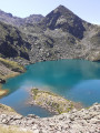
A magnificent hike in the upper Ariège in a spectacular setting. On the agenda for the day are the Etangs du Picot and the two Etangs Fourcat, which quickly make you forget the intense effort required during the climb.
Bassiès-Port de Lers mountain hut via the Étang d’Alate and Mont Ceint
 3.97 mi
+1,883 ft
-2,313 ft
3h 30
Difficult
Departure from Auzat (Ariège)
3.97 mi
+1,883 ft
-2,313 ft
3h 30
Difficult
Departure from Auzat (Ariège)
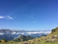
Before heading back, there is the option of a return trip to the Étang de Bassiès from the refuge, leaving some of your luggage at the refuge.A fairly short second stage, with two steep ascents (19% to 38%): one from the Refuge de Bassiès to the Port de Bassiès, and the even more challenging one from the Port de Saleix to the Pic de Girantès or Mont Ceint. In fact, it is a rather gruelling, up-and-down stage, classified as difficult. The ascents and descents are on challenging trails (pebbles, rocks, scree). The whole day is spent in open country with stunning panoramic views. The route passes the beautiful Étang d’Alate.The relative altitude, between 1,520 m and 2,100 m, means this day’s walk is feasible even in the height of summer.
Pradières d’en haut car park – Étang d’Izourt – Refuge du Fourcat
 4.80 mi
+4,298 ft
-75 ft
5h 55
Difficult
Departure from Auzat (Ariège)
4.80 mi
+4,298 ft
-75 ft
5h 55
Difficult
Departure from Auzat (Ariège)
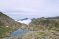
First stage of the journey through the Haute-Ariège.
A beautiful, steady climb takes you to the Étang d’Izourt, steeped in human history.
This is followed by a gruelling climb up to the Orri de la Caudière.
Once you’ve crossed the rustic footbridge, there’s another very steep climb up to the small Étang du Fourcat.
The rest of the route to the Étang du Fourcat refuge is more gentle.
A very steep climb to the Fourcat refuge with an average gradient of 17 per cent.
Please note: from the Étang d’Izourt to the refuge, the gradient is 24 per cent.
From Étang de Soulcem to the Josep M. Monfort Baiau Refuge
 9.00 mi
+4,629 ft
-1,752 ft
8h 10
Difficult
Departure from Auzat (Ariège)
9.00 mi
+4,629 ft
-1,752 ft
8h 10
Difficult
Departure from Auzat (Ariège)
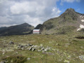
First stage of the 3-day hike that is circular and loops around the Étang de Soulcem. This beautiful, long stage will take us into Catalonia, first passing by small lakes and then through the Port de Bouet, through gentle high-mountain landscapes, over the grassy, undulating slopes of the Ariège and then Catalonia; we finally reach the unmanned Josep M. Monfort Baiau refuge, which is in perfect condition and offers safe shelter (sleeps 9).
Refuge Fourcat - Marc's lodge
9.76 mi
+1,247 ft
-5,958 ft
5h 35
Difficult
Departure from Auzat (Ariège)
This is the sixth and final stage of the Tour des Géants des Trois Nations, which has a steep descent (1,800 m of elevation loss, which will hurt your joints) to return to the starting point of this journey. This stage passes by the Fourcat Waterfall, the beautiful Izourt Pond and the forests of Goulier-Auzat and Montcalm.
Fourcat Mountain Hut – Picot Lakes – Mounicou
 5.90 mi
+1,109 ft
-5,564 ft
3h 40
Difficult
Departure from Auzat (Ariège)
5.90 mi
+1,109 ft
-5,564 ft
3h 40
Difficult
Departure from Auzat (Ariège)
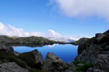
Second stage of the journey through Haute-Ariège.A difficult and long mountain stage (around 7 hours), to be undertaken seriously and by those in good physical condition.Shortly after leaving the mountain hut, there is a very steep climb.After crossing the first pass (2) (altitude 2,574 m), you’ll encounter rocks, snowfields, another climb and then another pass (3) at 2,640 m.From this point: tricky sections with cables and steel rungs fixed to the rock.Then the rest of the very gruelling descent through magnificent scenery.Please note that the Mounicou lodge will be closed in 2026 => accommodation in Marc: see the ‘Places to Visit’ section.
Vallferrera Refuge - Pic de Comapedrosa - Comapedrosa Refuge
6.88 mi
+3,727 ft
-2,549 ft
6h 25
Very difficult
Departure from Alins (Lleida)
Third stage passing through the highest point in Andorra: Pic de Comapedrosa. A high-mountain stage with no particular difficulties apart from the climb to Portella de Baiau over scree and the descent along the somewhat exposed ridge of Pic de Comapedrosa.
Port de Caraussans - Étang de Soulcem
 4.79 mi
+49 ft
-3,596 ft
2h 15
Difficult
Departure from Auzat (Ariège)
4.79 mi
+49 ft
-3,596 ft
2h 15
Difficult
Departure from Auzat (Ariège)
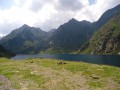
After our chairlift ride, we descend towards the Soulcem lake on the Ariège side. We enjoy the beauty of this glacial valley, the Soulcem lake, the Mérens horses grazing freely, not to mention the numerous orris that line the route. It is a wonderful but particularly challenging end to the hike between the Caraussans lake and the Soulcem trail.
Étang Fourcat - Port de Caraussans
 3.04 mi
+889 ft
-1,411 ft
2h 10
Moderate
Departure from Auzat (Ariège)
3.04 mi
+889 ft
-1,411 ft
2h 10
Moderate
Departure from Auzat (Ariège)
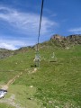
More magnificent lakes are on the agenda, with the added bonus of a short chairlift ride on the Andorran side to rest your legs before the descent to L'Étang de Soulcem, which is very challenging in the last section.