Country:

 City:
City:


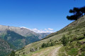

Red and white markings on the GRT64
(S) From the Refuge du Fourcat, head back along the same route as the previous day, heading due west.
At the barely marked junction, turn right and continue for 200 m. The Petit Étang Fourcat lies below on the right.
Red and white markings for the GRT64 and yellow markings. Follow both sets of markings.
(1) Turn left onto a steep climb through the mountain pastures. Soon the path over the rocks becomes steep.
You’ll reach a small pass at an elevation of 2,574. There’s a cairn on the left with the remains of a flag.
(2) Leave the cairn on your left and descend due west, then very quickly south-west along a path clearly marked on the ground. The path then turns due west to cross a very tricky section (red or dotted points on the IGN map).
It is essential to look out for the old red and white markings to navigate the enormous boulders and the two remaining snowfields at the start of the season as safely as possible.
Stay alert: there is no mobile phone coverage in case of an emergency.
After this tricky section, there is a steep climb through a mountain pasture and then along a well-marked path.
After all this effort, you’ll reach a pass at around 2,460 m.
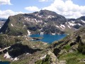
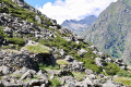
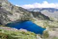
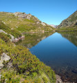
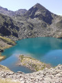
Walk a little further to enjoy the scenery and the view of the Étangs du Picot. A lovely spot for a well-deserved break.
(3) Caution: a technical and difficult descent with fixed ropes. Take the time needed to negotiate these various obstacles, which are equipped with ropes and steel hooks.
After this challenging descent, continue due north, making sure to follow the old red-and-white or yellow markings. Reach the edge of the first lake and go round it to the right until you reach its spillway.
(4) Continue due north, then turn left, heading due west, descending steeply towards a barely marked fork in the path.
Yellow markings only
(5) Please note: make sure you spot the yellow markings heading due north. Let the GRT64 heading south-west branch off to the left.
Following these yellow markings, continue due north, more or less along the mountainside.
Stunning scenery with views of numerous small ponds.
The path, which is clearly marked on the ground, curves north-west. It then turns south-west at a 90° angle along a ridge and, after a steep 100-metre descent, turns north-west.
Although the path is clearly marked on the ground, this descent is challenging all the way to the Orri de Tignalbu.
‘A lovely spot for a well-deserved break. Although the hut is closed, a picnic table and a fountain are accessible behind an electric fence, which must be closed to keep this place unspoilt. Thank you.’
(6) Then head due north along the track until you reach the sharp left-hand bend at the 1684-metre mark.
(7) Please note: there are no signposts. Follow the sparse, poorly marked yellow trail markers. Don’t hesitate to turn back to check the markings, which are clearly intended for the ascent.
After 150 m, you’ll reach a grassy track; head right at the very end of it for about a hundred metres.
(8) Leave the track and head down to the right along a winding path through the forest.
Then head due north along this path, which is very clearly marked on the ground.
Pass the large avalanche barrier and re-enter the forest, following numerous hairpin bends.
This will take you onto theGR®10.
Red and white markings for the GR®10
(9) Turn left onto this path and, after numerous hairpin bends, join the D8.
(10) Turn right onto the D8 and follow the signs for the Mounicou stopover lodge and café.
First, you’ll arrive at the hamlet’s café; then, after a quick introduction, head to the Mounicou stopover lodge for the night (E).
 Visorando Member
 Moderate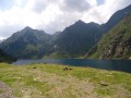
 Very difficult