Surface quarries and the vineyards of Saint-Même-les-Carrières

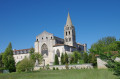
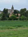
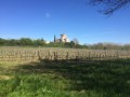
A lovely walk starting from Saint-Même-les-Carrières, passing through the vineyards and the open-cast stone quarries.

Details

n°41676531
Creation:
Last update:
Last review:
  • Walking
    Activity: Walking
  • ↔
    Distance: 5.87 mi
  • ◔
    Average duration: 3h 00 
  • ▲
    Difficulty: Easy

  • ⚐
    Back to start: Yes
  • ↗
    Ascent: + 361 ft
  • ↘
    Descent: - 361 ft

  • ▲
    Highest point: 282 ft
  • ▼
    Lowest point: 66 ft

Photos

Description of the walk

Start from the car park at the village square in Saint-Même-les-Carrières.

(S/E) Take the road towards Saint-Preuil. About 200 m further on, turn left onto the track, then, at the three-way junction, turn right and, at the next three-way junction, keep left.

(1) At the crossroads, continue to the right towards Douvesse, pass through this hamlet following the road on the left, then turn left at the next junction and continue for about 150 m.

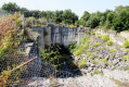
(2) Turn onto the track on the right, ignore a track on the left and carry on straight ahead until you reach the open-cast stone quarry.

(3) Take in the view of the quarry and continue along the track towards the east, then ignore the first track on the right (not shown on the IGN map). About forty metres further on, turn right and continue along the track towards the east.

(4) At the crossroads, turn left to reach the hamlet of Chebrat, head up towards the Route de Châteauneuf, turn right for 20 metres, taking care of the traffic, then turn left onto the track. Continue for 100 metres, turn right for 20 metres, then left, staying on the track. Follow it towards La Natrie and reach this hamlet.

(5) Turn left onto the road (Route de la Natrie), cross the Maine Buisson junction (D155) and head up the road opposite leading to the hamlet of Chez Marchand.

(6) As you leave the hamlet, turn left then right onto Voie de la Tuilerie; follow this road for about 300 metres and turn right onto the track.

(7) Turn left onto the Voie Communale de Saint-Même au Grollet, continue along the Route des Écoles until you reach the junction with the Route de la Gare, turn left, then head uphill to the village square (S/E).

Waypoints

  1. S/E : mi 0 - alt. 174 ft - Place de Saint-Même (car park)
  2. 1 : mi 1.15 - alt. 256 ft - Towards Douvesse
  3. 2 : mi 1.8 - alt. 213 ft - Walk through the woods
  4. 3 : mi 2.17 - alt. 240 ft - Surface quarries
  5. 4 : mi 2.67 - alt. 164 ft - Crossing the woodland
  6. 5 : mi 4.04 - alt. 79 ft - La Natrie
  7. 6 : mi 4.97 - alt. 121 ft - Chez Marchand hamlet
  8. 7 : mi 5.33 - alt. 108 ft - Route des Écoles
  9. S/E : mi 5.87 - alt. 174 ft - Place de Saint-Même (car park)

Notes

No water points along the walk

Worth a visit

Take some time to admire the open-cast quarries (mind the fence).

Reviews and comments

5 / 5
Based on 1 review

Reliability of the description
Not used
Ease of following the route
5 / 5
Route interest
5 / 5
chipie33290
chipie33290

Overall rating : 5 / 5

Date of your route : Dec 15, 2024
Reliability of the description : Not used / Not applicable
Ease of following the route : ★★★★★ Very good
Route interest : ★★★★★ Very good
Very busy route : No

A easy route with varied scenery.
Thank you for this route

Machine-translated

HORTOLAN Jean-Pierre.

A ‘shortened’ walk due to the flooding. This will be the focus of a future outing.

Machine-translated

Other walks in the area

For more walks, use our search engine .

The GPS track and description are the property of this route's author. Please do not copy them without permission.