Country:

 City:
City:


Below are some details on the condition of the mapped paths, which have become barely visible on the ground, as well as the numerous possible shortcuts.
Trails that are difficult to find or follow:
(7) A path heads straight ahead. It is barely visible at the start but is very clearly marked a few dozen metres further on.
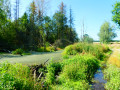
(10) The track turns into a path… which becomes invisible on the ground following a clear-cut. You must continue straight on, follow the fence, cross the small stream (dry in summer) and climb straight up into the woods to rejoin the perpendicular path situated a little further up.
(12) A tree has fallen (a very long time ago) across the middle of the path. The track created to go round it on the right zigzags between the blueberry bushes and rejoins the path a little further on, just before the next junction.
(14) The mapped path/track that branches off to the left is overgrown with tall grass and is invisible. Further on, it is supposed to curve to the left and cross a fallow field. The fallow field has become impenetrable scrub. Follow the edge of the scrub to the left, then to the right along the field, and reach the perpendicular path.
Shortcuts:
(3) Turn left to cut across the northern tip of the circular loop.
(6) After crossing the bridge over the RAVeL, you can continue straight on for a significant shortcut or turn left to return to the starting point even more directly.
(11) Carry on straight ahead to avoid the eastern circular loop.
(13) Carry on straight ahead to avoid the small detour to the east and/or the path/trail which becomes hidden and difficult to follow from (14).
 Visorando Member
 Moderate
 Easy
Easy