


Refine your search for walks in Cabane du Pis
Cabane du Pis walks


 Balcons de Beaume Rousse and Tirière
 Visorando Member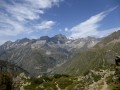
 9.61 mi
 +2,982 ft
 -3,002 ft
 7h 00
7h 00
 Difficult
 Departure from La Chapelle-en-Valgaudemar (Hautes-Alpes)
Hike with a panorama that changes throughout the crossing from the Chabournéou Refuge via the Beaume Rousse balcony and then the Tirière plateau. Magnificent view of the surrounding peaks and the Valgaudemar valley.
Tirière Mountain Pasture Route
5.47 mi
+2,188 ft
-2,192 ft
4h 25
 Moderate
Departure from La Chapelle-en-Valgaudemar (Hautes-Alpes)
Moderate
Departure from La Chapelle-en-Valgaudemar (Hautes-Alpes)
A hike offering a variety of points of interest at the bottom of a valley far from the main routes: glacial cirque, torrents, mountain pastures, larch forests, and paths that are sometimes steep or offer peaceful views.
Walks near Cabane du Pis
Chalet du Gioberney – Vallonpierre Mountain Hut
 6.84 mi
+3,442 ft
-1,358 ft
6h 10
Difficult
Departure from La Chapelle-en-Valgaudemar (Hautes-Alpes)
6.84 mi
+3,442 ft
-1,358 ft
6h 10
Difficult
Departure from La Chapelle-en-Valgaudemar (Hautes-Alpes)
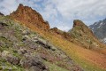
The sixth stage is a fairly easy climb up to the Vallonpierre Refuge.
This allows you to arrive at the refuge early and, if you wish, carry on to the Col des Chevrettes, where marmots are guaranteed.
Refuge du Pigeonnier – Chalet du Gioberney
 5.79 mi
+909 ft
-3,468 ft
3h 25
Moderate
Departure from La Chapelle-en-Valgaudemar (Hautes-Alpes)
5.79 mi
+909 ft
-3,468 ft
3h 25
Moderate
Departure from La Chapelle-en-Valgaudemar (Hautes-Alpes)
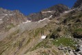
An easy fifth stage, mainly downhill, to recover from the previous days.
The crossing of the Gioberney glacial cirque at its highest point, before descending towards the Aiguille de la Vache (a great spot for a picnic), is fantastic!
From Rif du Sap to Navette via Le Chapeau
 7.39 mi
+4,045 ft
-4,301 ft
6h 55
7.39 mi
+4,045 ft
-4,301 ft
6h 55
 Very difficult
Departure from La Chapelle-en-Valgaudemar (Hautes-Alpes)
Very difficult
Departure from La Chapelle-en-Valgaudemar (Hautes-Alpes)
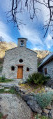
A beautiful and challenging hike in the hills, varied with some unexpected sections. Stunning views. Be careful, there are many tricky and slippery sections. Avoid in wet weather.
Vallonpierre refuge - Sebeyras lakes
 14.23 mi
+4,291 ft
-4,255 ft
10h 15
Very difficult
Departure from La Chapelle-en-Valgaudemar (Hautes-Alpes)
14.23 mi
+4,291 ft
-4,255 ft
10h 15
Very difficult
Departure from La Chapelle-en-Valgaudemar (Hautes-Alpes)
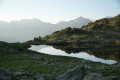
From the Vallonpierre refuge, the hike takes you to the Rif du Sap chapel, then to the charming village of La Chapelle-en-Valgaudémar, where you can stop for refreshments at a local grocery store. The route then crosses the Valgaudémar National Forest before reaching the magnificent lakes of Pétarel and Sebeyras.
Vallonpierre Refuge - La Chapelle-en-Valgaudemar
 8.45 mi
+112 ft
-3,999 ft
4h 00
Moderate
Departure from La Chapelle-en-Valgaudemar (Hautes-Alpes)
8.45 mi
+112 ft
-3,999 ft
4h 00
Moderate
Departure from La Chapelle-en-Valgaudemar (Hautes-Alpes)
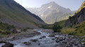
Here we are at the final stage of this 13-day route around the magnificent Écrins National Park. A downhill stage that takes you to La Chapelle-en-Valgaudemar, where this journey began 13 days earlier. A splendid start to the stage, all the way down to the glacial torrents. The panorama is breathtaking, surrounded by the most beautiful peaks of the southern part of the Écrins, already leaving us with a sense of nostalgia for the past 13 days. A route with no technical difficulty.
Pré de la Chaumette Mountain Hut - Vallonpierre Mountain Hut
 6.50 mi
+3,783 ft
-2,215 ft
6h 15
Difficult
Departure from Champoléon (Hautes-Alpes)
6.50 mi
+3,783 ft
-2,215 ft
6h 15
Difficult
Departure from Champoléon (Hautes-Alpes)
The12th stage of this route features three passes to cross, the last of which is particularly technical and difficult.
The panoramic views remain as exceptional as ever, with vistas of the majestic Chaillol, the Sirac and the Champoléon valley. The refuge is set in lush greenery at the bottom of a cirque at the foot of the Sirac and on the shores of the magnificent Lac de Vallonpierre. A campsite in a beautiful meadow at the foot of the Sirac, with a splendid view of the lake.
Vallouise - Pré de la Chaumette Mountain Hut
 9.83 mi
+3,852 ft
-3,228 ft
8 hrs
Very difficult
Departure from Vallouise (Hautes-Alpes)
9.83 mi
+3,852 ft
-3,228 ft
8 hrs
Very difficult
Departure from Vallouise (Hautes-Alpes)
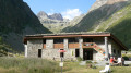
Stage11 of this route. One of the most beautiful and challenging stages of the route, featuring the Aup Martin pass at 2,700 metres and the Pas de la Cavale, the highest point ofthe GR® 54. This stage demands the utmost vigilance and experience of high-mountain hiking. The views are absolutely stunning and incredibly wild. We took the shuttle bus to avoid the 8 km of tarmac road to the car park at Entre-les-Aigues.
Les Prés de Lauplat – Les Naizets
 6.38 mi
+2,762 ft
-3,547 ft
5h 20
Moderate
Departure from La Chapelle-en-Valgaudemar (Hautes-Alpes)
6.38 mi
+2,762 ft
-3,547 ft
5h 20
Moderate
Departure from La Chapelle-en-Valgaudemar (Hautes-Alpes)
This stage takes you from the Prés de Lauplat to the Naizets bivouac, passing through the village of La Chapelle-en-Valgaudémar. The route follows the Oulles du Diable before climbing via the GR®54, passing the Combefroide Waterfall to reach a grassy plateau.
Olan Mountain Hut – Clot Mountain Hut (Xavier Blanc)
 8.28 mi
+1,152 ft
-4,216 ft
4h 50
Moderate
Departure from La Chapelle-en-Valgaudemar (Hautes-Alpes)
8.28 mi
+1,152 ft
-4,216 ft
4h 50
Moderate
Departure from La Chapelle-en-Valgaudemar (Hautes-Alpes)
A very beautiful third stage, albeit a little long, mainly at the bottom of the valley along the Séveraisse.
Les Naizets – Lac du Lautier (via Pic Turbat)
 4.81 mi
+4,209 ft
-2,582 ft
5h 55
Very difficult
Departure from La Chapelle-en-Valgaudemar (Hautes-Alpes)
4.81 mi
+4,209 ft
-2,582 ft
5h 55
Very difficult
Departure from La Chapelle-en-Valgaudemar (Hautes-Alpes)
This stage takes you from Les Naizets to Lac du Lautier via the Col de Colombes. The route offers an optional detour to climb Pic Turbat before descending to the campsite by the lake.