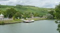
Champagne bubbles in Seine-et-Marne

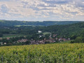
This walk will take you through three towns in northern Seine-et-Marne: Nanteuil-sur-Marne, Saâcy-sur-Marne and Citry – all of which have been awarded the ‘Champagne’ designation – before delving into a wild, unspoilt natural setting as you follow the Dhuys underground aqueduct, built between 1863 and 1865 to supply the Marne-la-Vallée conurbation. We’ll bring the ride to a peaceful close by cycling along the River Marne to La Ferté-sous-Jouarre.

Details

n°28644402
Creation:
Last update:
Last review:
  • Walking
    Activity: Walking
  • ↔
    Distance: 10.52 mi
  • ◔
    Average duration: 5h 30 
  • ▲
    Difficulty: Moderate

  • ⚐
    Back to start: No
  • ↗
    Ascent: + 778 ft
  • ↘
    Descent: - 791 ft

  • ▲
    Highest point: 600 ft
  • ▼
    Lowest point: 164 ft
  • ⚐ Country: France
  • ⚐ City: Saâcy-sur-Marne (77730)
  • ⚑
    Start: N 48.973704° / E 3.219952°
  • ⚑
    End: N 48.950856° / E 3.125693°
  • ❏
    IGN map(s): Ref. 2513E, 2513OT, 2514SB, 2613O, 2614O
  • Hour-by-hour weather

Photos

Description of the walk

This walk is not circular; it starts at Nanteuil/Saâcy-sur-Marne station and leads to La Ferté-sous-Jouarre station via the hills along the left bank of the Marne.

(S) With your back to the station, head left, leaving the memorial (Wagon des Déportés) on your right, cross the road (Avenue du Général Leclerc) and take the green path that runs alongside the railway line, then turn right into the fields.

Red/white markings forthe GR® 14A

(1) Take the first path on the left, then turn right and then left onto a small track leading to Citry church; walk down Rue de la Ferme and turn right, before the railway bridge, into Rue des Buttes.

(2) Turn right into Rue de la Marne, cross the small square and head up the road opposite into Rue Michaud, which turns into a farm track. Continue straight on at the junction with Chemin des Meulières, veer slightly to the right at the next junction and carry on to the Dhuys aqueduct.

End of red/white markings

(3) Turn right and follow this aqueduct as it winds through the vineyards. Cross Rue de Villaré and continue straight on.

(4) Cross the D55, continue along the Dhuys to the first junction and turn right down a farm track which becomes the Chemin de Bussières.

Yellow markings

(5) Turn left onto the first track, Chemin de Citry, then, before the Ru Philippe, turn right onto a footpath leading to the roundabout in the town centre.

End of yellow markings

(6) Turn left into the high street, continue straight on along Rue Chef de Ville, veer slightly to the right onto Rue de Laval and, after 100 m, turn left onto Chemin du Martret.

(7) Turn right onto the first track and continue climbing (ignore the turn-offs to the left and right) until you reach the aqueduct.

(8) Follow the aqueduct on your right as it winds through the woods for over 2 km.

(9) Turn right onto a farm track at a barrier across the path, then take the first track on the right and follow it to the hamlet of La Charbonnière (yellow markings).

(10) Head up towards Rue Roger Simon in Le Tillet, then, at a place called Cornevent, turn onto the first path on the right towards the wash house. Follow the path uphill to rejoin Rue Roger Simon (end of the yellow markings).

::11: Walk up Rue de la Cave opposite, and leave it at the first junction on the left, on leaving the village.

Red/white markings forthe GR®11A

(12) Continue along this signposted path, through a beautiful wetland area, to the cemetery at Reuil-en-Brie.

End of red/white markings

(13) Turn left at the corner of the cemetery to follow the purplePR® markings along a path leading into Rue Gambetta, then left into Rue du Commandant Frot, right for 50 metres, then left into Rue de Rohan, and cross the road opposite Reuil-en-Brie Town Hall.

(14) Cross the car park diagonally to the left and, at the corner of the fence, take a path on the right leading towards the Marne.

Red/white markings forthe GR®11A

Follow the bank of the Marne on the left, pass the stud farm and the tennis courts, and continue on to La Ferté-sous-Jouarre.

(15) Go through the gate by the first blocks of flats, follow the Marne along the pavement on Quai André Planson or along the water’s edge, until you reach the bridge in the town centre.

(16) Turn right, cross the bridge and head straight up through the town centre along Rue des Pelletiers, then Rue Michel Fauvet.

(17) At the top of the street, turn left into Rue de la Gare, which runs parallel to the D603 county road. Cross the road at the pedestrian crossing to reach La Ferté-sous-Jouarre station opposite (E).

Waypoints

  1. S : mi 0 - alt. 207 ft - Gare de Nanteuil-Saacy
  2. 1 : mi 0.51 - alt. 266 ft - A fork in the road in the middle of the fields
  3. 2 : mi 1.48 - alt. 187 ft - Wastewater treatment plant - église st Pons.
  4. 3 : mi 2.12 - alt. 407 ft - The Dhuys underground aqueduct
  5. 4 : mi 2.66 - alt. 407 ft - Crossing the D55
  6. 5 : mi 3.36 - alt. 249 ft - Chemin de Citry
  7. 6 : mi 3.74 - alt. 203 ft - Roundabout - Église Saint-Jean-Baptiste (Saâcy-sur-Marne)
  8. 7 : mi 4.14 - alt. 226 ft - Chemin du Martret
  9. 8 : mi 4.65 - alt. 430 ft - Aqueduct at Bois Galants
  10. 9 : mi 5.88 - alt. 522 ft - Les Poupelins
  11. 10 : mi 6.5 - alt. 433 ft - La Charbonnière
  12. 11 : mi 6.82 - alt. 531 ft - Le Tillet
  13. 12 : mi 7.36 - alt. 594 ft - Junction of farm tracks
  14. 13 : mi 8.77 - alt. 243 ft - Reuil-en-Brie Cemetery
  15. 14 : mi 9.13 - alt. 180 ft - Reuil-en-Brie Town Hall
  16. 15 : mi 9.95 - alt. 177 ft - Barrière, Rue du Stade - Marne (la)
  17. 16 : mi 10.15 - alt. 171 ft - Quai André Planson - Pont Charles de Gaulle (La Ferté-sous-Jouarre)
  18. 17 : mi 10.41 - alt. 213 ft - Rue de la Gare - Église Saint-Denis et Saint-Étienne (La Ferté-sous-Jouarre)
  19. E : mi 10.52 - alt. 207 ft - Gare de La Ferté-sous-Jouarre

Notes

Departure from Nanteuil-Saâcy station (Transilien line P, on the section between Paris-Est and Château-Thierry).
There is one train per hour in each direction on the P line between Paris-Est and Château-Thierry. For further details, please visit the Transilien website.

For motorists: Nanteuil/Saâcy-sur-Marne and La Ferté-sous-Jouarre stations have car parks. You can leave your car at either station, or leave it at La Ferté-sous-Jouarre and travel by train to Saâcy. Please note that the car park at Saâcy gets very busy from Monday to Friday from 7.00 am, so you may need to park nearby, either in Nanteuil or Saâcy.

All shops are in Saâcy-sur-Marne.

Worth a visit

The vineyards of the Marne Valley, the church at Saâcy-sur-Marne.
The Lavoir du Tillet, the church at Reuil-en-Brie.
The banks of the Marne at La Ferté-sous-Jouarre, a source of inspiration for the painter A. Planson.
The Town Hall in La Ferté-sous-Jouarre.

Always be cautious and plan ahead when you're outdoors. Visorando and the author of this route cannot be held responsible for any accidents occurring on this route.

The GR® and PR® markings are the intellectual property of the Fédération Française de Randonnée Pédestre.

Reviews and comments

4.7 / 5
Based on 1 review

Reliability of the description
5 / 5
Ease of following the route
5 / 5
Route interest
4 / 5
ozogiminy
ozogiminy
• Edited:

Overall rating : 4.7 / 5

Date of your route : Jun 13, 2023
Reliability of the description : ★★★★★ Very good
Ease of following the route : ★★★★★ Very good
Route interest : ★★★★☆ Good
Very busy route : No

A lovely walk through the vineyards of the Seine-et-Marne region, in the cool shade along the Dhuys aqueduct, and along the banks of the Marne towards the end of the route.

Machine-translated

Other walks in the area

For more walks, use our search engine .

The GPS track and description are the property of this route's author. Please do not copy them without permission.