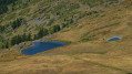
Bric Froid via the Col de Thures

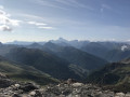
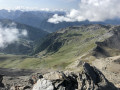
A beautiful but long hike in the Queyras. On a clear day, the view opens up onto the Viso, offering a 360° panorama of the French and Italian Alps.

Details

1414215
Creation:
Last update:
Last review:
  • Walking
    Activity: Walking
  • ↔
    Distance: 10.16 mi
  • ◔
    Duration according to the author: 8 hrs 
  • ▲
    Difficulty: Very difficult

  • ⚐
    Back to start: Yes
  • ↗
    Ascent: + 5,594 ft
  • ↘
    Descent: - 5,574 ft

  • ▲
    Highest point: 10,817 ft
  • ▼
    Lowest point: 5,673 ft

Photos

Description of the walk

Park in one of the small car parks in the hamlet of Le Roux, just past the village of Abriès.

(S/E) Walk through the hamlet, heading north, following the signs for the Col de Thures (GR®58variant).

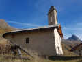
(1) Walk past the Chapelle Saint-Antoine and continue in the same direction (GR®58variant).

(2) When you reach the Chapelle de la Montette, turn left, continuing to follow the signs for the Col de Thures. (GR®58variant) From this point, the climb is very steep up to the pass.

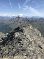
(3) Once at the pass, follow the ridge line to the right towards Bric Froid. Leave theGR®58variant.

(4) Find a path through the scree slope rising opposite. You must follow the border line (there is plenty of barbed wire on the ground).

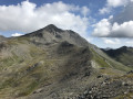
(5) Once at the summit of Bric Froid, descend a short distance towards the Italian side to reach the cross.

(6) Return to the Col de Thures via the same route.

(3) Extend the walk by heading straight on towards the Rocher des Thures. Follow the direction of the Pic du Malrif (GR®58variant).

(7) Leave the path and turn left to climb straight up towards the summit. Leave theGR®58variant. There isn’t really a path; you’ll need to follow the faint tracks on the ground to the summit.

(8) Rocher des Thures. Follow the route in the opposite direction back to the Col de Thures.

(3) Turn right to head back down to the hamlet of Le Roux and the car park (S/E) .

Waypoints

  1. S/E : mi 0 - alt. 5,673 ft - Car park in the hamlet of Le Roux
  2. 1 : mi 0.61 - alt. 5,915 ft - Saint-Antoine Chapel
  3. 2 : mi 1.43 - alt. 6,329 ft - La Montette Chapel
  4. 3 : mi 3.3 - alt. 9,183 ft - Col des Thures
  5. 4 : mi 3.94 - alt. 9,583 ft - Start of the Pierrier
  6. 5 : mi 4.54 - alt. 10,814 ft - Summit of > - Bric Froid - Bric Froid - Bric Froid
  7. 6 : mi 4.59 - alt. 10,801 ft - Croix
  8. 7 : mi 6.28 - alt. 9,393 ft - Start of the scree slope
  9. 8 : mi 6.35 - alt. 9,616 ft - Rocher des Thures
  10. S/E : mi 10.16 - alt. 5,676 ft - Car park in the hamlet of Le Roux

Notes

Whether you’re coming from Château-Queyras or Molines-en-Queyras, follow the signs for Aiguilles and then Abriès.
Please note: traffic is alternating on the road on the outskirts of Aiguilles following a landslide.
Once you reach Abriès, turn left after the bridge towards the hamlet of Le Roux.
There is a small car park at the entrance to the village where you can park easily.

Worth a visit

The Chapelle de la Montette has recently been restored, so do take a short break to visit it before tackling the climb.

On the way back, it’s very pleasant to stop for a drink on a terrace in the village of Abriès.

Always be cautious and plan ahead when you're outdoors. Visorando and the author of this route cannot be held responsible for any accidents occurring on this route.

The GR® and PR® markings are the intellectual property of the Fédération Française de Randonnée Pédestre.

Reviews and comments

4.6 / 5
Based on 4 reviews

Reliability of the description
4.5 / 5
Ease of following the route
4.3 / 5
Route interest
5 / 5
martialg
martialg

Overall rating : 5 / 5

Date of your route : Jul 25, 2026
Reliability of the description : ★★★★★ Very good
Ease of following the route : ★★★★★ Very good
Route interest : ★★★★★ Very good
Very busy route : No

A magnificent hike completed on 24 July 2026, excluding the Rocher des Thures. Steep in the final section before the Col des Thures and on the scree slopes. Although we strayed slightly from the route between the pass and the Bric Froid, we quickly found our way back onto the trail thanks to the GPS and by keeping a close eye on the cairns. A stunning 360° view from the summit. Best suited to very fit walkers, though!

Machine-translated

Marino de Marcy
Marino de Marcy

Overall rating : 3.7 / 5

Date of your route : Jul 17, 2025
Reliability of the description : ★★★☆☆ Average
Ease of following the route : ★★★☆☆ Average
Route interest : ★★★★★ Very good
Very busy route : No

We only used the route description from the Col de Thures onwards, as we were circling the Queyras region coming from Aiguilles, looking for interesting alternatives that branched off the GR.

It isn’t very precise at the point where you leave the ridge rising from the Col de Thures to head left in search of the track (it isn’t even a proper path) that climbs a very steep slope of scree and crumbling rock: had we not been accompanied by someone we met at the Col de Thures, who didn’t fancy climbing the Bric Froid alone (which is understandable!), we might not have ventured onto this rather uninviting track. And it was well worth it for the view at the top. The crumbling slope is actually quite manageable, provided you’re careful and follow the cairns closely, both on the ascent and the descent. The route description doesn’t emphasise caution enough: avoid standing beneath people who might dislodge rocks below. And make sure you follow the cairns closely through the rocky maze of the upper section.

The ‘very difficult’ rating is well deserved.

Machine-translated

grove
grove
• Edited:

Overall rating : 5 / 5

Date of your route : Jul 29, 2024
Reliability of the description : ★★★★★ Very good
Ease of following the route : ★★★★★ Very good
Route interest : ★★★★★ Very good
Very busy route : No

A magnificent hike at 3,303 metres, with splendid weather. A lovely, steady climb up to the pass, whilst the moon set. Plenty of flora and fauna to be seen at this time of year – a real treat. Then a superb view from the easy ridge and the final cairn-marked ascent to the summit, where we could admire Mont Blanc and other peaks. A solo hiker joined us and decided to head down with us. A long, steady descent, with a lovely slide on our wet bottoms down a snowfield at the foot of the summit face, just to get away from the scree for a bit. There were far more people on the GR trail after the pass. A warm atmosphere on the cold Bric!!!

Machine-translated

JODIDO
JODIDO
• Edited:

Overall rating : 5 / 5

Date of your route : Jul 29, 2020
Reliability of the description : ★★★★★ Very good
Ease of following the route : Not used / Not applicable
Route interest : ★★★★★ Very good
Very busy route : No

The hike starts at 6.00 am and involves a 1,100-metre ascent to reach the Col des Thures, at an altitude of 2,797 metres, in 2 hours 25 minutes.
Apart from the final hairpin bends, the climb isn’t difficult, and the view from the pass is superb! The elevation gain from the pass to the summit of Bric Froid is 505 m, and it’s quite a challenge, as a large section is over slippery terrain.
You really have to pay close attention to find the path as you descend from the ridges. There’s just a small cairn marking the start. It took me a good five minutes to spot it.
The path is narrow and I lost it several times. At one point, I even ended up ‘off-piste’ with a sheer drop to my right. But as I knew I had to head straight up towards the summit, I didn’t panic… It took me an hour and a half from the pass to reach the summit of Bric Froid at 3,302 metres. And I was on my own for quite a while before other walkers arrived, with whom I had a natter. I sat there for nearly an hour, and FREE informed me of the cost of calls, texts and MMS messages from Italy…! Those Italians are something else – in France, I’ve never had any signal above 3,000 metres! Back at the Col des Thures, I lost the path at one point… Grrrr Grrrr! But I came across some rusty barbed wire lying on the ground (remnants of the old border…) and managed to find it again. Lunch break at the pass, before heading up to the Rocher des Thures, which rises to 2,914 metres. You have to follow the GR for about a kilometre, then climb up the mountainside through scree to reach the summit and enjoy the stunning view. Back down to the pass, then a long descent of 1 hour 45 minutes to get back to the car park in the hamlet of Les Roux (which the locals pronounce ‘Rousse’!)
A magnificent 9-hour hike, comprising 7 hours 30 minutes of walking, with 1,700 metres of elevation gain and a distance of around 17 km.

Machine-translated

Other walks in the area

For more walks, use our search engine .

The GPS track and description are the property of this route's author. Please do not copy them without permission.