Circular route via La Montette from Le Roux d’Abriès

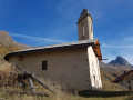
A pleasant circular loop along the Torrent de la Montette, starting from Le Roux d’Abriès. Climb up through the mountain pastures to the Chapelle de la Montette in the old village where more than 200 people once lived, mainly Protestants, then cross the torrent again and descend through the forest and along the contour line through the mountain pastures before returning to Le Roux.

Details

103103666
Creation:
Last update:
Last review:
  • Walking
    Activity: Walking
  • ↔
    Distance: 4.42 mi
  • ◔
    Average duration: 2h 55 
  • ▲
    Difficulty: Easy

  • ⚐
    Back to start: Yes
  • ↗
    Ascent: + 988 ft
  • ↘
    Descent: - 974 ft

  • ▲
    Highest point: 6,634 ft
  • ▼
    Lowest point: 5,758 ft

Photos

Description of the walk

Park at Le Roux d’Abriès.

(S/E) Set off due north, follow the GR®58 and its red and white markings, cross the village of Le Roux, pass in front of the Church of Saint-Jean-Baptiste, then come to a crossroads of paths.

(1) Keep left on the GR®, continue the climb and reach the Chapel of Saint-Antoine.

(2) Keep left, continue along this main path until you cross the stream and tackle a steep climb up to the ruined hamlet of La Montette.

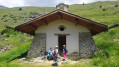
(3) Leave the GR® here and turn right in front of the chapel towards the meadow. Cross it via a path that’s barely visible through the grass. Follow this path until you reach a bridge.

(4) Cross the Col Saint-Martin stream. You will now enter the forest, and via a wide, almost level circular loop to the left, you will reach the Saint-Joseph Chapel in the hamlet of Pré Roubaud.

(5) Continue downhill through the mountain pasture, crossing the Ravin de Coumbalas. At the crossroads by the Oratoire Saint-Joseph, take the path leading off to the left – it’s a little longer but less strenuous. Carry on and enjoy a beautiful view of Valpréveyre. You’ll reach the hamlet of Malauret.

(6) Turn right, making a 180° turn, to return to the Roux car park (S/E).

Waypoints

  1. S/E : mi 0 - alt. 5,758 ft - Le Roux car park
  2. 1 : mi 0.13 - alt. 5,778 ft - Église Saint-Jean-Baptiste (Les Roux)
  3. 2 : mi 0.59 - alt. 5,902 ft - Chapelle Saint-Antoine (La Levée)
  4. 3 : mi 1.47 - alt. 6,339 ft - La Montette Chapel
  5. 4 : mi 2.11 - alt. 6,598 ft - Bridge
  6. 5 : mi 3.04 - alt. 6,417 ft - Pré Roubaud
  7. 6 : mi 3.91 - alt. 6,152 ft - Malauret
  8. S/E : mi 4.42 - alt. 5,758 ft - Le Roux car park

Notes

(S/E) Le Roux: water points

Worth a visit

(3) The hamlet of La Montette: in ruins, though only the chapel has been restored.
(5) The hamlet of Pré Roubaud: be sure to see its restored communal oven.

Always be cautious and plan ahead when you're outdoors. Visorando and the author of this route cannot be held responsible for any accidents occurring on this route.

The GR® and PR® markings are the intellectual property of the Fédération Française de Randonnée Pédestre.

Other walks in the area

For more walks, use our search engine .

The GPS track and description are the property of this route's author. Please do not copy them without permission.