Bourgueil Rose by Les Noues

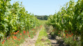
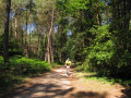
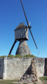
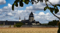
This walk will offer you panoramic views of Bourgueil and the surrounding area. You’ll pass through La Villatte, Les Noues, Beau Puy and Chevrette.

Details

n°62082743
Creation:
Last update:
Last review:
  • Walking
    Activity: Walking
  • ↔
    Distance: 3.66 mi
  • ◔
    Average duration: 1h 45 
  • ▲
    Difficulty: Easy

  • ⚐
    Back to start: Yes
  • ↗
    Ascent: + 102 ft
  • ↘
    Descent: - 102 ft

  • ▲
    Highest point: 249 ft
  • ▼
    Lowest point: 144 ft
  • ⚐ Country: France
  • ⚐ City: Bourgueil (37140)
  • ⚑
    Start/End: N 47.283043° / E 0.160657°
  • ❏
    IGN map(s): Ref. 1623ET
  • Hour-by-hour weather

Description of the walk

Car park at Bourgueil Stadium.

(S/E) With your back to the main stadium stand, take the path directly in front of you after the metal barrier. This path runs alongside the stadium on your right and follows the Allée de la Mailletterie, continuing straight ahead.

(1) Turn left onto Rue de la Villatte and carry on until you reach the end of the bend.

(2) Take the small footpath which leads you to the main road, Route de Tours. Take care when crossing the road and take the street directly opposite this path, Rue de la Martellerie. You’ll pass through a residential area on your right.

(3) At the junction, take the small path on the right as you leave this residential area and carry on straight ahead to the end of Route du Carroi Taveau, passing through Les Noues.

(4) Turn right onto Route du Carroi Taveau, then take the first road on the left, Chemin de Beaupuy, and carry on straight on until you reach the junction.

(5) Turn right and carry on to the hamlet of Beau Puy. When you reach Beau Puy, take the track on the right just before the hamlet. Carry on straight ahead to the end of Chemin aux Petits Bois.

(6) Turn right towards the hamlet of Chevrette, until you reach the junction.

(7) Keep to the right, then take the first left and carry on to the end of the road. There you’ll find a path on the right and one on the left. Take the one on the right to the end, until you reach the road, then turn left. Carry on for about twenty metres before the junction with Rue de Chevrette. Take the small path on the right. This will take you alongside the departmental road, Route de Tours. Continue to the Villatte veterinary surgery.

(8) Turn left until you reach the departmental road, Route de Tours; cross it and take the path directly opposite you. Immediately afterwards, you’ll come to a fork; take the right-hand path, then turn left until you reach the junction you passed on the way out.

(1) Turn right and return to the car park (S/E) by following the route in reverse.

Waypoints

  1. S/E : mi 0 - alt. 148 ft - Bourgueil Stadium
  2. 1 : mi 0.24 - alt. 148 ft - Newsletter
  3. 2 : mi 0.36 - alt. 148 ft - La Villatte
  4. 3 : mi 0.61 - alt. 151 ft - Residential area, La Martellière
  5. 4 : mi 1 - alt. 174 ft - Carroi Taveau
  6. 5 : mi 1.4 - alt. 197 ft - Turn-off towards Beau Puy
  7. 6 : mi 2.09 - alt. 226 ft - Les Petits Bois
  8. 7 : mi 2.29 - alt. 190 ft - Chevrette
  9. 8 : mi 3.21 - alt. 151 ft - La Villatte Veterinary Practice
  10. S/E : mi 3.66 - alt. 148 ft - Bourgueil Stadium

Notes

Our charity, which aims to raise funds for cancer research and awareness, has organised this walk for Sunday 6 October 2024 (starting at 10.00 am) to mark Pink October.
No walk is complete without a warm-up: StudioFit37 will get things going with a warm-up set to music and dance. On your return, you’ll be welcomed with a drink and some tasty treats to top up your energy levels. Well done! A great performance!

Reviews and comments

5 / 5
Based on 1 review

Reliability of the description
5 / 5
Ease of following the route
5 / 5
Route interest
5 / 5
GIRON Raymond
GIRON Raymond

Overall rating : 5 / 5

Date of your route : Jan 17, 2025
Reliability of the description : ★★★★★ Very good
Ease of following the route : ★★★★★ Very good
Route interest : ★★★★★ Very good
Very busy route : No

A very pleasant walk, but there weren’t many signposts along the route. Fortunately, the instructions and the map are very helpful.

Machine-translated

Other walks in the area

For more walks, use our search engine .

The GPS track and description are the property of this route's author. Please do not copy them without permission.