The forest of our ancestors

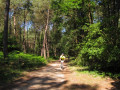
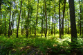
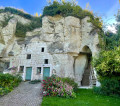
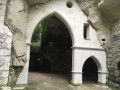
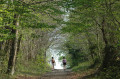
A route through the paths of the Bois de la Cave Peinte. It’s also a chance to stroll near an archaeological site. Situated between Saumur and Bourgueil, on the edge of a large forest, Brain-sur-Allonnes has unearthed some treasures from its archaeological heritage. Renowned for silkworm farming in the 19th century, the village now focuses on market gardening.

Details

1159427
Creation:
Last update:
Last review:
  • Walking
    Activity: Walking
  • ↔
    Distance: 4.64 mi
  • ◔
    Average duration: 2h 20 
  • ▲
    Difficulty: Easy

  • ⚐
    Back to start: Yes
  • ↗
    Ascent: + 259 ft
  • ↘
    Descent: - 259 ft

  • ▲
    Highest point: 348 ft
  • ▼
    Lowest point: 151 ft

Photos

Description of the walk

Start: Brain-sur-Allonnes (Chevalerie de Sacé) – Markings: Yellow – Also suitable for hybrid bikes and mountain bikes

(S/E) From the car park, turn left then right and take the path on your left. Follow it to the junction.

(1) Turn left and carry on to the junction by the sports ground. Continue along this path to the junction, approximately 1.7 km away.

(2) Turn left, then take the first path on the left. Follow it for about 2 km. It follows theGR®36.

(3) Turn left at the 6th path. Turn left, then right, and carry on to the four-way crossroads.

(4) Turn left, then right, and then left again at a right angle.

(5) Take the third path on the left, at the archaeological site. Continue to the next junction.

(6) Turn left, then right, until you reach the Six Allées crossroads.

(7) Take the second road on the right and return to the starting point (S/E).

Waypoints

  1. S/E : mi 0 - alt. 157 ft - Chevalerie de Sacé car park
  2. 1 : mi 0.25 - alt. 161 ft - Turn left onto the street
  3. 2 : mi 1.46 - alt. 341 ft - Path on the left
  4. 3 : mi 3.15 - alt. 233 ft - Path on the left
  5. 4 : mi 3.52 - alt. 174 ft - Path on the left
  6. 5 : mi 3.83 - alt. 171 ft - Path to the left of the archaeological site
  7. 6 : mi 4.13 - alt. 213 ft - Turn left at the junction
  8. 7 : mi 4.33 - alt. 197 ft - Carrefour des Six Allées
  9. S/E : mi 4.64 - alt. 157 ft - Chevalerie de Sacé car park

Notes

Worth a visit

Always be cautious and plan ahead when you're outdoors. Visorando and the author of this route cannot be held responsible for any accidents occurring on this route.

The GR® and PR® markings are the intellectual property of the Fédération Française de Randonnée Pédestre.

Reviews and comments

4.8 / 5
Based on 2 reviews

Reliability of the description
5 / 5
Ease of following the route
5 / 5
Route interest
4.5 / 5
EricVal
EricVal
• Edited:

Overall rating : 4.7 / 5

Date of your route : Oct 15, 2024
Reliability of the description : ★★★★★ Very good
Ease of following the route : ★★★★★ Very good
Route interest : ★★★★☆ Good
Very busy route : No

A pleasant walk through the heart of the forest. Yellow markings all along the route. No difficulty. The ideal time of year for mushroom hunting along the paths

Machine-translated

Bvio37
Bvio37

Overall rating : 5 / 5

Date of your route : Apr 28, 2024
Reliability of the description : ★★★★★ Very good
Ease of following the route : ★★★★★ Very good
Route interest : ★★★★★ Very good
Very busy route : Yes

For anyone who enjoys walking in the woods, I’d recommend this walk.

Machine-translated

Other walks in the area

For more walks, use our search engine .

The GPS track and description are the property of this route's author. Please do not copy them without permission.