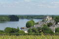
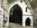
The village of Montsoreau and its castle between the Loire and troglodyte dwellings

A scenic route showcasing the various attractions of the Saumur region: the River Loire, cave dwellings, and vineyards alternating with wooded and wetland areas.

Please note: the path is impassable in the event of flooding of the Loire and/or heavy rainfall.

Details

n°945228
Creation:
Last update:
Last review:
  • Walking
    Activity: Walking
  • ↔
    Distance: 9.98 mi
  • ◔
    Average duration: 4h 55 
  • ▲
    Difficulty: Moderate

  • ⚐
    Back to start: Yes
  • ↗
    Ascent: + 400 ft
  • ↘
    Descent: - 410 ft

  • ▲
    Highest point: 331 ft
  • ▼
    Lowest point: 92 ft
  • ⚐ Country: France
  • ⚐ City: Montsoreau (49730)
  • ⚑
    Start/End: N 47.21723° / E 0.055415°
  • ❏
    IGN map(s): Ref. 1623ET, 1623SB
  • Hour-by-hour weather

Photos

Description of the walk

Starting point: Montsoreau (car park in front of the Tourist Office).

Signposting: Blue.

Route: From the car park in front of the Tourist Office / Maison du Parc, head back towards the banks of the Loire, turn left and follow the river for about 2.3 km. Go under the bridge and continue to the “Port du Turquant”.

Cross at the roundabout, continue straight on through the green space until you reach the junction of Rue des Ducs d’Anjou, Rue de la Vignole and Rue des Martyres. Turn right, walk past the church and, when you reach the town hall, turn left into Ruelle Antoine Cristal. Take the slate steps on the right, go round the community gardens, then turn right. At the junction, turn right onto the metal staircase. At the bottom of the stairs, turn left onto Rue Château Gaillard. Follow this street until you reach the fork. Turn right and continue to the crossroads.

(1) Carry on straight ahead, then turn left onto Impasse des Ducs d’Anjou. Take the first path on the left which climbs up the hillside. Walk up to Impasse du Haut Midi, then continue to the crossroads.

(2) Carry straight on. Follow the path through the vineyard and rejoin the road. Turn right and continue to the crossroads. Carry straight on, then take the first path on the left to rejoin the road.

(3) Turn left, then straight away right. Carry on straight along the path to the Pierre Percée crossroads.

(4) Turn left. At the crossroads, carry on straight ahead and rejoin the Route de Fontevraud. Turn left, then immediately right. At the end of the path, turn left. Carry on to the Plaine des Joncs crossroads.

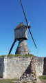
(5) Turn right, follow the track for about 1.5 km and rejoin the road. Turn left and continue to the Moulin de la Herpinière

(6) Turn right, then immediately left. Follow this path and, just before La Perruche, turn right.

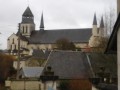
(7) Carry on straight ahead until you reach the road, turn left and carry on to the church.

(8) Turn right onto Rue de l’Église. At the crossroads, go straight ahead and then take the second path on the right. Carry on straight ahead until you reach Rue du Moulin de la Tranchée.

(9) Turn right, then left. At the Moulin, turn left and follow the path to the road. Turn right and carry on straight ahead until you reach the fork.

(10) At the fork, turn left. At the crossroads, head straight ahead onto the Chemin du Coteau. At the junction, turn left onto Ruelle Bussy d’Amboise and follow it to the end, then take the path on the right to the Haute Rue, where you continue to the right. At the bottom of the street, turn left to reach Quai Philippe de Commines. Cross over to the opposite side of the quays to return to the starting point. (S/E).

Waypoints

  1. S/E : mi 0 - alt. 108 ft - Car park in front of the Tourist Office - La Loire
  2. 1 : mi 2.34 - alt. 108 ft - Rue des Ducs d’Anjou
  3. 2 : mi 2.59 - alt. 203 ft - Across from Rue de la Matinière
  4. 3 : mi 3.21 - alt. 259 ft - Wine Route
  5. 4 : mi 4.23 - alt. 328 ft - Carrefour de la Pierre Percée
  6. 5 : mi 5.28 - alt. 299 ft - Carrefour de la Plaine des Joncs
  7. 6 : mi 6.94 - alt. 266 ft - La Herpinière Mill
  8. 7 : mi 7.74 - alt. 243 ft - Turn right onto the path before La Perruche
  9. 8 : mi 8.12 - alt. 108 ft - Cemetery
  10. 9 : mi 8.5 - alt. 197 ft - Rue du Moulin de la Tranchée
  11. 10 : mi 9.29 - alt. 167 ft - Rue de la Bonnardière
  12. S/E : mi 9.98 - alt. 108 ft - Car park in front of the Tourist Office

Notes

Saumur Val de Loire Tourism - Montsoreau
Maison du Parc
15, avenue de la Loire - F-49730 Montsoreau
Tel. 02 41 51 70 22 - Fax 02 41 38 38 89
Opening hours

Saumur Val de Loire Tourism
8 bis Quai Carnot – CS 54032 – 49415 Saumur Cedex
Tel. +33 (0)2 41 40 20 60 – Fax. +33 (0)2 41 40 20 69
Opening hours

www.saumur-tourisme.com

Worth a visit

Along the route:

- The Loire and birdwatching
- The village of Montsoreau, listed as one of the “Most Beautiful Villages in France”
- Montsoreau Castle
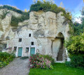
- The hillside cave dwellings between Montsoreau and Turquant
- The seigneurial residence of La Grande Vignolle
- The “Saumur-Champigny” appellation vineyards
- The water mills

Nearby:

- The Maison du Parc and the interpretive trail of the Loire-Anjou-Touraine Regional Nature Park: “Turquant, a tender heart of stone”
- The Saut-aux-Loups mushroom farm and the Loire Wine Market in Montsoreau
- The Métiers d’Art village and the Troglo des Pommes Tapées in Turquant

Reviews and comments

4.6 / 5
Based on 23 reviews

Reliability of the description
4.4 / 5
Ease of following the route
4.5 / 5
Route interest
5 / 5
User 9050227

Overall rating : 5 / 5

Date of your route : Oct 04, 2026
Reliability of the description : ★★★★★ Very good
Ease of following the route : ★★★★★ Very good
Route interest : ★★★★★ Very good
Very busy route : No

A VERY IMPRESSIVE CAREER

Machine-translated

Nathalie M7.
Nathalie M7.

Overall rating : 4.3 / 5

Date of your route : Mar 18, 2025
Reliability of the description : ★★★★★ Very good
Ease of following the route : ★★★★☆ Good
Route interest : ★★★★☆ Good
Very busy route : No

Very nice walk. The weather wasn't great, which was a shame. The mud and water made the forest section difficult. But it is March, so that's to be expected!

Machine-translated

Reni00GO
Reni00GO

Overall rating : 4.3 / 5

Date of your route : Nov 04, 2024
Reliability of the description : ★★★★☆ Good
Ease of following the route : ★★★★☆ Good
Route interest : ★★★★★ Very good
Very busy route : No

Varied route and scenery. Trails were clean despite the rain the previous week

Machine-translated

laclau sebastien
laclau sebastien
• Edited:

Overall rating : 5 / 5

Date of your route : Jul 21, 2024
Reliability of the description : ★★★★★ Very good
Ease of following the route : ★★★★★ Very good
Route interest : ★★★★★ Very good
Very busy route : No

A very beautiful hike, combining villages, cave dwellings and vineyards. Easy access and almost flat terrain.

Machine-translated

Michel Garet
Michel Garet

Overall rating : 5 / 5

Date of your route : Feb 21, 2024
Reliability of the description : ★★★★★ Very good
Ease of following the route : ★★★★★ Very good
Route interest : ★★★★★ Very good
Very busy route : No

A beautiful variety of landscapes and very little tarmac (apart from the village of Montsoreau). A very pleasant ride.

Machine-translated

Ludo Mantion
Ludo Mantion

Overall rating : 4.7 / 5

Date of your route : Jan 03, 2024
Reliability of the description : ★★★★★ Very good
Ease of following the route : ★★★★☆ Good
Route interest : ★★★★★ Very good
Very busy route : No

A very varied hike and, above all, very enriching in terms of discovering the region (troglodyte dwellings, proximity to the Loire, vineyards and windmills)

Machine-translated

SeveMorg
SeveMorg

Overall rating : 5 / 5

Date of your route : Aug 11, 2023
Reliability of the description : ★★★★★ Very good
Ease of following the route : ★★★★★ Very good
Route interest : ★★★★★ Very good
Very busy route : No

A varied hike through beautiful landscapes with blue signposts all the way, easy!

Machine-translated

vandromme claude
vandromme claude

Overall rating : 4.7 / 5

Date of your route : Jun 09, 2023
Reliability of the description : ★★★★☆ Good
Ease of following the route : ★★★★★ Very good
Route interest : ★★★★★ Very good
Very busy route : Yes

A truly beautiful hike with superb weather.
In fact, it's a very beautiful region.

Machine-translated

amostini
amostini
• Edited:

Overall rating : 5 / 5

Date of your route : May 24, 2023
Reliability of the description : Not used / Not applicable
Ease of following the route : ★★★★★ Very good
Route interest : ★★★★★ Very good
Very busy route : No

A magnificent and very varied hike. We loved Turquant and its cave dwellings, the views of the Loire, the vineyards... to be done again and again

Machine-translated

Oggynette
Oggynette

Overall rating : 4.3 / 5

Date of your route : Oct 19, 2021
Reliability of the description : ★★★★☆ Good
Ease of following the route : ★★★★☆ Good
Route interest : ★★★★★ Very good
Very busy route : No

A moment's hesitation on the Turquant hillside (the path passes right in front of houses and it feels like you're entering a private area, especially as the signpost pointing in the wrong direction is much further away
Very beautiful views, varied landscapes and terrain, little asphalt

Machine-translated

PPLR
PPLR

Overall rating : 2.7 / 5

Date of your route : Dec 18, 2020
Reliability of the description : ★☆☆☆☆ Very disappointing
Ease of following the route : ★★☆☆☆ Disappointing
Route interest : ★★★★★ Very good
Very busy route : No

The route, which starts along the Loire and then stretches between vineyards and forests, is full of charm. The discovery of the "troglo houses" is surprising.

The information sheet is not precise enough and is even ambiguous at times (for example, it says to take the path opposite when the paths are actually a few dozen metres apart, or vice versa). The directions on the map are hidden by numbers, making it impossible to find your way around. Fortunately, the route is well signposted (the colour of the signs is indicated on the information sheet).

In short, a lovely day in a region I knew nothing about

Machine-translated

freelance
freelance

Overall rating : 4.3 / 5

Date of your route : Jul 26, 2020
Reliability of the description : ★★★☆☆ Average
Ease of following the route : ★★★★★ Very good
Route interest : ★★★★★ Very good
Very busy route : No

A very beautiful hike with varied landscapes, from the banks of the Loire to the vineyard circuit, through forests, the beautiful church of Turquant, Montsoreau and the troglodyte caves... The signage is very good, although the explanations are sometimes unclear
But nothing too problematic.
Highly recommended!

Machine-translated

GIRON Raymond
GIRON Raymond

Overall rating : 4.7 / 5

Date of your route : Jun 01, 2020
Reliability of the description : ★★★★★ Very good
Ease of following the route : ★★★★☆ Good
Route interest : ★★★★★ Very good
Very busy route : Yes

A beautiful, varied hike with stunning views and traditional buildings
Just follow the blue signs and the very clear explanations.

Machine-translated

crirem72
crirem72

Overall rating : 4.7 / 5

Date of your route : Oct 15, 2019
Reliability of the description : ★★★★☆ Good
Ease of following the route : ★★★★★ Very good
Route interest : ★★★★★ Very good

Very beautiful hike, beautiful region, especially in autumn; varied route.

Machine-translated

Géraud de BOISSET
Géraud de BOISSET

Overall rating : 5 / 5

Date of your route : Sep 21, 2019
Reliability of the description : ★★★★★ Very good
Ease of following the route : ★★★★★ Very good
Route interest : ★★★★★ Very good

I can confirm that this is a very beautiful walk. Probably one of the most beautiful walks in the Touraine Saumurois region
The route is very easy to follow thanks to clear blue signposts and by following the map, the description or the GPX file. The paths are pleasant and well marked.
There are many points of interest: the banks of the Loire at the start and finish, the troglodyte houses of La Vignole and Turquant, the beautiful 12th and 15th century churches of Turquant and Montsoreau, the mills, the vineyards, the panoramic views of the Loire Valley, etc.
We did it on a sunny day at the end of summer, surrounded by grape pickers. Lots of walnut and almond trees...
I shortened the route a little by taking a path on the left after point 8 through the vineyards, which leads directly to point 10.

There is a small problem at point No. 2: the path that goes up the hillside near the hotel is currently closed because it is damaged and being repaired by the local council. In the meantime, and for the next few months, continue past the hotel for 50 metres to the wine tasting cellar and ask the owner (who is very friendly) to open the gate at the bottom of his garden, which will allow you to climb back up the hillside and reach the water tower at point No. 3.

Machine-translated

Other walks in the area

For more walks, use our search engine .

The GPS track and description are the property of this route's author. Please do not copy them without permission.