


 Country:
 City:
City:


Leave your car at the “Panorama” in Candes, where parking spaces are available. To get there: from the D751 coming from Thizay, pass the turn-off to the right onto the D751 towards Candes and continue for a further 500 metres, then turn right onto a small road signposted “Panorama” – though the sign is most visible when approaching from the opposite direction. Drive for about 1 km, then turn right onto the access road to the site, signposted “Panorama voiture” – again, the blue sign is more clearly visible from the opposite direction. This is a quiet car park, away from the crowds at the car parks along the banks of the Loire, which are, incidentally, rather limited in number.
(S/E) Leave the view over the Loire Valley behind you and follow the access road you took by car, until you reach the junction marked by the blue “Panorama voiture” sign. Turn right (for a rather uninteresting stretch of the route), ignore the next street on the right and you’ll come to a T-junction, near the cemetery and opposite a small park containing the Candes war memorial.
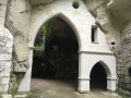
(1) Head to the right, immediately ignore the first street on the left, then take the second one, Rue de la Douve. This narrow street winds around the Old Castle of Candes (now a hotel), passing below a round tower, the Tour l’Enfant (sign). Walk under two bridges (which connect different parts of the castle grounds), turning round from time to time to catch a glimpse of the tower. Just after passing under the second bridge (sign: ‘Pont féodal’), turn left and enter a park, the municipal garden. Continue straight on along the main path to reach the road running alongside the Loire, near a beautiful mansion on the left (now a hotel exhibiting artists’ works).
(2) Head left and, at the roundabout, follow Rue des Diligences to the left. Ignore one alleyway and then two streets branching off to the right, and take Rue du Puits Saint-Michel, veering slightly to the left. Walk for about fifty metres until you come to a path marked with the red and white GR® sign. Please note: the path leading off to the left is closed (as of 2026 due to a rockslide at Puits Saint-Michel). In any case, your route follows the path on the right. At the T-junction, turn right onto Ruelle des Ouches (which forms the boundary between Candes and Montsoreau), then take the path on the left (Ruelle de l’église Saint-Michel), continuing to follow the GR® markings. You’ll arrive at a small square, Place des Dames de Tourzel. Leave the GR® here.
(3) Turn left and follow a small street. At the Fork in the road, keep to the right to climb up to the hillside, covered with patches of vineyards. Further on, turn left onto a path signposted for the Moulin à vent de la Tranchée. Continue straight on to reach this well-restored windmill.
(4) Set off again to the right. The path joins a road; follow it to the right (through a housing estate – not the most interesting part of the route). At the playground and recycling bins, veer left onto a path (Ruelle de l’Oiseau). Stay on this path, ignoring all turn-offs to the right. You’ll reach a street in Montsoreau after going down some steps.
(5) Follow it to the left until you reach the Stop sign. Cross the road and follow Rue de l’Église opposite. Cross over a stream, the Arceau, and you’ll reach a junction by the Church of Saint-Pierre-de-Rest. Turn right onto the street of the same name and follow it for about fifty metres, then turn left onto a one-way street and immediately ignore the road leading uphill to the left (rockfall warning sign). You will arrive on Avenue de la Loire, at the western entrance to Montsoreau.
(6) Cross it carefully and follow the path (cycle route) opposite, signposted towards Saumur. You’ll reach a path running alongside the Loire. Turn right to head back towards the centre of Montsoreau, with the Loire on your left and a campsite on your right. Further on, cross the Arceau again via a footbridge, then you’ll reach Quai Philippe de Commines and the port of Montsoreau, with several gabares moored there (for sightseeing trips). Continue a little further in the same direction, crossing to the other side of the road to find Rue du Port au Vin, which branches off to the right.
(7) Follow this street until you reach Place des Diligences, with a large circular bench and the entrance to the Château de Montsoreau on your left. Head into the Passage Marquis de Geoffre, at least to catch a glimpse of the château’s façade near the ticket office.
(8) Retrace your steps. Back at Place des Diligences, continue to the left. About 200 metres further on, turn left into Rue des Lavandières, a flight of steps leading down to the road along the Loire (here, Quai Alexandre Dumas).
(9) Follow the road to the right. Further on, take a path that descends to the left towards the Loire, then continue along the path as it continues to lead back towards Candes. You’ll pass a very beautiful weeping willow. At the Fork in the road, take the one on the right and you’ll come out onto a street at a bend.
(10) Follow it straight on and continue in the same direction along Rue du Confluent, ignoring the streets on the right, until you reach a landing stage for gabares, with a sign on the right showing the distances to towns along the Loire. You are now at the confluence of the Loire and the Vienne. Also note the rose garden (open to the public) at the music hall, the Maison Henri Dutilleux-Geneviève Jay. Turn right onto Rue Saint-Martin, cross the main street of Candes to arrive in front of the Collégiale Saint-Martin.
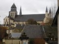
(11) It is always open, and a visit is a must: the tombstone and recumbent effigy of Saint Martin, and some beautiful polychrome capitals. As you leave the church, turn right to walk round it on the right-hand side; note the beautiful carved heads at the top of the walls and, in season, the swallows. On the opposite side of the collegiate church to the entrance, turn left onto Rue Saint-Maurice. At the junction at the end of the street, take Rue Trochet on the left, following the sign for ‘Panorama piétons’ – this direction will now be clearly signposted until the end of the walk, as will the red and white markings – then immediately turn right up Chemin du Tire-Jarret, which, of course, goes uphill! You’ll reach Rue de la Cour Dimière; follow the street to the left. When you reach Place du Puits, continue along the street to the left. At the end of the street, head straight on along Chemin du Panorama, marked GR®, to reach the Panorama car park (S/E), which offers a view over the Loire Valley, an orientation table and the remains of a tower.

 Visorando Member
 Moderate
  Tourist office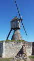


 Difficult
