Country:
 City:
City:


Signposting: Yellow Rectangle on a blue background; yellow line on tree trunks
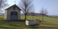
(S) The Bour chapel will be on your left; walk to the junction with the N12. Cross the road and turn right. Follow the road for about 500 m until you reach the next junction.
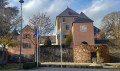
(1) Turn left towards Mersch. Enter Ansembourg and, looking through the foliage, spot the old castle on your left. Walk past the Chapel of Notre-Dame d’Ansembourg. Continue along the road, looking back from time to time to get a better view of the old castle. After the bend, you’ll see the Grand-Château d’Ansembourg. On your left, at the top of the hill, is the Ansembourg vicarage. Continue until you reach the road on your left after the turret.
(2) Head up the cycle path on your left towards Hollenfels. You’ll catch a glimpse of the Au Mont Marie chapel at the start of the climb. Further on, pass a religious memorial and continue up to the dirt track on your right.
No signposting
(3) Take the dirt track on your right and continue along the one immediately to the left. Further on, you’ll pass an orchard nature reserve on your right. You’ll come across another memorial stone at the junction with the entrance to the orchard; carry on straight ahead. At the crossroads, take the path on the left and then turn right to go down the steps. Cross the park and you’ll see Hollenfels Castle on your right. Leave the park. On your left, you’ll see Hollenfels Church. Retrace your steps and then turn right to explore the castle. Enter the courtyard: on the left is the youth hostel; on the right is the youth centre housed within the castle. Head straight ahead and take the path next to the building.
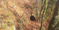
(4) Go down the stairs on your right. Keep to your left as you pass under the bridge – you’ll come back this way. Walk round the castle. Keep to your right and go up to the right to see the cave that gives the village its name. After this round trip, carry on uphill and then go downhill to the signpost. Head towards the road and walk up it a little to discover a chapel on the bend. Return to the signpost and continue round the castle. Go uphill, pass under the arched bridge and take the stairs on your left.
(4) At the top, turn right and rejoin the road on the other side of the church. Turn right until you reach the junction with a footpath.
Signposting: Yellow Rectangle on a blue background; yellow line on tree trunks
(5) Take the steps on the Didelbur path. Step over the fallen tree trunk. Go down the steps and, at the bottom, turn left. Keep to your left, step over the spring and carry on until you reach another path on your right.
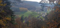
(6) Head down towards the road. Cross diagonally to the left and take the dirt track opposite. View from the plain of Hollenfels Castle. Cross over the Eisch. At the multi-way junction, take the middle path which climbs and turns right. The path then turns sharply left. Look out for the path on the right straight away.
(7) Follow the path up to your right. At the junction, turn left but do not take thefirst path (not shown on the map). At the top, ignore the path branching off to the right towards Reiterlay. Carry on straight ahead. A path joins from your left; carry on straight ahead. At the junction, with the gate on your right, carry on straight ahead for about 700 m until you reach a junction.
(8) Turn left. At the next junction, turn right. At the fork in the road, turn left. Walk straight on for 1 km until you reach a multi-way junction.
Blue Flag 2 signposting
Ignore the three paths on your left and the one on your right, and take the path straight ahead. Immediately turn onto the path on your right. At the junction (not shown on the map), go straight on. At the next junction (not shown on the map), continue straight on.
(9) At the more clearly marked junction, carry on straight ahead. At the next junction (not shown on the map), carry on straight ahead again. When you reach the wide path, head straight towards the shelter.
Yellow Cross markings
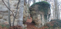
(10) With your back to the shelter, head down the path opposite with the barriers. At the corner of the fence, you’ll have a view of the keep of Schoenfels Castle. At the end of the fence on the left, take a short detour to Huellee Cave and back. Retrace your steps, then take the path leading above the cave. Follow the path, go down the steps and pass several caves and rock shelters. Continue until you reach a path leading down to your right.
No signposting
(11) Carry on straight ahead. Discover more caves, rock folds and rock shelters.
(12) At the fork in the road, turn right and head downhill. You’ll come across signposts again.
Yellow Cross Markings
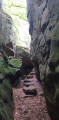
Carry on to the left. Walk alongside the Mamerlach rocks for about 1 km. Pass between two rock faces. Discover the rest of the rock formations and, on the wide path, continue to the left until you reach the Fork in the road.
(13) At the path, turn right and head downhill. At the crossroads, as you leave the forest, carry straight on. Follow the original signposting.
Markings: Yellow Rectangle on a blue background; yellow line on tree trunks
The path becomes a road. At the junction, continue to the right until you reach the footpath on your left.
(14) Take the steps and continue to the right. Cross over the motorway. Go down the steps and, at the road, turn left. Cross the road and take the cycle path on your right towards Mersch. Cross the bridge and continue straight ahead on the cycle path. Follow the River Mamer for 700 m. You’ll see the church spires of Mersch on your left. Cross the road and continue along the cycle path to the junction near the pond in Kirchewiss Park.
(15) Keep to the left, passing a wet meadow. Then turn right and keep to the right. Follow the River Mamer and turn left towards the bridge over the River Mamer. Go up the street and keep left at the junction; you’ll see the old tower on Place Saint-Michel. Turn right and cross the square to find yourself in front of Mersch Castle (E).
 Visorando Member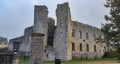
 Easy
Easy