Pays:
Pays:

 Commune:


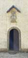
Car park on Rue du Château, alongside the church in Guirsch.
(S/E) With the church on your right, carry straight on. At the junction, where the tree forms a roundabout, turn left.
GR® signposting
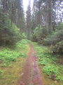
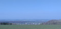
The road turns into a dirt track after the last house. At the Fork in the road, continue to the right. Walk alongside the woodland and, at the end of it, you’ll be treated to a superb view of Arlon in the distance. Head down between the fields, then enter the woodland. Continue downhill; the path veers to the right and ends in a hairpin bend. At the wide path, turn left. Further on, let theGR® trail pass you on your right.
Unmarked
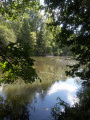
Carry on straight ahead. Follow the Gaichelbaach on your right. Ignore the forest track opposite and turn right to cross over the stream. With the stream now on your left, walk along the meadow until you reach the junction with a bench.
(1) Turn left, cross the Gaichelbaach over the stones and take the path on the left running alongside the Kinneksgriecht. Walk uphill for just under 2 km, staying close to the stream at all times and ignoring the adjacent paths.
(2) The path turns left. Pass the source of the stream (dry in March 2021) and emerge from the woods. Head right and walk along the cultivated fields until you reach the road. Turn left and walk along the road until you reach the end of the meadow fence on your right.
(3) At boundary marker 107, turn right. Enter the forest and, on your left, look out for boundary marker 108, riddled with bullet holes, beneath the trees. You are now in the Grand Duchy of Luxembourg.
Markings: Blue flag on a white background
(4) At the crossroads, go straight on along the sunken path. Walk downhill and, at the junction with a forest track, turn right. Walk to a memorial stone and take the path on the left just past it. At the crossroads, take the path on the left directly opposite.
No signposting
(5) Ignore the path on your left and continue to the right. The path turns left.
(6) At the end of the track, turn left onto the path and head uphill. At the top, turn right. Walk downhill to the junction with a hairpin bend to the left.
Bike Tour Signposting
(7) Turn left and head uphill until you reach a footpath.
Turn left. Discover the Kuelebierg Chapel. Follow another signpost.
Blue flag on a white background signpost
Continue along the wide path running past the chapel. At the Fork in the road, keep to the right. Walk to the road.
No signpost
Turn right and walk down the road until you reach thefirst forest track on your left.
(8) Take the hairpin bend to the left. Follow the main forest track for 1.1 km. Leave the woods when you come to a field.
(9) Turn right. At the road, turn left and follow this quiet road for 800 m, passing marker 115. Once back in Belgium, walk to the dirt track on your left.
(10) Turn left. Enter the woodland and follow the main forest track uphill for about 600 m. Emerge from the trees and enter the village of Guirsch. The track becomes a road at thefirst house. Ignore the road on your right and carry on to a junction on your left.
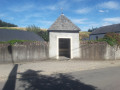
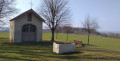
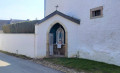
(11) You’ll come across a chapel built against the side of a house. Return to the road and carry on along it. At the next junction, ignore the road on your left and carry on to Saint Willibrord’s Chapel.
(12) Enjoy the superb view over the Vallée de la Pall. With your back to the chapel, return to the road and, at the Fork in the road, turn right. Return to the junction with the roundabout tree, go straight on and return to your car park (S/E).



 Visorandonneur

 Association / Club / AMM
 Facile