Country:

 City:
City:


Clairefontaine Abbey car park.
(S/E) Leave the car park and, at the road, turn left. Walk along the edge of the property until you reach the end of it.
(1) Turn left. Walk straight on, ignoring the path on the right. At the junction, level with the metal gate to the car park, turn right, go uphill and keep to the left. Walk over the car park, following the boundary wall until you reach a crossroads.
(2) Turn right and walk between the fir forest and the clear-cut area. At the end of the cleared plot, continue to the left. Come out from under the trees on the right and head straight left, following the edge of the field. At the T-junction, turn right onto the path, which then turns sharply right, and walk to the fork.
(3) Turn left and, at the crossroads, carry on straight ahead. The path turns right. At the road, turn left. At the next path, turn left again. Walk past the end of the microlight airfield runway. Enter the forest and, at the Fork in the road, keep right until you reach a junction.
(4) Carry on straight ahead. At the fir forest, keep to your left and head downhill. At the wide forest track, turn right. At the Fork in the road, keep to your right and, at the next track, turn right. At the crossroads (not fully shown on maps), take the left-hand track, which turns immediately to the right. Carry on until you reach a meadow.
(5) Turn left in the middle of the meadow onto the path leading downhill. At the wide forest track, continue to the right. At the three-way junction, take the left-hand branch. At the fork in the road, continue to the right and at the next fork, continue to the right again. Then keep to the right and head uphill. Below, look out for the Eisch and walk to a fork in the road.
(6) Head slightly to the left. The wide path becomes a narrow track for a short while and turns right, moving away from the river. At the Fork in the road, turn left and enter the Grand Duchy of Luxembourg. Walk to the steps and turn left.
(7) At the road, head left towards the sewage treatment works. Take the path on the left running alongside the hedge and go round the works. At the end of the fence, continue to the left and turn right onto the path leading towards the bat tunnel.
(8) Take the stairs on your right. At the top, you’ll come across the old Pétange–Ettelbruck railway line; continue to the left. Before the bridge, go down to the left and, at the bottom, turn left. At the pond, ignore the jetty and head straight on into the Stengeforter-Steekaulen Nature Reserve. Walk until you reach a path on your right. Climb the embankment and you’ll find a viewing point further up. Then continue along the path to the junction.
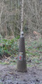
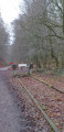
(9) Turn right for a view of the canopy. Retrace your steps and head down to the wide path. Turn right and, a little further on, you’ll see a superb solitary tree on your left. Take the path on your right. At the fork in the road with a standing stone, continue to the right. At the railway line, turn left; at the crossroads at the end of the line, turn left and follow this path to a crossroads.
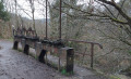
(10) Carry on to the left. At the low walls, you’ll see the mechanism for closing the dam gates. On your right, take the path with the handrail and head downhill. Pass an old dam building. At the three-way junction, keep left and follow the Eisch. At the junction, keep left: you’ll see the building of the old hydroelectric power station, now a roost for bats, on the opposite bank.
(11) At the circular bend in the Eisch, you’ll see a boundary marker on your left. Continue along the river on the path which veers sharply to the right and moves away from the water. Ignore the path on your right and stay at river level. Further on, at the three-way junction, turn left towards the bridge. Cross the bridge, enter Belgium and walk to the boundary wall.
(12) Turn left and head uphill. At the meadow, turn right. Ignore the path on the left. At the junction further on, turn right and walk alongside the buildings. At the road, turn left. Take thesecond path on the right. Head uphill and enjoy the view of the Plateau des Sorcières State Nature Reserve on your right until you reach a Fork in the road.
(13) Turn left, head uphill and follow the most clearly marked path. At the end of the bend, turn left onto the track. Pass through the broom. The path bends and descends steeply. At the bottom, continue to the left, ignoring the path on your right which is overgrown with shrubs. Ignore the next path on your right and, at the next junction, turn right. Walk uphill for about 450 m and, at the T-junction, turn left. Walk for about 650 m until you reach the crossroads.
(14) Head straight on along a less well-marked path and walk down to the road. Turn left and, at the junction, turn right. Enter the abbey car park (S/E).

 Visorando Member

 Association / Club / Walk leader
 Easy
Easy