Blois Forest

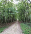
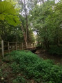
A shaded forest walk on flat terrain with little tarmac; the route can be shortened to 5.5 or 10.5 km, or walked in the opposite direction to avoid a slightly noisy final section due to the D 766.

Details

10714591
Creation:
Last update:
Last review:
  • Walking
    Activity: Walking
  • ↔
    Distance: 7.49 mi
  • ◔
    Average duration: 3h 30 
  • ▲
    Difficulty: Moderate

  • ⚐
    Back to start: Yes
  • ↗
    Ascent: + 98 ft
  • ↘
    Descent: - 79 ft

  • ▲
    Highest point: 407 ft
  • ▼
    Lowest point: 338 ft
  • ⚐ Country: France
  • ⚐ City: Blois (41000)
  • ⚑
    Start/End: N 47.586568° / E 1.298354°
  • ❏
    IGN map(s): Ref. 2021O, 2121OT
  • Hour-by-hour weather

Photos

Description of the walk

Park in the Pinçonnière car park.

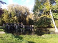
(S/E) Go past the metal barrier then go round the pond on the right. After the ‘abdominal exercises’ station on the fitness trail, turn right, go past the half-barriers and join the tarmac road.

(1) Turn right onto it. At the villas just past the care home, turn left onto the track. Cross the cleared area. At the opening, turn right, return to the lane and turn left. You will then reach a fork; take the dirt track to the left of the tree to quickly reach a four-way junction.

(2) Turn right; further on, cross theGR®353A– this is also the Allée de Bégon. Keep to this path ahead, running almost along the edge of the woodland, until you rejoin theGR®353A. Take it to the right, ignoring the first right-angled junction, to reach a second one.

(3) Leave theGR® and turn right onto the path which then runs along the edge of the woodland. Take a sharp bend to reach the Saint-Sulpice Forest House, where you’ll rejoin the GR®.

(4) Turn left onto this path (Allée Catherine de Médicis), ignore a turn-off to the left and take the next left. Continue to the junction you passed earlier.

(3) Leave theGR® again and head off to the right. Follow the path, cross the Allée Catherine de Médicis and continue to the Allée Saint-Sulpice. Turn left onto it and head towards another junction.

(5) Turn left, go round the pond and continue along a straight path. Cross the Allée Catherine de Médicis and you’ll reach another crossroads with four perpendicular paths.

(6) At the boundary between plots 13 and 11, turn right onto Allée de Bégon. Turn left. Pass the Grand Maître crossroads. About a hundred metres further on, turn right between plots 27 and 20. Follow the track, then turn left at the boundary of plot 20. Continue straight on until you reach the crossroads you passed on the way there.

(2) Turn right between plots 26 and 25, towards the D766. Continue to the end of this track.

(7) Turn left and follow the path running parallel to the road. When you emerge into the open, veer slightly to the right then left through the grass. Wind your way between the large oak trees. At the end, continue under the high forest canopy. When you emerge, turn right towards the D766 then left, still running parallel to the road. This will take you back to the original crossroads.

(1) Head straight ahead towards the lake, turn right, and follow the lakeshore to easily find the Pinçonnière car park (S/E).


Waypoints

  1. S/E : mi 0 - alt. 341 ft - La Pinçonnière car park
  2. 1 : mi 0.44 - alt. 351 ft - Starting point
  3. 2 : mi 1.39 - alt. 400 ft - Crossroads (5.5 km circular loop)
  4. 3 : mi 2.52 - alt. 394 ft - Crossroads – circular loop of 10.5 km
  5. 4 : mi 3.09 - alt. 374 ft - Saint-Sulpice Forest House
  6. 5 : mi 4.1 - alt. 404 ft - Allée Saint-Sulpice
  7. 6 : mi 4.81 - alt. 384 ft - Junction of plots 11 and 13
  8. 7 : mi 5.87 - alt. 400 ft - End of trail
  9. S/E : mi 7.49 - alt. 341 ft - La Pinçonnière car park

Notes

Alternatives:
You can shorten the route to 5.5 km via a variant at WP (2) or to 10.5 km via a variant at WP (3), with two additional options (S/E) thanks to the forest car parks at La Picardière or the Maison Forestière de Saint-Sulpice.

This route was mapped using OSM Trails World; therefore, some differences in the route may be apparent when viewed on an IGN map.
Depending on the weather, some sections may be muddy and slippery.
Depending on the season, bring: gaiters, water bottle(s), cereal bars, a spare battery, mosquito repellent, a hat, rainwear, etc.

State-owned forests are hunting grounds. The hunting areas, days and times can be viewed here.

Worth a visit

Angling, a fitness trail and pétanque (with food and drink available in summer) at Lac de la Pinçonnière.
The Vrillière water ram in Saint-Lubin-en-Vergonois.
Blois Castle, the Maison de la Magie and various museums.

Always be cautious and plan ahead when you're outdoors. Visorando and the author of this route cannot be held responsible for any accidents occurring on this route.

The GR® and PR® markings are the intellectual property of the Fédération Française de Randonnée Pédestre.

Reviews and comments

3.6 / 5
Based on 5 reviews

Reliability of the description
3.2 / 5
Ease of following the route
3.5 / 5
Route interest
4 / 5
GrossDom
GrossDom

Overall rating : 2 / 5

Date of your route : Mar 31, 2025
Reliability of the description : ★★☆☆☆ Disappointing
Ease of following the route : Not used / Not applicable
Route interest : Not used / Not applicable
Very busy route : No

This walk is impassable in places: trees have been felled and left lying across the route, and there is a section overgrown with brambles that is also impassable
We were forced to take detours off the marked trail, and then found it very difficult to get back on the right path

Machine-translated

gentilflorent41
gentilflorent41

Overall rating : 3.7 / 5

Date of your route : Mar 21, 2024
Reliability of the description : ★★★★☆ Good
Ease of following the route : ★★★☆☆ Average
Route interest : ★★★★☆ Good
Very busy route : No

This route, set in the beautiful Blois Forest, is a lovely walk. The route isn’t particularly difficult. Do bear in mind, however, that depending on the time of year you visit, puddles may block the path.
A major drawback is that there are no signposts anywhere along the route. It’s therefore essential to have the route saved on your phone so you can follow it.

Machine-translated

LARRAMENDY
LARRAMENDY

Overall rating : 2.7 / 5

Date of your route : Nov 08, 2022
Reliability of the description : ★★☆☆☆ Disappointing
Ease of following the route : ★★☆☆☆ Disappointing
Route interest : ★★★★☆ Good
Very busy route : No

I had a lot of trouble finding the starting point of the walk.
To this day, I’m not sure I’ve actually found it.
The location of this starting point needs to be clarified and described in more detail.
The walk and the surroundings are pleasant, even in November.

Machine-translated

ronsard41
ronsard41

Overall rating : 4 / 5

Date of your route : Jan 09, 2023
Reliability of the description : ★★★★☆ Good
Ease of following the route : ★★★★☆ Good
Route interest : ★★★★☆ Good
Very busy route : Yes

It was a lovely route; we walked the 5 km as a family.

Machine-translated

bionat
bionat

Overall rating : 4.3 / 5

Date of your route : Oct 17, 2021
Reliability of the description : ★★★★☆ Good
Ease of following the route : ★★★★★ Very good
Route interest : ★★★★☆ Good
Very busy route : No

A walk taken on a lovely October afternoon.
The trees hadn’t lost their leaves yet
The route consists of lovely forest paths.
There are numerous side paths allowing you to alter or shorten the route.
The final section (after point 7) is less pleasant (partly deforested and with traffic noise from the D766).
I’d recommend doing the route in the opposite direction so you end on a high note.

Machine-translated

Other walks in the area

For more walks, use our search engine .

The GPS track and description are the property of this route's author. Please do not copy them without permission.