Monthou-sur-Bièvre circular via Le Bout du Pont

A route starting from Monthou-sur-Bièvre, winding through woodland, streams and vineyards. 

Details

71736179
Creation:
Last update:
Last review:
  • Walking
    Activity: Walking
  • ↔
    Distance: 5.28 mi
  • ◔
    Average duration: 2h 30 
  • ▲
    Difficulty: Easy

  • ⚐
    Back to start: Yes
  • ↗
    Ascent: + 115 ft
  • ↘
    Descent: - 95 ft

  • ▲
    Highest point: 325 ft
  • ▼
    Lowest point: 217 ft

Photos

Description of the walk

Parking is available in the Espace Beauregard car park.

(S/E) With your back to the Espace Beauregard, turn right towards Rue du Gué aux Loups. Take this road to the right until you reach the Bièvre.

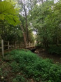
(1) Cross the river via the bridge, then turn left onto the path. At the road, turn left, then continue along the path to the crossroads in the Bois des Hautes Bruyères.

(2) Turn right, leave the forest and pass through the Bois des Landes until you reach another woodland.

(3) Keep to the right until you reach a road. Turn left and then immediately right, towards Le Plessis.

(4) Take the path that continues from there to the Pont de la Bièvre.

(5) Cross the bridge over the Bièvre and keep going straight on until you reach the village restaurant.

(6) First turn left then right to cross the D764 with care, then head uphill opposite, passing a playground, the war memorial and the cemetery.

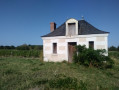
(7) Turn right and continue to a junction. Keep right until you reach the hut.

(8) Continue along the road before heading uphill to the left. Continue to the right until you enter the woods. Keep to the right at the two junctions. Leave the woods, then continue to the left. Then head straight ahead, then left until you reach the Chemin des Bernadettes, a track through the woods.

(9) Turn sharply right and follow the same path to Beauregard and its main road. 

(10) Turn left, cross the D764 again with care and arrive at Espace Beauregard (S/E).

Waypoints

  1. S/E : mi 0 - alt. 233 ft - Espace Beauregard
  2. 1 : mi 0.14 - alt. 220 ft - Bridge at the - Bievre (rivière) - Loir-et-Cher
  3. 2 : mi 0.73 - alt. 230 ft - Les Hautes Bruyères. Near the - Beuvron (rivière)
  4. 3 : mi 1.56 - alt. 299 ft - Woods
  5. 4 : mi 2.08 - alt. 282 ft - Le Plessis
  6. 5 : mi 2.51 - alt. 240 ft - Bièvre Bridge
  7. 6 : mi 2.64 - alt. 259 ft - Chez Blanche Restaurant
  8. 7 : mi 2.83 - alt. 289 ft - War memorial and cemetery
  9. 8 : mi 3.45 - alt. 322 ft - Vineyard hut
  10. 9 : mi 4.39 - alt. 240 ft - Chemin des Bernadettes
  11. 10 : mi 5.18 - alt. 240 ft - Beauregard
  12. S/E : mi 5.28 - alt. 233 ft - Espace Beauregard

Notes

In wet weather, some sections may be damp or even muddy. Part of the route is sheltered within the woodland.

Worth a visit

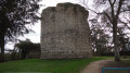
Near the walk, you can see Fougères-sur-Bièvre Castle, the old Montils Tower and the mill at the bottom of the Ouchamps hill.

Reviews and comments

4.4 / 5
Based on 3 reviews

Reliability of the description
4.7 / 5
Ease of following the route
4.7 / 5
Route interest
4 / 5
bionat
bionat

Overall rating : 4.7 / 5

Date of your route : Sep 09, 2025
Reliability of the description : ★★★★★ Very good
Ease of following the route : ★★★★★ Very good
Route interest : ★★★★☆ Good
Very busy route : No

An easy and very pleasant route, mainly through woodland with a short section through vineyards.
Note that at point 7, near the cemetery, there is parking, picnic tables and toilets.

Machine-translated

bionat
bionat

Overall rating : 4.7 / 5

Date of your route : Aug 10, 2025
Reliability of the description : ★★★★★ Very good
Ease of following the route : ★★★★★ Very good
Route interest : ★★★★☆ Good
Very busy route : No

An easy and very pleasant route, mostly through woodland.
Between points 7 and 8, the route follows a small paved road, but allows you to discover the vineyards.
You can follow the dotted line (purple on the map) to the right after point 7, which rejoins the route after point 8.
Overall, a very positive experience; thank you to the organisers.

Machine-translated

tortissier
tortissier

Overall rating : 4 / 5

Date of your route : Jul 09, 2025
Reliability of the description : ★★★★☆ Good
Ease of following the route : ★★★★☆ Good
Route interest : ★★★★☆ Good
Very busy route : No

A beautiful route with no particular difficulties.

The only minor issue is in the description at point 3, where I think it would be better to say:
'turn right at the first path at the edge of the woods, then continue until you reach a road. Go left...'.

Machine-translated

Other walks in the area

For more walks, use our search engine .

The GPS track and description are the property of this route's author. Please do not copy them without permission.