Grassy paths of Les Montils

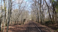
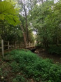
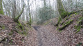
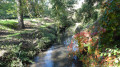
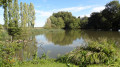
In the heart of the Sologne wine-growing region, the grassy paths link the vineyards, wooded areas and architectural remains of the commune of Les Montils, which was a stronghold in the 12th century.

Details

n°2976916
Creation:
Last update:
Last review:
  • Walking
    Activity: Walking
  • ↔
    Distance: 6.66 mi
  • ◔
    Average duration: 3h 05 
  • ▲
    Difficulty: Moderate

  • ⚐
    Back to start: Yes
  • ↗
    Ascent: + 26 ft
  • ↘
    Descent: - 26 ft

  • ▲
    Highest point: 328 ft
  • ▼
    Lowest point: 285 ft

Photos

Description of the walk

Park in the car park near the church at Les Montils. Access it via Rue du Vieux Porche due to the town’s traffic scheme.

(S/E) With your back to the church, turn onto Rue de l’Église, which runs northwards. Cross the Route de Candé and continue along the path opposite, marked with the ‘La Loire à vélo’ symbol. Turn left in front of the cemetery, then take a right and then a left onto Rue du Bac. The path, which is poorly marked, first bends to the left near a house and then to the right, leading into a narrow alleyway.

(1) At the junction with Rue Creuse, turn left, then right after about 50 metres onto a wide, compacted track, the Chemin de Tue Bœuf. This track runs past various vineyard plots before joining a grassy path.

(2) As soon as you’ve passed the last vineyard plot, turn right once you’re in the woods. Continue straight on at the junction with Rue Creuse until you reach Rue du Bac.

(3) Turn left onto this street, then, at Les Vieux Montils, turn right onto Rue de Frileuse. After about a hundred metres, take the stabilised track on the left, then turn right at the junction. The track heads north, passing through fields, woods and vineyards, then bends to the left.

(4) Turn right at the junction, then right again at the next junction. The path becomes tarmacked, becoming the Chemin des Quatre Boisselées. First turn right then left whilst crossing the D764 with caution. The path heads north-east. Turn left when you reach a cross-path, then, after 150 m, turn right. Follow the busiest path, ignoring the various side tracks, until you reach a cross-path which you take to the right.

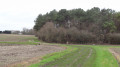
(5) Turn left at the junction with a cross-path, recognisable by a large tree. The grassy track leads out onto a cultivated field. A gully serving as a path has been created to ensure continuity all the way to the Route de la Haye.

(6) Turn left onto Route de la Haye, then, after 100 m, take a path on the right at the edge of a wood.

(7) Turn right at the Maison Verte and pass Les Châtaigniers. The path joins a hard-surfaced track. Turn left onto the Route de la Haye (crossing). Ignore the various turn-offs until you reach the junction signposted for the Tourist Office.

(8) Turn left towards the Tourist Office, pass Rue de la Gare on your right and then, at the roundabout, head right onto the lane known as Rue de Saint Lazare.

(9) First turn left then right, crossing Rue de Bel Air with care to reach a path marked in yellow, which is barely visible from the road. The grassy path tends to blend in with the vegetation. You must turn left before the hard-surfaced path from where you can see the Montils bell tower. You will then need to turn right to walk alongside a wall on your right.

(10) Turn left onto the cross-path. The grassy, poorly marked path runs alongside a hedge on your left before opening out onto Route de Candé, which you take to the right. Turn left onto Rue de l’Église.

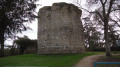
Before returning to the church car park and the starting point of the walk, head left along Rue du Vieux Porche for a good hundred metres – a must-do to appreciate the heart of the old town and reach the site of the royal castle, of which the keep remains.

(11) After taking in the sights, retrace your steps along Rue du Vieux Porche and return to the church car park (S/E).


Waypoints

  1. S/E : mi 0 - alt. 302 ft - Car park near the church at Les Montils
  2. 1 : mi 0.34 - alt. 292 ft - On the left, junction with Rue Creuse
  3. 2 : mi 0.82 - alt. 292 ft - Turn right once you’re in the woods
  4. 3 : mi 1.44 - alt. 302 ft - On the left: Rue du Bac
  5. 4 : mi 1.96 - alt. 302 ft - Turn right at the junction,
  6. 5 : mi 3.8 - alt. 302 ft - Turn left at the junction (large tree)
  7. 6 : mi 4.14 - alt. 295 ft - On the left: Route de la Haye
  8. 7 : mi 4.67 - alt. 295 ft - Turn right at the Maison Verte
  9. 8 : mi 5.67 - alt. 302 ft - Turn left towards the Tourist Office
  10. 9 : mi 6 - alt. 305 ft - Left-right Rue de Bel Air
  11. 10 : mi 6.15 - alt. 328 ft - Turn left onto the side path
  12. 11 : mi 6.5 - alt. 305 ft - Keep
  13. S/E : mi 6.66 - alt. 302 ft - Car park near the church at Les Montils

Notes

As there are no signposts, the walk requires a good sense of direction as some paths are poorly marked. It can be enjoyed in all seasons, although some paths may be muddy in winter, or even slightly flooded. The grassy paths are damp in the morning due to the dew. Waterproof footwear is recommended.

However, the best seasons are summer, when you can enjoy the shaded areas, and autumn, when the vines are ablaze with their most beautiful colours after the grape harvest.

Worth a visit

This route showcases the historical heritage of the village of Les Montils, of which the keep, with its central well, is a remarkable feature.

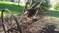
The Museum of Antique Tools and Folk Art houses over 1,200 objects from the local rural world and other regions.

Reviews and comments

4.2 / 5
Based on 2 reviews

Reliability of the description
4.5 / 5
Ease of following the route
4.5 / 5
Route interest
3.5 / 5
bionat
bionat

Overall rating : 4 / 5

Date of your route : May 07, 2026
Reliability of the description : ★★★★☆ Good
Ease of following the route : ★★★★☆ Good
Route interest : ★★★★☆ Good
Very busy route : No

An easy and pleasant walk.
Varied scenery, vineyards and woodland.
No difficulty following the route, but a GPS is recommended.
Note at point 6: a field of rapeseed between the road and the entrance to the woods.
Is this an encroachment on the public footpath?

Machine-translated

Jean-Louis Pinault
Jean-Louis Pinault

Thank you for your comments,
Have a lovely day,
Jean-Louis

Machine-translated

tcheuma
tcheuma

Overall rating : 4.3 / 5

Date of your route : Mar 15, 2020
Reliability of the description : ★★★★★ Very good
Ease of following the route : ★★★★★ Very good
Route interest : ★★★☆☆ Average

Unfortunately, we didn’t see the tower – it was our mistake, as we followed the signposts along Rue du Vieux Porche… By then it was too late to get back on track…
I didn’t find the walk particularly interesting, even though it was pleasant. It would no doubt be worth doing again in the autumn when the vines and trees have taken on their beautiful colours.

Machine-translated

Other walks in the area

For more walks, use our search engine .

The GPS track and description are the property of this route's author. Please do not copy them without permission.