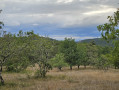
A circular path offering both sun and shade in Saint-Amand-de-Coly

A short walk through woods and fields. An easy, short walk suitable for families, where you can observe the trees, plants and even mushrooms in season. From the ridge, the horizon opens up to offer beautiful views of the hillsides. There is a picnic area.

Details

40564326
Creation:
Last update:
Last review:
  • Walking
    Activity: Walking
  • ↔
    Distance: 2.49 mi
  • ◔
    Average duration: 1h 25 
  • ▲
    Difficulty: Easy

  • ⚐
    Back to start: Yes
  • ↗
    Ascent: + 308 ft
  • ↘
    Descent: - 308 ft

  • ▲
    Highest point: 787 ft
  • ▼
    Lowest point: 469 ft

Description of the walk

From the hiking information point at the Montignac Tourist Office, head towards Sarlat (D704). After 6 km, turn left towards Saint-Amand-de-Coly. Park at Place du 14 Juillet: a car park with a picnic table and shelter.

(S/E) Leaving the car park, with the square behind you, take the Route de Coly (signposted ‘La Veyssière – La Combe Nègre – Coly’). Continue to the junction in the bend.

(1) Pass the private road to La Veyssière on your left and continue along the road to the campsite.

(2) Turn left past the campsite and follow the road to a crossroads marked in the middle by a large oak tree.

(3) Turn right at the fork. As you emerge from the woods, the path continues between two fields, passes the Granges farm and joins a tarmac road at a place called Mansac.

(4) Follow the road to the left for about fifty metres, then leave it to take a path on the left which winds down alongside a low wall to the village. It ends amongst the box trees and joins the road.

(1) Turn right, and carry on straight ahead at the junction to return to the starting point (S/E)

Waypoints

  1. S/E : mi 0 - alt. 548 ft - Car park, Place du 14 Juillet - Abbaye de Saint-Amand-de-Coly
  2. 1 : mi 0.11 - alt. 548 ft - Crossroads at the end of the circular loop
  3. 2 : mi 0.59 - alt. 476 ft - Campsite, on the left
  4. 3 : mi 0.69 - alt. 486 ft - Crossroads with a large oak tree
  5. 4 : mi 1.97 - alt. 787 ft - Mansac, tarmac road on the left
  6. S/E : mi 2.49 - alt. 548 ft - Car park, Place du 14 Juillet - Abbaye de Saint-Amand-de-Coly

Worth a visit

You can enjoy a very unobstructed view of the hillsides.

Reviews and comments

4.8 / 5
Based on 2 reviews

Reliability of the description
5 / 5
Ease of following the route
5 / 5
Route interest
4.5 / 5
Alain_42
Alain_42
• Edited:

Overall rating : 4.7 / 5

Date of your route : May 12, 2025
Reliability of the description : ★★★★★ Very good
Ease of following the route : ★★★★★ Very good
Route interest : ★★★★☆ Good
Very busy route : No

It’s a fairly short circular loop at 4.5 km, but there’s a bit of a steep climb halfway through. So it’s not as easy as it looks.
When we did it, a group of fallen trees had blocked the route at a place called La Veyssiere, making it difficult to get past.
I reported this to the town hall in St Amand de C.. and on the Suricate website

Machine-translated

Ma nu
Ma nu

Overall rating : 5 / 5

Date of your route : Jul 29, 2024
Reliability of the description : ★★★★★ Very good
Ease of following the route : ★★★★★ Very good
Route interest : ★★★★★ Very good
Very busy route : No

Official walking route – thank goodness for the GPX file, as it was very poorly signposted, if at all.
Thanks

Machine-translated

Other walks in the area

For more walks, use our search engine .

The GPS track and description are the property of this route's author. Please do not copy them without permission.