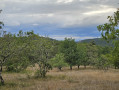
Circular walk through woods and slate-roofed villages in Saint-Amand-de-Coly

From agricultural landscapes to the woodlands of the Périgord Noir. The walk begins with a fairly steep climb through the woodland, leading to the Malénies and Bos plateaus. The route continues via Larnaudie and through the woodland to the Croix du Peuch.

Details

n°41130354
Creation:
Last update:
Last review:
  • Walking
    Activity: Walking
  • ↔
    Distance: 4.53 mi
  • ◔
    Average duration: 2h 35 
  • ▲
    Difficulty: Easy

  • ⚐
    Back to start: Yes
  • ↗
    Ascent: + 600 ft
  • ↘
    Descent: - 574 ft

  • ▲
    Highest point: 876 ft
  • ▼
    Lowest point: 512 ft

Description of the walk

From the hiking information point at the Montignac Tourist Office, head towards Sarlat (D704). After 6 km, turn left towards Saint-Amand-de-Coly. Park your car in the car park on Place du 14 Juillet at the entrance to the village.

(S/E) With your back to the car park, turn right onto the Route de l’Abbaye (D704) towards the cemetery. Walk past it.

(1) Turn onto the small, steep path on the left. After climbing the hill, you’ll reach the Malénies plateau. Walk alongside the walnut grove and take a path leading to the Malénies campsite. Turn left at the second junction, then left again at the end of the street. Turn right, then left when you reach the next street. Then carry on straight ahead until you reach the end of the road and its junction with Route de l’Abbaye.

(2) Turn left to reach the three-way junction at Saint-Laurent. Carry on straight ahead, then veer left to reach the junction with the Chemin du Bos.

(3) Carry on to the left to pass through the hamlet of the same name.

(4) After passing the Bos farm, take a dirt track leading to the road connecting Foussigne to Larnaudie. At the road, turn left towards Larnaudie, a rural hamlet.

(5) In the hamlet, opposite a stone house with two-coloured tiles, turn left. After passing through the hamlet, turn left again onto a limestone track. At the next junction, take the Chemin des Valats straight ahead and make a quick left/right turn at the edge of the woodland to begin an ascent, continuing to the end of the track.

(6) At the top of the ridge, turn left then right at Le Peuch to reach a cross.

(7) Turn left towards Saint-Amand-de-Coly. Pass through the hamlet of Le Peuch, then continue straight on until you reach a path lined with slate walls, and climb a few steps to reach Saint-Amand-de-Coly. Follow the street to the left to reach the car park (S/E).

Waypoints

  1. S/E : mi 0 - alt. 551 ft - Car park, Place du 14 Juillet - Abbaye de Saint-Amand-de-Coly
  2. 1 : mi 0.27 - alt. 594 ft - Cemetery
  3. 2 : mi 0.83 - alt. 761 ft - Route de l’Abbaye
  4. 3 : mi 1.5 - alt. 814 ft - Chemin du Bos
  5. 4 : mi 1.63 - alt. 758 ft - The hamlet of Le Bos
  6. 5 : mi 2.41 - alt. 587 ft - Larnaudie hamlet
  7. 6 : mi 3.35 - alt. 840 ft - End of the climb, on the left
  8. 7 : mi 3.57 - alt. 876 ft - Peuch Cross
  9. S/E : mi 4.53 - alt. 551 ft - Car park, Place du 14 Juillet - Abbaye de Saint-Amand-de-Coly

Worth a visit

Reviews and comments

4.2 / 5
Based on 2 reviews

Reliability of the description
4 / 5
Ease of following the route
4.5 / 5
Route interest
4 / 5
balvay brigitte
balvay brigitte

Overall rating : 3.3 / 5

Date of your route : Oct 02, 2025
Reliability of the description : ★★★☆☆ Average
Ease of following the route : ★★★★☆ Good
Route interest : ★★★☆☆ Average
Very busy route : No

The hike begins with a long walk along a tarmac road, which isn't very interesting.
Fortunately, as you continue, you come across beautiful paths and lovely old houses.
We ended with a visit to the abbey and the small village. Magnificent!
Well marked.

Machine-translated

jpbr31
jpbr31

Overall rating : 5 / 5

Date of your route : Sep 05, 2025
Reliability of the description : ★★★★★ Very good
Ease of following the route : ★★★★★ Very good
Route interest : ★★★★★ Very good
Very busy route : No

beautiful hike
good climb at the start
lovely houses to see along the way
we didn't see anyone, but it was early in the morning
we saw deer

Machine-translated

Other walks in the area

For more walks, use our search engine .

The GPS track and description are the property of this route's author. Please do not copy them without permission.