Circular route via Lac Noir and Lac de la Girotte

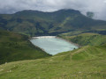
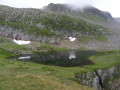
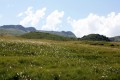
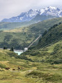
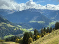
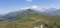
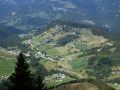
A lovely walk with superb views of Lac Noir and Lac de la Girotte, the area around Hauteluce, the surrounding peaks and Mont Blanc in the background (weather permitting).
The route starts near Hauteluce. It is easy to follow thanks to the signposts and yellow markings, which are almost always present at junctions. The climb is fairly steep to begin with, with the vast majority of the elevation gain occurring halfway along the route. The route alternates between pleasant woodland on the ascent and open landscapes at higher altitudes and on the descent.

Details

n°37063761
Creation:
Last update:
Last review:
  • Walking
    Activity: Walking
  • ↔
    Distance: 9.82 mi
  • ◔
    Average duration: 8h 15 
  • ▲
    Difficulty: Difficult

  • ⚐
    Back to start: Yes
  • ↗
    Ascent: + 4,259 ft
  • ↘
    Descent: - 4,242 ft

  • ▲
    Highest point: 7,247 ft
  • ▼
    Lowest point: 3,701 ft

Photos

Description of the walk

Park at a place called Les Marais, at the junction of the Route des Revers and a small track, near a house. You can park at the side of the road, about twenty metres from the starting sign.

(S/E) Take the path opposite and, via a fairly steep climb, reach the hamlet of Les Airies.

(1) Follow the path towards Sur les Airies and, via several hairpin bends, reach a wider track. Turn left onto it and head for this hamlet.

(2) Leave the track and take the path on the right. After several hairpin bends, cross the track to reach the ‘Bois de la Thuliettaz’ sign further up.
Note: to reach this sign, follow the path and/or signposts as closely as possible. Otherwise, take the road uphill until you come to a path.

(3) Take the road on the right and continue along the dirt track that follows it. At the edge of the forest, you’ll reach the Journée crossroads.

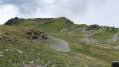
(4) Carry on straight ahead to cross a plain, then begin another climb across open ground. Continue in a wide circular loop to the left to reach the summit of the Pas d’Outray.

(5) Follow the ridge – it’s not dangerous – then turn left and head back down into the valley.

(6) Climb a little. Turn slightly left, then cross the plain to the Col du Sallestet.

(7) Continue straight ahead up the slope, following the yellow markings, and then reach the viewpoint overlooking Lac Noir.

(8) Now head back down to reach the information board at Les Enclaves.

(9) Turn left towards the hamlets of Le Pin Cembro and Plan de la Mouille-Nord.
Take care on the descent; if it has rained recently, water may be running across the path.
Cross the Ruisseau du Sallestet and head slightly uphill. Cross a wetland area (via a wooden bridge) and arrive at the ‘Plan de la Mouille-Nord’ sign

(10) Turn right towards the lake, following an open path above the lake, and you’ll reach a junction with a sign for ‘Vers le Lac’.

(11) Turn left and continue downhill to reach the chalets at La Commanderie.

(12) Walk downhill, passing La Commanderie-le-Haut, La Commanderie and La Commanderie-le-Bas in turn. At thefirst cattle trough, cross the main path to reach thesecond trough.
Continue down through the forest. As you emerge, you’ll come to the ‘La Montaz’ sign, near a building.

(13) Carry on towards Les Granges and pass a second sign marked ‘La Montaz’. Keep heading towards Les Granges.
As you leave the forest, pass a paddock, then a stream, and arrive at the houses in Les Granges.

(14) Turn left onto the Route des Revers and follow it until you reach the Marais car park (S/E).

Waypoints

  1. S/E : mi 0 - alt. 3,701 ft - Marais car park
  2. 1 : mi 0.32 - alt. 4,144 ft - Les Airies
  3. 2 : mi 0.7 - alt. 4,636 ft - On the Airies
  4. 3 : mi 1.43 - alt. 5,367 ft - Bois de la Thuilettaz
  5. 4 : mi 1.97 - alt. 5,531 ft - The Day
  6. 5 : mi 3.23 - alt. 7,139 ft - The Pas d’Outray - Montagne d'Outray
  7. 6 : mi 3.84 - alt. 6,854 ft - Low point
  8. 7 : mi 4.86 - alt. 6,923 ft - Col du Sallestet
  9. 8 : mi 5.68 - alt. 7,234 ft - Lac Noir (Beaufortain)
  10. 9 : mi 6.23 - alt. 6,739 ft - The Enclaves
  11. 10 : mi 6.93 - alt. 6,319 ft - Map of La Mouille-Nord
  12. 11 : mi 7.45 - alt. 6,142 ft - Towards the Lake - Lac de la Girotte
  13. 12 : mi 7.97 - alt. 5,594 ft - La Commanderie
  14. 13 : mi 8.42 - alt. 5,010 ft - La Montaz
  15. 14 : mi 9.33 - alt. 3,802 ft - Les Granges
  16. S/E : mi 9.82 - alt. 3,717 ft - Marais car park

Notes

(S/E) The car park is about an 8-minute drive from Hauteluce, 15 minutes from Les Saisies and Beaufort, 20 minutes from Villard-sur-Doron, and 30 minutes from Crest-Voland and Bisanne 1500.
Wear sturdy footwear; there is a steady climb during thefirst half of the route. However, there is no need to scramble uphill. The descent is fairly gentle and safe, apart from the risk of slipping if it has rained recently, between Le Pin Cembro and the stream below.
You may cross enclosures or pastures, often with sheep or cows. From time to time, you’ll need to pass under non-electrified wires or open gates. Please respect the animals and their owners: close the gates behind you, stay on the path and, if possible, keep your distance from the animals; do not feed them and allow the sheepdog (patou) to look after the animals.
Do not drink from any water sources you may come across: there is no indication that the water is safe to drink.

Worth a visit

Viewpoints:
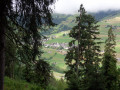
- over the surroundings of Hauteluce during the ascent through the Thuliettaz forest, then between (4) and (5).
- of the surrounding peaks on the Pas d’Outray ridge and in the valley just beyond,
- of Lac Noir at (8),
- on Lac de la Girotte during the descent between (8) and (9),
- and of Mont Blanc as soon as you gain a little altitude.
- and a sign explaining the construction of the Girotte Dam at (9).
Alternative route: between (9) and (11) to admire Lac de la Girotte and its dam at closer quarters, and to see a monument commemorating acts of resistance in the Beaufortain; it is possible to walk around the lake by adding just over 5 km to the route. The route is straightforward: walk round the lake, heading to the Chalet du Berger then on to the dam, before returning to Vers le Lac. The additional elevation gain is fairly negligible.

Reviews and comments

5 / 5
Based on 1 review

Reliability of the description
5 / 5
Ease of following the route
5 / 5
Route interest
5 / 5
dedelanguille
dedelanguille

Overall rating : 5 / 5

Date of your route : Aug 19, 2024
Reliability of the description : ★★★★★ Very good
Ease of following the route : ★★★★★ Very good
Route interest : ★★★★★ Very good
Very busy route : No

A superb hike, completed in 4 hours 35 minutes including a few short photo breaks! 1,366 metres of elevation gain and an extra 3 km!

Machine-translated

Other walks in the area

For more walks, use our search engine .

The GPS track and description are the property of this route's author. Please do not copy them without permission.