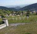
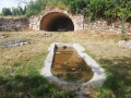
Circular route via the Champ Du Feu and the Haut des Monts from Neuviller-la-Roche

Circular walk starting from Neuviller La Roche town hall.
A steady climb towards the scree slopes of the Champ du Feu massif, and return via the Col de la Perheux.

Details

1866348
Creation:
Last update:
Last review:
  • Mountain biking
    Activity: Mountain biking
  • ↔
    Distance: 12.61 mi
  • ◔
    Duration according to the author: 2 hrs 
  • ▲
    Difficulty: Moderate

  • ⚐
    Back to start: Yes
  • ↗
    Ascent: + 2,090 ft
  • ↘
    Descent: - 2,093 ft

  • ▲
    Highest point: 3,504 ft
  • ▼
    Lowest point: 1,696 ft
  • ⚐ Country: France
  • ⚐
  • ⚐ City: Neuviller-la-Roche (67130)
  • ⚑
    Start/End: N 48.439232° / E 7.238762°
  • ❏
    IGN map(s): Ref. 3716ET, 3716ETR, 3717ET

  • ◶
    Type of surface:
  •  
     
     
     33% Road  34% Byway  33% Path
  • ⇧
    Bike carrying: Not specified
  • ▲
    Difficulty: Not specified
  • Hour-by-hour weather

Description of the route

Park in the car park at Neuviller-la-Roche Town Hall.

(S/E) Follow the level road towards the church and La Haute Goutte. Take the first forest track on the right, signposted with a Yellow Triangle + Red Triangle; stay on this forest track, which climbs gently up to the reservoir. Turn left, heading downhill, to catch your breath after this warm-up, and reach the River Serva. Cross it.

(1) This is where the climb up to the ridges begins. It’s a bit steep at first, but quickly becomes much easier. However, make sure you don’t miss the key junctions.

(2) Keep to the left.

(3) Turn right and follow this forest track until you reach the ridge (elevation 1017). Go through the gate.

(4) Turn right to walk alongside the road, keeping close to it but without joining it.

(5) Do not join the road; turn right onto the small path, continuing to follow the departmental road. You will reach a road.

(6) Turn right and walk a few dozen metres along this tarmac road leading to the military transmitter.

(7) Turn left at the edge of the forest and the stubble fields. Head down through the grass to the Chaumes des Myrtilles.

(8) First turn right then left, and continue down the slopes to the ski lifts.

(9) From the Myrtilles ski lift, carry on straight ahead to reach the ski resort. Cross the resort until you reach the equestrian centre and go past it.

(10) Turn right into the forest and walk past the tennis courts.

(11) Turn right onto this easy path, before joining the Red–White–Red marked walking route maintained by the Club Vosgien

(12) Follow the Red–White–Red markings. As you emerge from the forest, there’s a magnificent view and a bench inviting you to take in the scenery, with views of the Climont and the wind turbines at Saales and Donon. You’ll arrive at the Chaume.

(13) Take a hairpin bend to the right, slightly uphill, before joining the forest track which begins the descent again to the left.

(14) At the junction with the Chemin de Derrière les Monts (elevation 919), coast along to the left for several hundred metres until you reach a junction of several tracks and a hunters’ lookout.

(15) Turn left, going slightly uphill for a few metres, then keep to the right in the hairpin bend (elevation 825) to follow an unmarked, flat track which begins to descend.

(16) At the Col de la Perheux, head towards the farmhouse inn. Carry on straight ahead at thefirst junction.

(17) At the second junction from the farmhouse inn, turn right onto the path with the gentlest climb.
Carry on straight ahead, slightly uphill, then a gentle descent, then on level ground before reaching the T-junction. Turn left down the slightly steep slope until you reach the edge of the woods.

(18) At the reservoir intake, take the path on the right across the field and join the tarmac road

(19) Follow the tarmac road, which climbs slightly towards the old holiday camp.

(20) Pass the ceramic Giraffes and Crocodile in the former garden of the artist Martine Cassar, then take the path at the gate before the final descent to Neuviller and the car park where you started (S/E).

Waypoints

  1. S/E : mi 0 - alt. 1,713 ft - Neuviller-la-Roche Town Hall car park. Nearby - Rothaine (rivière) - Affluent de la Bruche
  2. 1 : mi 1.42 - alt. 1,906 ft - The - Serva (cours d'eau) - Affluent de la Rothaine
  3. 2 : mi 2.13 - alt. 2,277 ft - Junction
  4. 3 : mi 2.56 - alt. 2,448 ft - Junction
  5. 4 : mi 4.86 - alt. 3,337 ft - Gate
  6. 5 : mi 5.15 - alt. 3,376 ft - Junction before the county road
  7. 6 : mi 5.47 - alt. 3,465 ft - Small tarmac road
  8. 7 : mi 5.57 - alt. 3,488 ft - Edge of the woodland
  9. 8 : mi 5.77 - alt. 3,474 ft - Chaumes des Myrtilles - Champ du Feu
  10. 9 : mi 6.11 - alt. 3,314 ft - Start at the Myrtilles ski lift
  11. 10 : mi 6.89 - alt. 3,245 ft - Cheval Alsace
  12. 11 : mi 7.06 - alt. 3,225 ft - Tennis court
  13. 12 : mi 7.53 - alt. 3,235 ft - Fitness trail junction
  14. 13 : mi 7.96 - alt. 3,071 ft - Chaumes above Belmont
  15. 14 : mi 8.56 - alt. 3,015 ft - Path junction behind the hills
  16. 15 : mi 9.33 - alt. 2,631 ft - Les Reylés
  17. 16 : mi 10.37 - alt. 2,297 ft - Col de la Perheux
  18. 17 : mi 10.85 - alt. 2,080 ft - Junction
  19. 18 : mi 11.44 - alt. 1,962 ft - Reservoir above Wildersbach
  20. 19 : mi 11.62 - alt. 1,991 ft - Rue du Belzy
  21. 20 : mi 11.77 - alt. 2,083 ft - Le petit Preyé
  22. S/E : mi 12.61 - alt. 1,709 ft - Neuviller-la-Roche Town Hall car park

Reviews and comments

4.8 / 5
Based on 2 reviews

Reliability of the description
5 / 5
Ease of following the route
5 / 5
Route interest
4.5 / 5
LauWein
LauWein

Overall rating : 5 / 5

Date of your route : Mar 04, 2021
Reliability of the description : ★★★★★ Very good
Ease of following the route : ★★★★★ Very good
Route interest : ★★★★★ Very good
Very busy route : No

Route de mountain bike.
No technical difficulties.
A very pleasant ride with magnificent scenery.
It’s a bit of a challenge to start with, with a long climb… but the descent makes up for it.
We’ll be back!

Machine-translated

cyberstorik
cyberstorik

Overall rating : 4 / 5

Date of your route : Aug 07, 2020
Reliability of the description : Not used / Not applicable
Ease of following the route : Not used / Not applicable
Route interest : ★★★★☆ Good
Very busy route : No

We tackled this route by joining it from Solbach, which doesn’t detract from its appeal in the slightest! The GPS track we used is excellent. The route itself is a bit of a challenge due to the fairly long climb, though the gradients are reasonable (around 12–15 per cent) from La Serva to the stubble fields of Le Champ du Feu. The sections through the stubble fields of the Champ du Feu and those on the Col de la Perrheux are always a real feast for the eyes for us. Do make sure you stay on the paths and tracks in these wonderful natural areas.
The route isn’t particularly technically difficult; it’s perfectly manageable on a hard-tail mountain bike, including an e-bike. Special mention goes to the short single-track section that descends towards La Perrheux on the way back from Le Champ du Feu – not so much for its technical difficulty as for the surroundings: the heather in bloom was magnificent in early August 2020.
A highly recommended route (but do make sure to follow it in the suggested direction).
Thanks to the author!

Machine-translated

Other walks in the area

For more walks, use our search engine .

The GPS track and description are the property of this route's author. Please do not copy them without permission.